Hindmarsh Island is a sacred inland river island located in the lower Murray River near the town of Goolwa, South Australia.

Pardelup Prison Farm is an Australian minimum security prison located on a 2,600-hectare (6,425-acre) mixed farming operation 27 km west of Mount Barker, Western Australia. The site was originally the home of Andrew Muir (1802-1874), a district pioneer and flour-miller, and became a prison farm in 1927.

The SteamRanger Heritage Railway is a historic train society in South Australia running trains on the Victor Harbor railway line. It is the only group regularly operating broad gauge steam locomotives in South Australia. It is run by volunteers of the South Australian Division of the Australian Railway Historical Society.

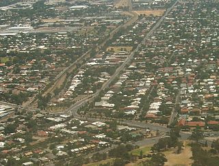
Prospect is the seat of the City of Prospect and an inner northern suburb of greater Adelaide. It is located 5 km (3.1 mi) north of Adelaide's centre.
Cornerstone College is an independent, Lutheran, co-educational, secondary, day school, located at Mount Barker in the Adelaide Hills south-east of Adelaide, South Australia.
St Francis de Sales College is a Catholic co-educational school in Mount Barker, South Australia. It teaches students from Reception until Year 12.
The State Parks of New South Wales are eighteen protected areas in New South Wales, Australia reserved for camping, water sports and recreational uses. State Parks are maintained by the New South Wales Department of Lands and managed by community trust boards.

Bicentennial Park is a 40-hectare (99-acre) of parkland located 16 kilometres (9.9 mi) west of the Sydney central business district in the local government area of City of Parramatta. Bicentennial Park is situated on the shores Homebush Bay and is a part of the Sydney Olympic Park in New South Wales, Australia. The Park is a natural heritage site featuring an important wetland ecosystem and parklands.
The Suttor River is a river in Central Queensland, Australia. The Belyando River is its main tributary. The river has its origins in the Leichhardt Range, north west of Glenden.

Banhados do Delta do Jacuí Biological Reserve is a biological reserve in the Jacuí River delta in Rio Grande do Sul, Brazil.
Greenhills Adventure Park was a theme park located near Victor Harbor, South Australia. It was established in 1982, and officially opened in March 1983 by Gavin Keneally, South Australia Minister for Tourism.

Mount Barker High School is a public high school located in the Adelaide Hills, 34 kilometres east of Adelaide. It was founded in 1908, celebrating its centenary in 2008.

Wright Island is a 1 hectare island in Encounter Bay, South Australia. It is located between the popular tourist destination Granite Island and the prominent rocky headland known as The Bluff. The island consists largely of granite boulders. It also features low vegetation and a sandy beach suitable for the landing of small boats. The island is uninhabited and can only be accessed from the water. It was named after William Wright, one of the headmen of the South Australia Company's whaling operations in the Victor Harbor area in the 1800s. The island is managed by the City of Victor Harbor, the local government authority, as part of its parks and gardens asset.
Moncks Bay is a south-eastern suburb of Christchurch, New Zealand.

Munduney Station is a pastoral lease that operates as a sheep station in South Australia.
Hamilton's Ewell Vineyards was a winery founded by Richard Hamilton (1792–1852) in the early days of the colony of South Australia.

The County of Hindmarsh is one of the 49 cadastral counties of South Australia. It was proclaimed by Governor George Grey in 1842 and named for Governor John Hindmarsh.
Conservation reserves of South Australia is a class of protected area used in the Australian state of South Australia where crown land under the control of the responsible minister has been dedicated for conservation purposes. This class of protected area has been in use as early as 1985 and as of 2016, there are fifteen conservation reserves that cover an area of 194.7 square kilometres or less than 1% of South Australia's land area.


