Las Maravillas, New Mexico | |
|---|---|
Census-designated place | |
 Las Maravillas, New Mexico | |
| Coordinates: 34°44′02″N106°40′08″W / 34.73389°N 106.66889°W | |
| Country | United States |
| State | New Mexico |
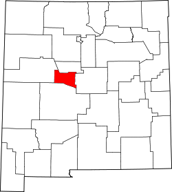
| County | Valencia |
| Area | |
• Total | 1.01 sq mi (2.62 km2) |
| • Land | 1.01 sq mi (2.61 km2) |
| • Water | 0 sq mi (0.00 km2) |
| Elevation | 5,013 ft (1,528 m) |
| Population | |
• Total | 1,604 |
| • Density | 1,588.8/sq mi (613.44/km2) |
| Time zone | UTC-7 (Mountain (MST)) |
| • Summer (DST) | UTC-6 (MDT) |
| GNIS feature ID | 2584133 [2] |
Las Maravillas is a census-designated place in Valencia County, New Mexico, United States. Its population was 1,628 as of the 2010 census. [4]