
Medina is a town in Dane County, Wisconsin, United States. The population was 1,235 at the 2000 census. The unincorporated community of Deansville is located in the town.

Calamus is a town in Dodge County, Wisconsin, United States. The population was 1,005 at the 2000 census. The unincorporated community of South Beaver Dam is located in the town. The unincorporated community of Lost Lake is also located partially in the town.

Herman is a town in Dodge County, Wisconsin, United States. The population was 1,207 at the 2000 census. The unincorporated communities of Herman Center and Huilsburg are located in the town. The unincorporated communities of Hochheim and Woodland are also located partially in the town.

Hubbard is a town in Dodge County, Wisconsin, United States. The population was 1,643 at the 2000 census. The unincorporated community of Neda is located in the town. The town is named for Henry Hubbard, the governor of New Hampshire from 1842 to 1844.

Forest is a town in Fond du Lac County, Wisconsin, United States. The population was 1,108 at the 2000 census. The unincorporated communities of Banner, Dotyville, and Graham Corners are located in the town.

Lyndon Station is a village in Juneau County, Wisconsin, United States. The population was 500 at the 2010 census.

Harrison is a town in Lincoln County, Wisconsin, United States. The population was 833 at the 2010 census, up from 793 at the 2000 census. The unincorporated communities of Bundy, Harrison, and Jeffris are located in the town.

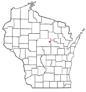
Bern is a town in Marathon County, Wisconsin, United States. It is part of the Wausau, Wisconsin Metropolitan Statistical Area. The population was 591 at the 2010 census. The unincorporated community of Gad is located partially in the town.

Day is a town in southwest Marathon County, Wisconsin, United States. It is part of the Wausau, Wisconsin Metropolitan Statistical Area. The population was 1,085 at the 2010 census. The unincorporated community of Rozellville is located in the town. The unincorporated community of Rangeline is also located partially in the town.

Guenther is a town in Marathon County, Wisconsin, United States. It is part of the Wausau, Wisconsin Metropolitan Statistical Area. The population was 341 at the 2010 census. The unincorporated communities of Ashley and Rocky Corners are located partially in the town.
The Town of Norrie is located in Marathon County, Wisconsin, United States. It is part of the Wausau, Wisconsin Metropolitan Statistical Area. The population was 976 at the 2010 census.

Belle Plaine is a town in Shawano County, Wisconsin, United States. The population was 1,867 at the 2000 census. The unincorporated communities of Adams Beach and Belle Plaine are located in the town. The former unincorporated community of Hunting was located partially in the town.

Mukwonago is a town in Waukesha County, Wisconsin, United States. The population was 7,781 at the 2020 census. The Village of Mukwonago is located mostly within the town. The unincorporated community of Jericho is also located in the town.

Winchester is a town in Winnebago County, Wisconsin, United States. The population was 1,763 at the 2010 census. The census-designated place of Winchester and the unincorporated communities of Clarks Point, Indian Shores, Lasleys Point, and Piacenza are located in the town.

Dane is a town in Dane County, Wisconsin, United States. The population was 968 at the 2000 census. The unincorporated community of Lutheran Hill is located partially in the town.
The Town of Potosi is located in Grant County, Wisconsin, United States. The population was 831 at the 2000 census. The Village of Potosi and the unincorporated communities of British Hollow, Buena Vista, Rockville, and Van Buren are located in the town.

Oakdale is a town in Monroe County, Wisconsin, United States. The population was 679 at the 2000 census. The Village of Oakdale is located within the town.

Tomah is a city in Monroe County, Wisconsin, United States. The population was 9,570 as of the 2020 census. The city is surrounded by the Town of Tomah and the Town of La Grange.
Almond is a town in Portage County, Wisconsin, United States. The population was 679 at the 2000 census. The unincorporated community of West Almond is located in the town.
Birchwood is a town in Washburn County, Wisconsin, United States. The population was 453 at the 2000 census. The Village of Birchwood is located within the town.

