Lewis Run, Pennsylvania | |
---|---|
![]() The borough of Lewis Run from the hills and State Route 4001 (Lafayette Avenue). | |
![]() Location of Lewis Run in McKean County, Pennsylvania. | |
Coordinates: 41°52′12″N78°39′44″W / 41.87000°N 78.66222°W | |
Country | United States |
State | Pennsylvania |
County | McKean |
Incorporated | 1911 |
Area | |
• Total | 1.84 sq mi (4.76 km2) |
• Land | 1.83 sq mi (4.74 km2) |
• Water | 0.01 sq mi (0.03 km2) |
Population | |
• Total | 583 |
• Density | 318.75/sq mi (123.08/km2) |
Time zone | UTC-5 (Eastern (EST)) |
• Summer (DST) | UTC-4 (EDT) |
Zip code | 16738 |
Area code | 814 |
FIPS code | 42-42984 |
Lewis Run is a borough in McKean County, Pennsylvania, United States. The population was 578 at the 2020 census. [3]
Census | Pop. | Note | %± |
---|---|---|---|
1920 | 665 | — | |
1930 | 837 | 25.9% | |
1940 | 844 | 0.8% | |
1950 | 694 | −17.8% | |
1960 | 714 | 2.9% | |
1970 | 756 | 5.9% | |
1980 | 677 | −10.4% | |
1990 | 578 | −14.6% | |
2000 | 577 | −0.2% | |
2010 | 617 | 6.9% | |
2020 | 578 | −6.3% | |
2021 (est.) | 570 | [3] | −1.4% |
Sources: [4] [5] [6] [2] |
As of the census [5] of 2000, there were 577 people, 259 households, and 178 families residing in the borough. The population density was 297.7 inhabitants per square mile (114.9/km2). There were 287 housing units at an average density of 148.1 per square mile (57.2/km2). The racial makeup of the borough was 98.61% White, 0.17% African American, 0.52% Native American, 0.17% Asian, 0.17% from other races, and 0.35% from two or more races. Hispanic or Latino of any race were 0.17% of the population.
There were 259 households, out of which 25.9% had children under the age of 18 living with them, 57.1% were married couples living together, 6.9% had a female householder with no husband present, and 30.9% were non-families. 28.2% of all households were made up of individuals, and 14.3% had someone living alone who was 65 years of age or older. The average household size was 2.23 and the average family size was 2.70.
In the borough the population was spread out, with 19.4% under the age of 18, 6.6% from 18 to 24, 27.0% from 25 to 44, 23.2% from 45 to 64, and 23.7% who were 65 years of age or older. The median age was 43 years. For every 100 females there were 96.9 males. For every 100 females age 18 and over, there were 92.1 males.
The median income for a household in the borough was $35,221, and the median income for a family was $41,719. Males had a median income of $31,042 versus $23,750 for females. The per capita income for the borough was $21,670. About 3.8% of families and 6.5% of the population were below the poverty line, including 8.1% of those under age 18 and 7.5% of those age 65 or over.
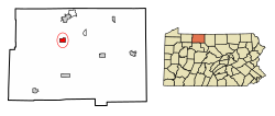
Lewis Run is located at 41°52′12″N78°39′44″W / 41.87000°N 78.66222°W (41.870101, -78.662201). [7]
According to the United States Census Bureau, the borough has a total area of 1.9 square miles (4.9 km2), all land.
According to the Köppen Climate Classification system, Lewis Run has a humid continental climate, abbreviated "Dfb" on climate maps. [8]
Climate data for Lewis Run, Pennsylvania | |||||||||||||
---|---|---|---|---|---|---|---|---|---|---|---|---|---|
Month | Jan | Feb | Mar | Apr | May | Jun | Jul | Aug | Sep | Oct | Nov | Dec | Year |
Mean daily maximum °C (°F) | −1 (31) | 1 (33) | 6 (43) | 13 (56) | 20 (68) | 24 (76) | 26 (79) | 25 (77) | 22 (71) | 16 (60) | 8 (46) | 2 (35) | 13 (56) |
Mean daily minimum °C (°F) | −11 (13) | −11 (13) | −6 (21) | −1 (31) | 5 (41) | 10 (50) | 12 (54) | 12 (53) | 8 (46) | 2 (36) | −2 (28) | −8 (18) | 1 (34) |
Average precipitation mm (inches) | 79 (3.1) | 66 (2.6) | 86 (3.4) | 94 (3.7) | 100 (4.1) | 120 (4.9) | 120 (4.7) | 100 (4) | 110 (4.2) | 94 (3.7) | 99 (3.9) | 89 (3.5) | 1,160 (45.8) |
Source: Weatherbase [9] |
Bon Air is a town in Talladega County, Alabama, United States. It incorporated in 1932. At the 2010 census the population was 116, up from 96 in 2000.
College City is a former town in Lawrence County, Arkansas, United States. The population was 455 at the 2010 census. It is the site of Williams Baptist College, a four-year liberal arts college. The town merged with nearby Walnut Ridge effective January 1, 2017.
Clarence is a village in Natchitoches Parish, Louisiana, United States. The population was 499 at the 2010 census. It is located some seven miles east of the parish seat of Natchitoches and is part of the Natchitoches Micropolitan Statistical Area.
Powhatan is a village in Natchitoches Parish, Louisiana, United States. The population was 141 at the 2000 census. It is part of the Natchitoches Micropolitan Statistical Area.
Allagash is a town in Aroostook County, Maine, United States. It is on the Allagash River in the North Maine Woods region.
Fruitland [fruːtlɪnd] is a city in Wicomico County, Maryland, United States. The population was 4,866 at the 2010 census. It is included in the Salisbury, Maryland-Delaware Metropolitan Statistical Area.
Everett is a borough in Bedford County, Pennsylvania, United States. The population was 1,765 at the 2020 census.
Daisytown is a borough in Cambria County, Pennsylvania, United States. The population was 326 at the 2010 census.
Bowmanstown is a borough in Carbon County, Pennsylvania. It is part of Northeastern Pennsylvania. The population was 937 at the 2010 census.
Troutville is a borough in Clearfield County, Pennsylvania, United States. The population was 230 at the 2020 census.
Sykesville is a borough in Jefferson County, Pennsylvania, United States. The population was 1,157 at the time of the 2010 census.
Nescopeck is a borough in Luzerne County, Pennsylvania, United States. The population was 1,480 as of the 2020 census.
Smethport is a borough in and county seat of McKean County, Pennsylvania, United States. The mayor is Wayne V. Foltz. The population was 1,430 at the 2020 census. Smethport is part of the Bradford, PA Micropolitan Statistical Area. Smethport, having the coldest temperature ever recorded in Pennsylvania, is the coldest place in Pennsylvania and one of the coldest towns in the contiguous United States.
New Lebanon is a borough in northeastern Mercer County, Pennsylvania, United States. The population was 186 at the 2020 census. It is part of the Hermitage micropolitan area.
Glendon is a borough in Northampton County, Pennsylvania. The population of Glendon was 373 at the 2020 census. Glendon is part of the Lehigh Valley metropolitan area, which had a population of 861,899 and was thus the 68th-most populous metropolitan area in the U.S. as of the 2020 census. Glendon is the second smallest municipality in Northampton County by population, just behind Chapman.
Pukwana is a town in Brule County, South Dakota, United States. The population was 233 at the 2020 census.
Loudon is a city in and the county seat of Loudon County, Tennessee, United States. Its population was 6,001 at the 2020 census. It is included in the Knoxville, Tennessee Metropolitan Statistical Area. The city is located in East Tennessee, southwest of Knoxville, on the Tennessee River. Fort Loudoun, the colonial era fort for which the city was named, is located several miles to the south in Monroe County.
Burnsville is a town in Braxton County, West Virginia, United States, at the confluence of the Little Kanawha River and Saltlick Creek. The population was 401 at the 2020 census. Burnsville was incorporated in 1902 by the Circuit Court and named for Captain John Burns who operated the first sawmill in that section of the state and who established the town shortly after the close of the American Civil War. It was named "All West Virginia City" in 1976.
Jane Lew is a town in Lewis County, West Virginia, United States. The population was 409 at the time of the 2020 census.
Yorkville is a village in Belmont and Jefferson counties in the U.S. state of Ohio. The population was 968 at the 2020 census. Yorkville lies within two Metropolitan Statistical Areas; the Belmont County portion is part of the Wheeling metropolitan area, while the Jefferson County portion is part of the Weirton–Steubenville metropolitan area.