Lincoln is a town in Providence County, Rhode Island, United States. The population was 22,529 at the 2020 census. Lincoln is located in northeastern Rhode Island, north of Providence. Lincoln is part of the Providence metropolitan statistical area and the Greater Boston combined statistical area.

Minute Man National Historical Park commemorates the opening battle in the American Revolutionary War. It also includes the Wayside, home in turn to three noted American authors. The National Historical Park is under the jurisdiction of the National Park Service and protects 970 acres (392.5 ha) in and around the Massachusetts towns of Lexington, Lincoln, and Concord.

Reading station is an MBTA Commuter Rail station in Reading, Massachusetts. It serves the Haverhill/Reading Line. It is located at Lincoln and High Streets on the western fringe of Reading's central business district. The station's historic depot building was built in 1870 by the Boston and Maine Railroad. The station was the terminus of the line from 1959 until the re-extension to Haverhill station in 1979.

The General Benjamin Lincoln House is a National Historic Landmark at 181 North Street in Hingham, Massachusetts, United States. It was the birthplace and principal residence of Continental Army Major General Benjamin Lincoln (1733–1810), a well-respected military leader of the American Revolutionary War. The home was built in 1665 by Thomas “The Cooper” Lincoln. The last major modifications to the house were probably undertaken by General Lincoln in the late 18th century.

The Brookfield Common Historic District encompasses a historically significant portion of the town center of Brookfield, Massachusetts. It is focused on the town common, which extends south from Main Street to Lincoln Street, and includes a dense cluster of houses on roads to its east, as well as properties on Main Street and the Post Road. The district includes more than 100 properties, including the Colonial Revival Town Hall, Banister Memorial Hall, and Romanesque Revival Congregation Church. The district was added to the National Register of Historic Places in 1990.

The Franklin Common Historic District is a historic district encompassing the traditional village center of Franklin, Massachusetts. The primary focus of the district is the town common, a roughly triangular green which took shape in the mid-18th century. The district includes the buildings that abut the green, and extends northward along Main Street to its junction with Lincoln Street, where the Red Brick School is located. The Dean Junior College Historic District abuts this district to the south. The district is predominantly residential in character, with several civic and religious institutional buildings facing the common. The latter group are dominated by the Federated Church, and the Roman Catholic St. Mary's Church complex, which includes three buildings from the 1920s to 1955.

The Lincoln–Sunset Historic District is a residential historic district located west of the downtown area of Amherst, Massachusetts. Colloquially known as Millionaire's Row, the district extends along Lincoln and Sunset Avenues between Northampton Street and the campus of the University of Massachusetts, Amherst. This area was one of Amherst's first planned residential subdivisions, and features a large number of high-quality houses, built by merchants, businessmen, and academics. It was added to the National Register of Historic Places in 1993.

The Russell Center Historic District is a historic district encompassing the historic village center of Russell, Massachusetts. It is centered at the junction of Main Street and Lincoln Avenue, and is bordered by the Westfield River to the east, and the rising foothills of The Berkshires to the west. The village's 19th century development was spurred by the railroad and sustained by local papermaking businesses. It was listed on the National Register of Historic Places in 1996, and was named as one of the 1,000 places to visit in Massachusetts by the Great Places in Massachusetts Commission.

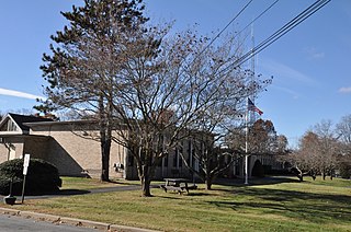
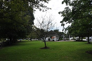
The Common Historic District is a historic district encompassing the civic and institutional heart of Reading, Massachusetts. The district is centered on the town common, at the intersection of Main and Salem Streets. The common has been communally owned since at least 1737, with the original burying ground to the north. In 1769 the area's first meeting house was built, giving the area a sense of identity separate from portions of Reading that would later be set off as Wakefield and North Reading. Since then the area has become a focal point for religious and civic institutions in the town.

The Winchester Center Historic District encompasses the commercial and civic heart of Winchester, Massachusetts. It is roughly bounded Mt. Vernon and Washington Streets, Waterfield Road, Church and Main Streets. The district includes a number of Romanesque Revival buildings, including Winchester Town Hall and the Winchester Savings Bank building on Mount Vernon Street. Noted architects who contributed to the district include Robert Coit and Asa Fletcher. The district was listed on the National Register of Historic Places in 1986.

The Common District encompasses the main civic center of Wakefield, Massachusetts. It is centered on the historic town common, just south of Lake Quannapowitt, which was laid in 1644, when it became the heart of Old Reading. The area was separated from Reading as South Reading in 1818, and renamed Wakefield in 1868. The 25 acre district includes the buildings that line the common on Common Street and Main Street, which include the town hall, public library, YMCA, post office, and several churches. It was listed on the National Register of Historic Places in 1990.

The Lincoln Estate–Elm Park Historic District is an expansive residential area in northwestern Worcester, Massachusetts. It is centered on Cedar and William Streets, and includes properties on adjacent streets. The area was developed beginning in the late 1830s by former Governor of Massachusetts Levi Lincoln, Jr., a Worcester native who had inherited land in the area. The district was divided and developed by Lincoln until his death, and then by his heirs, and became a popular location for homes of Worcester's wealthy and elite, many of which were designed by architects.

South Reading Academy is a historic former school building at 7 Foster Street in Wakefield, Massachusetts, US. Built in 1828–29 for the First Baptist Church, the building has served as a religious school, public high school, clubhouse, and commercial space. The building was listed on the National Register of Historic Places in 1989.

The Lincoln Historic District is a historic district in Hingham, Massachusetts, United States. It is roughly located on North and South Streets from West to Water Streets, Main Street south to Garrison Road, and Lincoln Street and Fearing Road north to Miles. It encompasses the earliest streets laid out in Hingham at the time of its founding in 1635, covering more than 300 years of development and a cross section of Hingham's architectural history. It includes some of the town's oldest buildings, including most notably the Old Ship Church and the General Benjamin Lincoln House, both National Historic Landmarks. The district takes its name from the large number of Lincolns who were among Hingham's early settlers.

The Amherst Village Historic District encompasses the historic village center of Amherst, New Hampshire. Centered on the town's common, which was established about 1755, Amherst Village is one of the best examples of a late-18th to early-19th century New England village center. It is roughly bounded on the north by Foundry Street and on the south by Amherst Street, although it extends along some roads beyond both. The western boundary is roughly Davis Lane, the eastern is Mack Hill Road, Old Manchester Road, and Court House Road. The district includes the Congregational Church, built c. 1771-74, and is predominantly residential, with a large number of Georgian, Federal, and Greek Revival houses. Other notable non-residential buildings include the Farmer's Bank, a Federal-style brick building built in 1806, and the Amherst Brick School, a brick Greek Revival structure that has served as the School Administrative Unit 39 offices since 1997.

Forest Park is a Victorian garden district located in Springfield, Massachusetts, developed between 1880 and 1920. It is the city's most populous neighborhood, and surrounds the 735-acre Forest Park, for which the neighborhood is named. The Forest Park neighborhood has nature and recreation within walking distance. To the west, I-91 separates Forest Park from the Connecticut River. A 195-acre section of the neighborhood was listed on the National Register of Historic Places in 1982 as the Forest Park Heights Historic District.

Elias Carter (1781-1864) was an American architect whose first church design, at Brimfield, Massachusetts, was completed in 1805. He was born in 1781 to Timothy and Sarah (Walker) Carter in Ward, a village of Auburn, Massachusetts. His father, a builder, died when he was three, and the family moved to Hardwick when his mother remarried, to a farmer there. He followed in his father's profession, working in the American South for a time before returning to central Massachusetts. He was responsible for the construction of a number of churches in central Massachusetts, which an early biographer described as "typical white steepled churches of New England". His most influential design appears to have been the church in Templeton, Massachusetts, which inspired the design of at least two others. He also built houses throughout central Massachusetts, as well as a wing of the Westborough State Hospital, and played a role in the construction of the New Hampshire state insane asylum.
The Salem Common Historic District encompasses the early colonial center of Salem, New Hampshire. The district dates to the earliest period of settlement of Salem, and includes the historic common, old town hall, fire station, and library. The town hall was built in 1738 and extensively altered in 1838 and 1899; it served as a place for town meetings until 1958. The district was listed on the National Register of Historic Places in 2011.

The Town Center Historic District encompasses the historic village center of South Hampton, New Hampshire. Centered around the Barnard Green, the town common, on New Hampshire Route 107A, it includes architectural reminders of the town's growth and change over time. The district was listed on the National Register of Historic Places in 1983.


