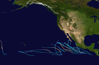
Track maps of Pacific hurricanes from 1832 to 1922
The following is a list of Pacific hurricanes before 1900. Data on most of the storms that formed is unavailable, however, some regions had a large enough coastal population or ship traffic to give data on the occurrence of hurricanes. Tropical cyclones in the region typically formed between May and November.
A hurricane struck Tlapa in Guerrero, Mexico, producing strong winds, hail, excessive rains, and other natural phenomena. Juan Bautista Moya, an Augustinian missionary friar in Tlapa and Chilapa viewed this tempest as "a miraculous prodigy of the Lord to confirm his missionary preaching among the indigenous people. The wind unleashed over the town of Tlaba and lashed the countryside and cottages like a giant whip. The fury of the gale uprooted and demolished trees. Hail shattered the maize corn grains without pity. Successive earthquakes at quick intervals further terrorized the populace."[1] In this and other cases, the "earthquakes" probably entered the records because the hurricane winds shook houses and other occupied buildings, and survivors likened the shaking to that of a continuous earthquake.
1573
On 14 November, a violent hurricane lasted 3 hours at Colima City in Mexico. Earthquakes accompanied the storm, and many houses and the church building fell.[1]
1609
A hurricane tore the cover off the church and ruined many houses in the town of Huaynamota in Jalisco, Mexico.[1]
1832
In December 1832, according to a log from a German Merchant Marine vessel later left at Deutsche Seewarte, a tropical cyclone occurred southeast of the Hawaiian Islands; it then tracked west-northwestward, approaching 350 miles south of Ka Lae, Hawaii (island), and thence to a point near Johnston Atoll.[2]
On 1 November 1839, a destructive hurricane struck Mazatlán, Sinaloa, doing heavy damage to boats and watercraft; most of the twelve ships then in the harbor sunk with their crews.[4][5]
1840
On November 1, a destructive hurricane did heavy damage to shipping and sunk three vessels at San Blas, Nayarit.[4]
III. On 5 August 1850, the barqueComo encountered a "severe gale" at 14°20′N117°0′W / 14.333°N 117.000°W / 14.333; -117.000, commencing at north and veering to west and south. She "lost sails and bulwarks and sustained much other damage." These winds suggest that the vessel traveled on the left side of the track of the storm, which passed to its northwest.[3]
For five hours on 11 September 1850, the Diana at 22°N116°W / 22°N 116°W / 22; -116 experienced a "severe hurricane" from the northeast, veering to southwest; the vessel "hove on beam-ends." The veering intense wind suggests that the hurricane passed slightly northwest of the vessel, which experienced the left side. If a hurricane progressed from Niagara to Diana (and the ships logged their dates accurately), then the hurricane moved between west-northwest and northwest at 23 miles per hour (37km/h).[3]
VI. On 3 October 1850, the brigAmazon, sailing from New York northward for San Francisco, encountered a "severe hurricane" at 13°30′N116°50′W / 13.500°N 116.833°W / 13.500; -116.833. A passenger on the brig published an account of this storm. Heavy rain accompanied squalls from southwest, which increased in frequency and intensity until 5 pm, when a "hurricane" commenced with the brig under reefing fore-topsail and mainsail. The captain "scudded" the vessel, putting her before the blast. The tempest raged through the night with momentarily increased fury. The wind veered from southwesterly to southerly to southeasterly to easterly to northeasterly to northerly to westerly to southwesterly, making the circuit of "thirty-four points" of the compass in 6 hours. This account suggests a small, violent hurricane moving less than 4 miles per hour (6.4km/h); the Amazon probably actually overtook the hurricane from its southeastern quadrant and traveled through the eyewall almost completely around the eye of the storm.
At 4 am on 4 October 1850, the hurricane blew the foresail of the brig Amazon from the yard (sailing) and then brought the vessel to the wind, which blew her directly down on her side or beam-ends. Captain Watt then ordered her put again before the wind, but the crew did not succeed in executing this order. The crew then let the main-topsail go; she "dashed away like lightning before the tempest." The crew kept her "scudding" until the hurricane abated and then laid her in a heavy gale from the southwest. The vessel reported a position of 13°40′N116°30′W / 13.667°N 116.500°W / 13.667; -116.500 and thereafter drifted likely in a direction opposite the progression of the storm through a prolonged gale. Captain Watt described the gale as equally severe as those in the West Indies. This offshore hurricane occurred contemporaneously with the next succeeding hurricane.
VII. Reports from 1–6 October 1850 suggest that a "gale...with great violence" swept the whole Mexican coast.
On 1 October 1850, a "severe gale" threw the Kingston, traveling from San Francisco for Panama City, on beam-ends, off the Mexican coast at 14°N. The Belgrade, voyaging from San Francisco for El Realejo, recorded a fine breeze from the west-northwest and heavy swell from the southeast. At 10 AM, the wind hauled suddenly to southeast with increased force and squally appearances.
At midnight on 1/2 October, the Belgrade sailed under reefingtopsails. On the same route from San Francisco for El Realejo, the Galindo experienced a "severe hurricane," which threw her on beam-ends and dismasted her.
At 1 AM on 2 October, the wind against the Belgrade increased still with vivid lightning and heavy rain. At 4 am, the storm split the fore-topsail. At 8 am, the vessel lost her foresail, and the gale increased to a "hurricane," which threw her on beam-ends with loss of main and mizzen topmasts with the head of the mainmast, when the ship righted a little. At 1 pm on 2 October, the hurricane still increased with the ship on her beam-ends; she lost her fore-topmast with much other damage.
At midnight on 2/3 October, the wind blew as hard as ever against the Belgrade; at 4 am on 3 October, the wind moderated with heavy rain.
On 4 October, the Belgrade reported a position of 18°11′N104°05′W / 18.183°N 104.083°W / 18.183; -104.083 and made for Acapulco. Given the southeasterly hurricane, she probably had passed to the right of the west-moving storm, which passed to her south. The Belgrade and Galindo arrived at Acapulco at the same time.
On 5 October off Cabo San Lucas, a "violent hurricane" threw the Lavina on beam-ends, and she lay twenty-one hours.
On 5/6 October, "the gale" damaged the Fanny, voyaging from Mazatlán for San Francisco; she put back to Mazatlán.
This hurricane apparently progressed northwestward at less than 8 miles per hour (13km/h).
VIII. One existed on an unknown date in October.[6]
1851
Three systems are recorded. They existed on September 16, October 21, and some time in October.[6]
Before June or after October of this year, a system considered a tropical cyclone made landfall just north of the Golden Gate.[6]
1855
Seven systems are recorded. One existed in June and two in August from the third to sixth and eighth through ninth days of that month respectively. Another was recorded on September 4.[6]
1857
Two tropical cyclones existed, on June 20 and September 6.[6]
On June 17, German shipping logs reported a tropical cyclone.[6]
From September 21 to September 24, German shipping logs reported a tropical cyclone, with a path running northwest from near 17°N 141°W to close to the Big Island to near 19°N 160°W.[2]
1871
A system was recorded by German shipping logs on July 3.[6]
On July 10, a storm of unknown strength was encountered by the USS Jamestown. There was a moderate gale, rain, squalls, diving barometer, choppy seas, and winds that changed direction in a counter clockwise manner.[2]
On August 9, a severe cyclonic storm struck Hawaii. Heavy rains flooded a plantation on the Big Island, causing around $5000 (1871dollars) or $108,556 (2021 dollars)[8] in damage. Trees were blown down. On Maui, there was considerable damage to trees and buildings.[2] Significant damage was reported by indigenous newspapers on both islands with the accounts suggesting a major category 3 hurricane.[9]
1874
From November 17 to November 20, German shipping records recorded a cyclone. This may have actually been a type of seasonal extratropical system known as a Kona storm.[2]
1876
Atlantic Hurricane 4, which had made landfall in Southern Nicaragua on October 3 as a Category2, survived passage over Central America and emerged into the Pacific Ocean as a tropical storm on October 4. It dissipated or was lost track of on October 3.[10] While in the Pacific, this hurricane hassled and damaged a ship, the Costa Rica.[11]
Two tropical cyclones were reported. They existed on July 6 and October 13.[6]
1881
In late September, a hurricane with winds estimated near 110knots struck Mazatlán.[4]
On the late afternoon of October 27, a major hurricane with estimated winds of 110knots hit Manzanillo.[4] The lowest measured pressure was 28 inches of mercury (950mb). This hurricane totally destroyed the city. In Manzanillo Harbor, a ship, a bark, two schooners, several small boats, and numerous lighters were total losses. The total damage exceeded $500,000.[12]
1882
In July, a cyclone was reported near the location 13°N, 118°W. It may have been traveling southwestward.[5]
On September 7, German shipping logs recorded the existence of a tropical cyclone.[6]
1883
Two tropical cyclones existed, from September 21 to 23 and on October 3. Including one that struck Mexico[6]
1884
Two tropical cyclones are known. One existed from September 28 to 30, the other on October 23.[6]
1885
Four systems existed, on July 31, September 12, October 5 to 6, and October 25.[6]
1886
A system was recorded on September 19 by German shipping logs.[6]
1887
On July 6 and from October 3 to 6, two tropical cyclones were recorded.[6]
1888
Four systems are known. They existed on August 9 to 10, August 13 to 14, September 10 to 11, and September 20.[6]
1889
The one tropical cyclone known this year existed on August 2 and 3.[6]
1890
A tropical cyclone existed on August 18 and 19.[6]
On 11 August 1891, a severe thunderstorm occurred at and about San Bernardino, California, where lightning struck and burned a barn. It burned out telegraph instruments at Riverside, California. Very heavy rain fell in the mountains east of Redlands, California, flooded a considerable extent country, and much damaged orchards. On 12 August 1891, extreme rainfall fell at Campo, California—11.50 inches (292mm) in 80minutes before the cloudburst carried away the rain gauge.[14] At least 16.10inches fell that month at the station.[15] This rain caused destructive floods over portions of San Diego County, California. These floods may or may not have been related to the preceding cyclone.
On October 1, a cyclone first spotted on September 29 made landfall in Mexico, having rapidly moved north for its short life. It caused much loss of life and property damage.[5]
On November 1, unusual waves were reported at Sausalito, California. These have been attributed to a tropical cyclone.[16]
1899
A cyclone, which passed near the Revillagigedo Islands, was first spotted southwest of Manzanillo on August 26, before it paralleled the coast from August 29 to August 31.[17] The "tropical hurricane" made landfall on the night of September 1 before moving into mainland Mexico.[18]
A cyclone moved west-northwest well south and southwest of Baja California from September 2 to September 6 of this year.[18]
The 1995 Pacific hurricane season was the least active Pacific hurricane season since 1979, and marked the beginning of a multi-decade period of low activity in the basin. Of the eleven tropical cyclones that formed during the season, four affected land, with the most notable storm of the season being Hurricane Ismael, which killed at least 116 people in Mexico. The strongest hurricane in the season was Hurricane Juliette, which reached peak winds of 150 mph (240 km/h), but did not significantly affect land. Hurricane Adolph was an early-season Category 4 hurricane. Hurricane Henriette brushed the Baja California Peninsula in early September.
The 1987 Pacific hurricane season was the last year in which the Eastern Pacific Hurricane Center was the primary warning center for tropical cyclones in the eastern Pacific Ocean. The season officially started May 15, 1987, in the eastern Pacific, and June 1, 1987, in the central Pacific, and lasted until November 30, 1987. These dates conventionally delimit the period of each year when the vast majority of tropical cyclones form in the northeastern Pacific Ocean.
The 1977 Pacific hurricane season stands alongside 2010 as the least active Pacific hurricane season since reliable records began in 1971. Only eight tropical storms formed throughout the year; four further intensified into hurricanes, yet none strengthened into major hurricanes—a Category 3 or stronger on the Saffir–Simpson scale—an occurrence not seen again until 2003. Most tropical cyclones remained over the open eastern Pacific; however, the remnants of hurricanes Doreen and Heather led to heavy rainfall which damaged or destroyed structures and flooded roadways throughout the Southwest United States. Notably, Hurricane Anita which originally formed in the Gulf of Mexico made the rare trek across Mexico into the eastern Pacific, briefly existing as a tropical depression. Eight deaths were recorded while damage reached $39.6 million.
The 1899 Atlantic hurricane season featured the longest-lasting tropical cyclone in the Atlantic basin on record. There were nine tropical storms, of which five became hurricanes. Two of those strengthened into major hurricanes, which are Category 3 or higher on the modern day Saffir–Simpson hurricane wind scale. The first system was initially observed in the northeastern Gulf of Mexico on June 26. The tenth and final system dissipated near Bermuda on November 10. These dates fall within the period with the most tropical cyclone activity in the Atlantic. In post-season analysis, two tropical cyclones that existed in October were added to HURDAT – the official Atlantic hurricane database. At one point during the season, September 3 through the following day, a set of three tropical cyclones existed simultaneously.
The 1893 Atlantic hurricane season ran through the summer and the first half of fall in 1893. The 1893 season was fairly active, with 12 tropical storms forming, 10 of which became hurricanes. Of those, five became major hurricanes. This season proved to be a very deadly season, with two different hurricanes each causing over 2,000 deaths in the United States; at the time, the season was the deadliest in U.S. history. The season was one of two seasons on record to see four Atlantic hurricanes active simultaneously, along with the 1998 Atlantic hurricane season. Additionally, August 15, 1893 was the only time since the advent of modern record keeping that three storms have formed on the same day until 2020 saw Wilfred, Alpha, and Beta forming on the same day; and for the first time, there were two high-intensity hurricanes simultaneously in one month of August, and this was not repeated until the year 2023.
The 1924 Atlantic hurricane season featured the first officially recorded Category 5 hurricane, a tropical cyclone with maximum sustained winds exceeding 155 mph (249 km/h) on the modern-day Saffir–Simpson scale. The first system, Tropical Storm One, was first detected in the northwestern Caribbean Sea on June 18. The final system, an unnumbered tropical depression, dissipated on November 24. These dates fall within the period with the most tropical cyclone activity in the Atlantic. Of the 13 tropical cyclones of the season, six existed simultaneously. The season was average with 11 tropical storms, five of which strengthened into hurricanes. Further, two of those five intensified into major hurricanes, which are Category 3 or higher on the Saffir–Simpson scale.
The 1854 Atlantic hurricane season featured five known tropical cyclones, three of which made landfall in the United States. At one time, another was believed to have existed near Galveston, Texas in September, but HURDAT – the official Atlantic hurricane database – now excludes this system. The first system, Hurricane One, was initially observed on June 25. The final storm, Hurricane Five, was last observed on October 22. These dates fall within the period with the most tropical cyclone activity in the Atlantic. No tropical cyclones during this season existed simultaneously. One tropical cyclone has a single known point in its track due to a sparsity of data.
The 1957 Pacific hurricane season was a moderately active year in which 13 tropical cyclones formed. The hurricane season ran through the summer and fall months which conventionally delimit the period during which most tropical cyclones form in the northeastern Pacific Ocean. The first tropical cyclone developed on July 15. The final storm dissipated on December 6, becoming one of the few Pacific storms to exist outside of the seasonal dates. Of the season's 13 storms, five of these formed or crossed into the central Pacific.
The 2015 Pacific hurricane season is the second-most active Pacific hurricane season on record, with 26 named storms, only behind the 1992 season. A record-tying 16 of those storms became hurricanes, and a record 11 storms further intensified into major hurricanes throughout the season. The Central Pacific, the portion of the Northeast Pacific Ocean between the International Date Line and the 140th meridian west, had its most active year on record, with 16 tropical cyclones forming in or entering the basin. Moreover, the season was the third-most active season in terms of accumulated cyclone energy, amassing a total of 290 units. The season officially started on May 15 in the Eastern Pacific and on June 1 in the Central Pacific; they both ended on November 30. These dates conventionally delimit the period of each year when most tropical cyclones form in the Northeast Pacific basin. However, the formation of tropical cyclones is possible at any time of the year. This was shown when a tropical depression formed on December 31. The above-average activity during the season was attributed in part to the very strong 2014–16 El Niño event.
The 1860 Atlantic hurricane season featured three severe hurricanes that struck Louisiana and the Gulf Coast of the United States within a period of seven weeks. The season effectively began on August 8 with the formation of a tropical cyclone in the eastern Gulf of Mexico, and produced seven known tropical storms and hurricanes until the dissipation of the last known system on October 24. Six of the seven storms were strong enough to be considered hurricanes on the modern-day Saffir–Simpson Hurricane Scale, of which four attained Category 2 status and one attained Category 3 major hurricane strength. The first hurricane was the strongest in both winds and pressure, with peak winds of 125 miles per hour (201 km/h) and a barometric pressure of 950 millibars (28 inHg). Until contemporary reanalysis discovered four previously unknown tropical cyclones that did not affect land, only three hurricanes were known to have existed; all three made landfall in Louisiana, causing severe damage.
The 1861 Atlantic hurricane season occurred during the first year of the American Civil War and had some minor impacts on associated events. Eight tropical cyclones are believed to have formed during the 1861 season; the first storm developed on July 6 and the final system dissipated on November 3. Six of the eight hurricanes attained Category 1 hurricane status or higher on the Saffir-Simpson Hurricane Scale, of which three produced hurricane-force winds in the United States. No conclusive damage totals are available for any storms. Twenty-two people died in a shipwreck off the New England coast, and an undetermined number of crew members went down with their ship in the July hurricane. Based on maximum sustained winds, the first and third hurricanes are tied for the strongest of the year, although the typical method for determining that record—central barometric air pressure—is not a reliable indicator due to a general lack of data and observations.
The 1859 Atlantic hurricane season featured seven hurricanes, the most recorded during an Atlantic hurricane season until 1870. However, in the absence of modern satellite and other remote-sensing technologies, only storms that affected populated land areas or encountered ships at sea were recorded, so the actual total could be higher. An undercount bias of zero to six tropical cyclones per year between 1851 and 1885 has been estimated. Of the eight known 1859 cyclones, five were first documented in 1995 by Jose Fernandez-Partagás and Henry Diaz, which was largely adopted by the National Oceanic and Atmospheric Administration's Atlantic hurricane reanalysis in their updates to the Atlantic hurricane database (HURDAT), with some adjustments. HURDAT is the official source for hurricane data such as track and intensity, although due to sparse records, listings on some storms are incomplete.
The 1855 Atlantic hurricane season featured tropical cyclone landfalls in the Gulf Coast of the United States, the Greater Antilles, and Mexico, but none along the East Coast of the United States. It was inactive, with only five known tropical cyclones. Another tropical storm was believed to have existed offshore Atlantic Canada in late August and early September, but HURDAT – the official Atlantic hurricane database – now excludes this system. The first known system was initially observed on August 5, while the final known storm was last noted on September 17. These dates fall within the period with the most tropical cyclone activity in the Atlantic. At one point during the season, two tropical cyclones existed simultaneously. Two of the cyclones only have a single known point in their tracks due to a sparsity of data.
The 1858 Atlantic hurricane season was one of only three Atlantic hurricane seasons on record in which every tropical cyclone intensified into a hurricane. The first hurricane was first observed over the northwestern Caribbean Sea on June 12. The sixth and final storm was last noted on October 26. These dates fall within the period with the most tropical cyclone activity in the Atlantic. Three tropical cyclones during the season existed simultaneously. Two of the cyclones have only a single known point in its track due to a sparsity of data. Operationally, another tropical cyclone was believed to have existed over the eastern Atlantic between September 17 and September 18, but HURDAT – the official Atlantic hurricane database – excludes this system. However, in the absence of modern satellite and other remote-sensing technologies, only cyclones that affected populated land areas or encountered ships at sea are currently known, so the actual total could be higher. An undercount bias of zero to four tropical cyclones per year between 1886 and 1910 has been estimated. Of the six known 1858 Atlantic cyclones, five were first documented in 1995 by Jose Fernandez-Partagas and Henry Diaz.
The 1850 Atlantic hurricane season was the last season excluded from the scope of the official Atlantic hurricane database. Although meteorological records are sparse and generally incomplete, they indicate that three significant tropical cyclones affected land, each causing some degree of damage. The first system struck North Carolina on July 18, causing significant damage before battering the Mid-Atlantic states with high tides, strong winds, and heavy rainfall. Torrential rainfall caused river flooding from Baltimore to Philadelphia, particularly along the Schuylkill River, which took the lives of 20 people in various incidents. Strong winds damaged property and public facilities in and around New York City, and damaging floods extended into central and northern New England. Crops and railroad infrastructure suffered throughout the entire region.
The 1842 Atlantic hurricane season featured several maritime catastrophes in the Gulf of Mexico and along the U.S. East Coast, and produced one of the only known tropical cyclones to directly affect the Iberian Peninsula. As the season falls outside the scope of the Atlantic hurricane database, records of most storms in 1842 are scarce, and only approximate tracks are known. The first documented storm of the season battered the coast of North Carolina in mid-July, wrecking dozens of ships and destroying homes along the Outer Banks. A little over a month later, another storm impacted the same region and caused several more shipwrecks that killed at least 12 men. This storm later doused the Mid-Atlantic states with flooding rains. In early September, a powerful storm known as "Antje's Hurricane"—named after a ship that it dismasted—tracked generally westward after first being spotted over the Leeward Islands. After yielding widespread destruction across the Bahamas, the storm traversed the Florida Straits, causing severe damage in both northern Cuba and the lower Florida Keys. Many ships and their crews were lost to the storm as it crossed the Gulf of Mexico; it finally struck northern Mexico on September 8.
Racer's hurricane was a destructive tropical cyclone that had severe effects in northeastern Mexico, the Republic of Texas, and the Gulf Coast of the United States in early October 1837. It was named after the Royal Navy ship HMS Racer, which encountered the cyclone in the northwestern Caribbean. Termed "one of the most famous and destructive hurricanes of the century" by meteorology historian David Ludlum, the storm first affected Jamaica with flooding rainfall and strong winds on September 26 and 27, before entering the Gulf of Mexico by October 1. As the hurricane struck northern Tamaulipas and southern Texas, it slowed to a crawl and turned sharply northeastward. The storm battered the Gulf Coast from Texas to the Florida Panhandle between October 3 and 7. After crossing the Southeastern United States, it emerged into the Atlantic shipping lanes off the Carolinas by October 9.
1 2 3 4 5 6 Redfield, William C., 1856:Observations in Relation to Cyclones of the Western Pacific: Embraced in a Communication to Commodore Perry. Narrative of the Expedition of an American Squadron to the China Seas and Japan, Performed in the Years 1852, 1853, and 1854, under the Command of Commodore M. C. Perry, United States Navy, by Order of the Government of the United States. Commodore Matthew Calbraith Perry, USN, and Francis Lister Hawks, DD, LLD, Eds., Vol II, United States Senate Executive Document No. 79 (33rd Congress, 2nd Session), 333-359.
↑ Businger, Steven; M. P. Nogelmeier; P. W. U. Chinn; T. Schroeder (2018). "Hurricane with a History: Hawaiian Newspapers Illuminate an 1871 Storm". Bull. Amer. Meteor. Soc. 99 (2): 137–47. Bibcode:2018BAMS...99..137B. doi:10.1175/BAMS-D-16-0333.1.
↑ J. L. H. Paulhaus (1973). World Meteorological Organization Operational Hydrology Report No. 1: Manual For Estimation of Probable Maximum Precipitation. World Meteorological Organization. p.178.
1 2 United States Weather Bureau (1947). Pressure Center Tracks From the 1300 GMT Northern Hemisphere Sea Level Pressure Maps. Tracks of Lows 1899-1903.
This page is based on this Wikipedia article Text is available under the CC BY-SA 4.0 license; additional terms may apply. Images, videos and audio are available under their respective licenses.


