List of communities in Colchester County, Nova Scotia .
Communities are ordered by the highway on which they are located, whose routes start after each terminus near the largest community.
Colchester County is a county in the Canadian province of Nova Scotia. With a population of 51,476 the county is the fourth largest in Nova Scotia. Colchester County is located in north central Nova Scotia.
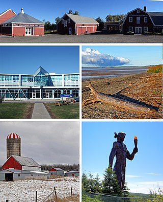
Truro is a town in central Nova Scotia, Canada. Truro is the shire town of Colchester County and is located on the south side of the Salmon River floodplain, close to the river's mouth at the eastern end of Cobequid Bay.
Tatamagouche is a village in Colchester County, Nova Scotia, Canada.

Cumberland—Colchester is a federal electoral district in Nova Scotia, Canada, that has been represented in the House of Commons of Canada since 2004.
Highway 102 is a north–south highway in the Canadian province of Nova Scotia that runs from Halifax to Onslow, immediately north of the town of Truro. It is the busiest highway in Atlantic Canada.

The Chignecto-Central Regional Centre for Education is a Canadian public school district in Nova Scotia.

Trunk 2 is part of the Canadian province of Nova Scotia's system of Trunk Highways. The route runs from Halifax to Fort Lawrence on the New Brunswick border. Until the 1960s, Trunk 2 was the Halifax area's most important highway link to other provinces, and was part of a longer Interprovincial Highway 2 which ended in Windsor, Ontario. The controlled access Highway 102 and Highway 104 now carry most arterial traffic in the area, while Trunk 2 serves regional and local traffic.

Trunk 4 is part of the Canadian province of Nova Scotia's system of Trunk Highways. The route runs from Highway 104 exit 7 near Thomson Station to Glace Bay. Until the construction of the Trans-Canada Highway, Trunk 4 was a major traffic link in northern Nova Scotia and Cape Breton, and is still used on Cape Breton as an alternative to Highway 105. The highway was originally called the King's Highway, however, this name is no longer applied to the entire road. The only remaining historic section of the highway that maintains the name "King" is King's Road in Sydney.
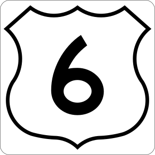
Trunk 6 is part of the Canadian province of Nova Scotia's system of trunk highways. The route runs from Highway 104 exit 3 at Amherst to the rotary at Pictou, a distance of 136 kilometres (85 mi). It is part of the Sunrise Trail, a designated tourist route.
The Lighthouse Route is a scenic roadway in the Canadian province of Nova Scotia. It follows the province's South Shore for 585 km (364 mi) from Halifax to Yarmouth.
Route 289 is a collector road in the Canadian province of Nova Scotia.
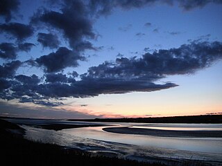
The Fundy Shore Ecotour is a former scenic drive and network of tourist destinations in the Canadian province of Nova Scotia and encircles several sub-basins of the Bay of Fundy, which contains the highest tidal range on the planet.

Route 236 is a collector road in the Canadian province of Nova Scotia.
The Stewiacke Valley is a Canadian rural region in central Nova Scotia running from western Pictou County through southern Colchester County to the Shubenacadie River.