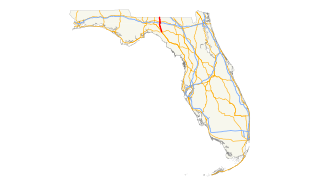
| Route | Road Name(s) | From | To | Notes |
|---|
 CR 14 CR 14 | | CR 14 at the Taylor County line southeast of Ebb | SR 14 southwest of Madison | Former SR 14 [1] |
 CR 53 CR 53 | | CR 53 at the Lafayette County line south-southeast of Lee | SR 53 southwest of Lee | Former SR 53 [1] |
 CR 140 CR 140 | | US 221 (SR 55) north of Greenville | CR 150 northeast of Greenville | Former SR 140 [1] |
 CR 141 CR 141 | Myrrh Road | NE Myrrh Street in Suwannee River State Park east-southeast of Lee | CR 141 at the Hamilton County line east of Lee | Unsigned |
 CR 146 CR 146 | Little Cat Road | SR 53 north of Madison | Empress Road at the Georgia state line north-northwest of Madison | Former SR 146 [1] |
 CR 150 CR 150 | SW Overstreet Avenue
NW Lovett Road
NW Little Cat Road
NE Bellville Road | US 19 / US 27 (SR 20) / Wyoming Street south-southwest of Greenville
US 90 (SR 10) east of Greenville
SR 145 / NE Persimmon Drive in Pinetta | US 221 (SR 55) south of Greenville
SR 145 / NE Eucalyptus Street south-southwest of Pinetta
CR 152 at the Hamilton County line east of Pinetta | Former SR 150 [1] |
 CR 158 CR 158 | Sundown Creek Road | US 221 (SR 55) south of Greenville | CR 14 south-southwest of Madison | Former SR 158 [1] |
 CR 253 CR 253 |
NE Cherry Lake Circle | Milton Road at the Georgia state line north-northwest of Madison
SR 53 north-northwest of Madison | SR 53 north-northwest of Madison
CR 253 north of Madison | Former SR 253 [1] |
 CR 254 CR 254 | NE Dusty Miller Avenue | SR 145 north-northeast of Madison | CR 255 northeast of Madison | Former SR 254 [1] |
 CR 255 CR 255 | NE Hickory Grove Road
NE Dusty Miller Avenue | CR 53 south-southeast of Lee | CR 150 east-southeast of Pinetta | Former SR 255 [1] |
 CR 360 CR 360 | SW Moseley Hall Road | US 221 (SR 55) in Ebb | SR 14 south-southwest of Madison | Former SR 360 [1] |
 CR 360A CR 360A | SW Martin Luther King Jr. Drive | SR 14 southwest of Madison | US 90 (SR 10) / NW Crane Avenue in Madison | Former SR 360A [1] |
 CR 591 CR 591 | NE Rocky Ford Road | SR 145 in Madison | CR 150 / NE Rootman Road west-southwest of Pinetta | |

