List of county roads in Polk County, Florida

Last updated

County blank.svg
County road shields used in Florida
Highway names
Interstates Interstate X (I-X)
US Highways U.S. Highway X (US X)
State State Road X (SR X)
County:County Road X (CR X)
System links

The following is a list of county roads in Polk County, Florida . All county roads are maintained by the county in which they reside.

County roads in Polk County

RouteRoad Name(s)FromToNotes
CR 17 jct.svg CR 17 Polk City RoadCR 557 US 17/92 in Haines City former SR 17 [1]
CR 17A jct.svg CR 17A Masterpiece Garden Road
Burns Avenue
US 27 SR 17former SR 17A [1]
CR 17B jct.svg CR 17B Hunt Brothers Road
Buckmore Road
US 27CR 17Aformer SR 17A (south of SR 60) and SR 17B (north of SR 60) [1]
CR 33A jct.svg CR 33A Edgewood Drive SR 37 US 98 former SR 33A [2]
unsigned
CR 35A jct.svg CR 35A West Socrum Loop Road
Dade City Road
Kathleen Road
US 98 I-4 & SR 539 former SR 35A [1]
CR 37A jct.svg CR 37A Cleveland Heights Boulevard
Scott Lake Road
former SR 37A [1]
CR 37B jct.svg CR 37B Lakeland Highlands Roadformer SR 37B [1]
CR 54 jct.svg CR 54 Ronald Reagan Parkway (formerly Loughman Road)US 27US 17/92 at Loughman former SR 54 [1]
unsigned since ca. 2000 when it was renamed for Ronald Reagan
CR 60A jct.svg CR 60A Polk Avenue SR 60 SR 60 former SR 60A [1]
unsigned
CR 64 jct.svg CR 64 Main StreetHighlands-Polk County Line Avon Park Air Force Range former SR 64 [1]
CR 540 jct.svg CR 540 Clubhouse RoadCR 37B US 98 former SR 540 [1]
CR 540 jct.svg CR 540 Waverly Road
Main Street
US 27 & SR 540 SR 17 former SR 540 [3]
unsigned
CR 540A jct.svg CR 540A Central Barn Road SR 37 US 98 former SR 540A [1]
CR 540A jct.svg CR 540A Eloise Loop Road
Lake Ruby Drive West
CR 655 SR 540 former SR 540A [1]
CR 542 jct.svg CR 542 Old Tampa HighwayCounty Line RoadWabash Avenueformer SR 542 [1]
CR 542 jct.svg CR 542 K-Ville Avenue
North Lake Howard Drive
Avenue D Northwest
Gary RoadUS 17former SR 542 [1]
CR 542 jct.svg CR 542 Lake Hatchineha Road SR 17 Lake Hatchinehaformer SR 542 [1]
CR 542A jct.svg CR 542A North Galloway RoadSR 572 & CR 542CR 35Aformer SR 542A [1]
CR 544 jct.svg CR 544 Old Lucerne Park Road SR 544 SR 544 unsigned
CR 544 jct.svg CR 544 Lake Marion Road SR 17 & SR 544 Lake Marionformer SR 544 [1]
CR 544A jct.svg CR 544A Derby Avenue SR 655 SR 544 former SR 544A [1]
CR 546 jct.svg CR 546 Saddle Creek Road
Old Dixie Highway
SR 659 CR 655former SR 546; [1] Continues east of CR 655 as Dixie Highway
CR 546 jct.svg CR 546 Kokomo RoadSR 17CR 544former SR 546 [1]
CR 547 jct.svg CR 547 Holly Hill Drive
Lee Jackson Street
US 27 CR 54former SR 547 [1]
CR 550 jct.svg CR 550 Overlook Drive SR 540 SR 542 former SR 542 [1]
CR 555 jct.svg CR 555 County Road 555
Agricola Road
CR 630 SR 60 former SR 555 [1]
CR 555 jct.svg CR 555 South Buena Vista Drive
West Echo Street
US 17/92US 17/92former SR 555 [1]
CR 557 jct.svg CR 557 North Buena Vista Drive
Old Grade Road
US 17/92 at Lake Alfred I-4former SR 557 and SR 557A [1]
CR 557A jct.svg CR 557A SR 559 CR 557former SR 557 [1]
CR 559 jct.svg CR 559 CR 640CR 655Aformer SR 559 [1]
CR 559 jct.svg CR 559 US 17 CR 655former SR 559 [1]
unsigned
CR 559A jct.svg CR 559A C. Fred Jones BoulevardCR 655 SR 559 former SR 559 [1]
CR 580 jct.svg CR 580 East Johnson Avenue
Marion Creek Road
Cypress Parkway
US 17/92 in Haines CityPolk-Osceola County Line at Poinciana former SR 580 [1]
CR 582 jct.svg CR 582 Knights Station-Griffin Road
North Florida Avenue
North Socrum Loop Road
Hillsborough-Polk County LinePearce Avenueformer SR 582 [1]
signed only north of SR 33
CR 630 jct.svg CR 630 Brewster-Fort Meade Road SR 37 US 17 & US 98 former SR 630 [1]
CR 630 jct.svg CR 630 State Highway 630 West
West H Street
Highway 630 East
US 27 & US 98 SR 60 former SR 630 [1]
CR 630A jct.svg CR 630A US 27 CR 630former SR 630A [1]
CR 630A jct.svg CR 630A Fort Meade RoadCR 630 SR 17 former SR 630A [1]
unsigned
CR 640 jct.svg CR 640 Pinecrest Road
Homeland-Garfield Road
Hillsborough-Polk County LineCR 559former SR 640 [1]
CR 640 jct.svg CR 640 Alturas-Babson Park Cutoff US 27 SR 17 former SR 640 [1]
CR 653 jct.svg CR 653 Old Bartow Lake Wales RoadCR 540Aformer SR 653 [1]
CR 655 jct.svg CR 655 Berkley Road US 92 SR 33 former SR 655 [1]
CR 655 jct.svg CR 655 Rifle RangeRoad
Pine Ridge Road
Old 9 Foot Road
SR 60 US 17 & SR 655 former SR 559 and SR 655 [1]
CR 655A jct.svg CR 655A Cox Road
Alturas Road
SR 60 SR 60 former SR 655A [1]
CR 657 jct.svg CR 657 CR 664 (Hardee County line) Fort Meade former SR 657 [1]
unsigned
CR 664 jct.svg CR 664 Northwest County Line Street US 17 Bridge over an undetermined creekformer SR 664 [1]
unsigned; follows Hardee County line
CR 676 jct.svg CR 676 Hillsborough-Polk County Line SR 60 former SR 676 [1]

Related Research Articles

<span class="mw-page-title-main">Interstate 4</span> Interstate Highway in Florida, United States

Interstate 4 (I-4) is an Interstate Highway located entirely within the US state of Florida, maintained by the Florida Department of Transportation (FDOT). Spanning 132.30 miles (212.92 km) along a generally southwest–northeast axis, I-4 is entirely concurrent with State Road 400 (SR 400). In the west, I-4 begins at an interchange with I-275 in Tampa. I-4 intersects with several major expressways as it traverses Central Florida, including US Highway 41 (US 41) in Tampa; US 301 near Riverview; I-75 near Brandon; US 98 in Lakeland; US 27 in unincorporated Davenport; US 192 in Celebration; Florida's Turnpike in Orlando; and US 17 and US 92 in multiple junctions. In the east, I-4 ends at an interchange with I-95 in Daytona Beach, while SR 400 continues for roughly another four miles (6.4 km) and ends at an intersection with US 1 on the city line of Daytona Beach and South Daytona.

<span class="mw-page-title-main">U.S. Route 92</span> Highway in the United States

U.S. Route 92 or U.S. Highway 92 is a 181-mile (291 km.) U.S. Route entirely in the U.S. state of Florida. The western terminus is at US 19 Alt. and SR 687 in downtown St. Petersburg. The eastern terminus is at SR A1A in Daytona Beach.

State Road 570 (SR 570), also known as the Polk Parkway, is a 24-mile (39 km) controlled-access toll road which runs through Polk County, Florida. It is operated as part of Florida's Turnpike Enterprise system of tolled freeways. The Polk Parkway mainly serves as a beltway around Lakeland forming a semicircle, which along with I-4 circumscribes most of the city limits of Lakeland.

<span class="mw-page-title-main">Sunset Drive</span>

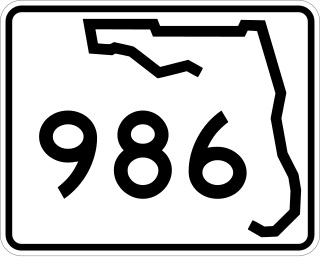
Sunset Drive, also known as Southwest 72nd Street is a 12.5-mile-long (20.1 km) east–west arterial road traversing the southwestern suburbs of Miami, Florida, from the northwestern portions of the Kendall area to Coral Gables. A central portion of Sunset Drive is maintained by the Florida Department of Transportation as State Road 986, which runs from the Homestead Extension (HEFT) underpass to Southwest 69th Avenue and is signed through South Miami to US 1.

<span class="mw-page-title-main">Florida State Road 48</span> Highway in Florida

State Road 48 (SR 48) was an east–west state highway that ran from U.S. Highway 41 in Floral City, Florida, to Florida State Road 19 in Howey-in-the-Hills, Florida. In the last years of the route's existence, it was a 2.167 miles (3.487 km) state road in Bushnell, Florida, which ran from Interstate 75 (I-75) at exit 314 to U.S. Highway 301 (US 301). Today, all segments are designated County Road 48 (CR 48), where they are under county maintenance. Segments in Sumter County are part of the Scenic Sumter Heritage Byway.

<span class="mw-page-title-main">Florida State Road 542</span> State highway in Florida, United States

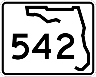
State Road 542 is a west–east route in Central Florida, serving Polk County. It runs 6 miles from downtown Winter Haven to west of downtown Dundee, Florida.

<span class="mw-page-title-main">Florida State Road 35</span> Highway in Florida

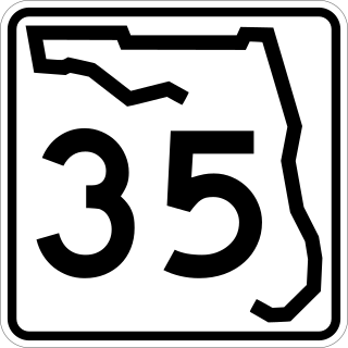
State Road 35 is a north–south state highway in the western counties of the U.S. state of Florida.

<span class="mw-page-title-main">Central Polk Parkway</span>

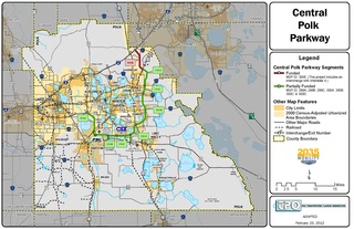
The Central Polk Parkway, also known as State Road 570B (SR 570B), is a proposed controlled-access toll road in Polk County, Florida. The proposed road is actually two separate roads—called legs by the Florida Department of Transportation (FDOT). The western segment will connect the Polk Parkway with SR 60 between Bartow and Lake Wales. The eastern leg will start a few miles east of SR 60 and run north, parallel to US Highway 27 (US 27), and terminate at Interstate 4 (I-4) north of Davenport. The most recent, and viable, proposed routing will connect the two legs together near the CSX Intermodal Facility south of Wahneta. In December 2015, FDOT announced the cancellation of any further work on the project, citing insufficient funds and low traffic volume. The project continued to have the support of the local business community and local politicians, however, and it was revived in 2018.

<span class="mw-page-title-main">Florida State Road 563</span> State highway in Florida, United States

State Road 563 (SR 563) is a 4.912-mile-long (7.905 km) state highway in Lakeland, Polk County, Florida, that runs from 0.162 miles (0.261 km) south of Beaker Road to U.S. Route 92 and Martin Luther King Jr. Avenue.

<span class="mw-page-title-main">Florida State Road 655</span> State highway in Florida, United States

State Road 655 (SR 655) is a 7.125-mile-long (11.467 km) state highway in Polk County, Florida, that runs from U.S. Route 17 and County Road 655 at Eloise just south of Winter Haven city limits to U.S. Route 92 in western Auburndale.

References