
State Road 80 is a 123.5 miles (198.8 km) route linking US 41 Business in Fort Myers and State Road A1A in Palm Beach. The road is the northernmost of three linking Southwest Florida to South Florida via the Everglades. Due to increasing traffic, State Road 80 has experienced upgrades and widening in various sections since 2000.
Spanish River Boulevard is a short east–west highway in Boca Raton, Palm Beach County, Florida. The eastern 0.5 miles (0.80 km) is signed as State Road 800 (SR 800), though the western segment was formerly SR 800 as well. The western terminus of the boulevard is at Military Trail, but the state route does not begin until Federal Highway. Both the state route and the road itself terminate at Ocean Boulevard near the Atlantic Ocean shoreline at the northeastern corner of Spanish River Park, near Highland Beach.

Dixie Highway in Palm Beach and Broward counties carries two segments of the State Road 811 designation by Florida Department of Transportation, as well as the local County Road 811 in southeast Florida. The entire road comprises a section of the Dixie Highway, a National Auto Trail which eventually became a former routing of U.S. Route 1 after the route was shifted east to Federal Highway. One segment of SR 811 is in Broward County and the other is in Palm Beach County, Florida. The segments of SR 811 are supplemented by three shorter segments of CR 811, one of which is unsigned.

State Road 704 (SR 704), also known as Okeechobee Boulevard, is a 10.199-mile-long (16.414 km) east–west boulevard in the West Palm Beach area, known for being dangerous to pedestrians and bicyclists. It extends from an intersection with SR 7 at the border of West Palm Beach and Royal Palm Beach and just south of The Acreage at the western end to an intersection with SR A1A in Palm Beach at the east end.

Florida State Road 817 (SR 817) is a 25.691-mile-long (41.346 km) state highway in the U.S. state of Florida, locally known as Northwest 27th Avenue in Miami-Dade County and University Drive in Broward County. Its southern terminus is an intersection in Opa-locka with SR 9, which continues south along Northwest 27th Avenue to Dixie Highway in the Coconut Grove neighborhood of Miami. Its northern terminus is at State Road 834 in Coral Springs, though the right of way continues north to Loxahatchee Road at the Palm Beach County line.
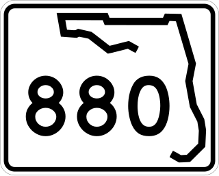
State Road 880 is a 0.475 miles (0.764 km) long state highway in Belle Glade, Florida, running from SR 80 and SR 15 east to State Road 717. From here, it continues east for almost 19 miles (31 km) to Twenty Mile Bend as County Road 880.

Military Trail is a 46.2-mile (74.35 km) long six-lane north–south arterial road in Broward and Palm Beach counties in South Florida. A portion of the road is designated State Road 809 (SR 809), but most of the road within Palm Beach County is locally maintained and signed as County Road 809 (CR 809), while the Broward County section exists without either designation.

Glades Road is an 11.115-mile (17.888 km) long east–west arterial boulevard in southern Palm Beach County, Florida. The majority of the road is signed as State Road 808, but the westernmost 3.5 miles (5.63 km) is designated as County Road 808. SR 808 begins at an intersection with US 441–SR 7 in what was formerly Mission Bay (but is now unincorporated Boca Raton; its eastern terminus is an intersection with Federal Highway in Boca Raton. The county-maintained segment proceeds west from US 441 / SR 7 and bends south to end at the western terminus of Palmetto Park Road.
Northlake Boulevard is an east–west road in Palm Beach County, Florida that currently comprises State Road 850 and County Road 809A from Seminole Pratt Whitney Road in Loxahatchee to US 1 in North Palm Beach.

County Road 707 (CR 707) is a designation applied to two segments of road across three counties on Florida's Treasure Coast. The entire road was formerly designated State Road 707 (SR 707) and has been gradually transferred to county jurisdiction.

Indiantown Road is a 17-mile (27 km) east–west road connecting inner Palm Beach County, with Florida's Turnpike, Interstate 95, and U.S. Route 1 in Jupiter, Florida. The road was formerly entirely designated as State Road 706 (SR 706), but majority of it has been transferred to local jurisdiction and is signed as County Road 706.

The former State Road 827, was an east–west road that stretched 35 miles (56 km) along the southern edge of the Hillsboro Canal, originally extending from Sixmile Bend to present-day Parkland. Now County Road 827, the road is locally known as Browns Farms Road and Loxahatchee Road in two segments, while a third is unnamed.
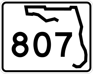
Congress Avenue is a 28.9-mile (46.51 km) long north–south arterial road serving central Palm Beach County, Florida. A 4.8-mile (7.72 km) section from Palm Springs to Palm Beach International Airport encompasses Florida State Road 807 (SR 807), while the remaining southern section is officially known––but seldom referred to––as County Road 807. In addition, a segment north of the airport exists without state or county designation.

State Road 732 (SR 732) comprises two segments of a state highway in the Jensen Beach, Florida vicinity. The western 2.2-mile-long (3.5 km) segment is a part of Jensen Beach Boulevard between U.S. Route 1 (US 1) and County Road 723 (CR 723) and CR 707A. The eastern 1.9-mile-long (3.1 km) segment consists of Causeway Boulevard and the Jensen Beach Causeway over the Indian River Lagoon and runs between CR 707 and SR A1A.

U.S. Highway 1 (US 1) in Florida runs 545 miles (877 km) along the state's east coast from Key West to its crossing of the St. Marys River into Georgia north of Boulogne and south of Folkston. US 1 was designated through Florida when the U.S. Numbered Highway System was established in 1926. With the exception of Monroe County, the highway runs through the easternmost tier of counties in the state, connecting numerous towns and cities along its route, including nine county seats. The road is maintained by the Florida Department of Transportation (FDOT).

U.S. Route 98 is a major east-west thoroughfare through the U.S. state of Florida. Spanning 670.959 miles (1,079.804 km), it connects Pensacola and the Alabama/Florida state line to the west with Palm Beach and the Atlantic coast in the east. It is the longest US road in Florida, as well as the longest US road in any state east of the Mississippi River.
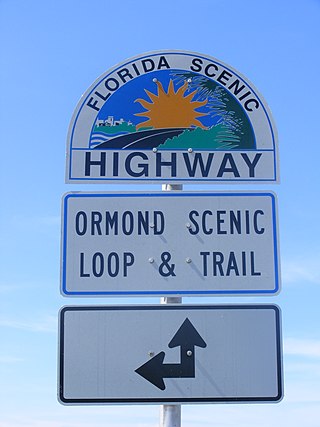
The Ormond Scenic Loop and Trail is a series of scenic state and county highways in Volusia County, Florida. CR 2002 is the northern leg of the trail. CR 4011(Old Dixie Highway and North Beach Street) is the western leg, with a spur onto Pine Tree Drive. SR 40(East Granada Boulevard) is the southern leg of the trail. CR 2803(John Anderson Drive) is the central leg of the trail, and SR A1A is the eastern leg of the trail. Florida Scenic Highway, designated this route on July 9, 2007.

