The following is a list of county roads in Bay County, Florida. All county roads are maintained by the county in which they reside, although not all routes are marked with standard county road shields.
Interstate 4 (I-4) is an Interstate Highway located entirely within the US state of Florida, maintained by the Florida Department of Transportation (FDOT). Spanning 132.30 miles (212.92 km) along a generally southwest–northeast axis, I-4 is entirely concurrent with State Road 400 (SR 400). In the west, I-4 begins at an interchange with I-275 in Tampa. I-4 intersects with several major expressways as it traverses Central Florida, including US Highway 41 (US 41) in Tampa; US 301 near Riverview; I-75 near Brandon; US 98 in Lakeland; US 27 in unincorporated Davenport; US 192 in Celebration; Florida's Turnpike in Orlando; and US 17 and US 92 in multiple junctions. In the east, I-4 ends at an interchange with I-95 in Daytona Beach, while SR 400 continues for roughly another four miles (6.4 km) and ends at an intersection with US 1 on the city line of Daytona Beach and South Daytona.
U.S. Route 92 or U.S. Highway 92 is a 181-mile (291 km.) U.S. Route entirely in the U.S. state of Florida. The western terminus is at US 19 Alt. and SR 687 in downtown St. Petersburg. The eastern terminus is at SR A1A in Daytona Beach.
State Road A1A (SR A1A) is a major north–south Florida State Road consisting of seven separate sections running a total of 338.752 miles (545.168 km) along the Atlantic Ocean, from Key West at the southern tip of Florida, to Fernandina Beach, just south of Georgia on Amelia Island. It is the main road through most oceanfront towns. Part of SR A1A is designated the A1A Scenic and Historic Coastal Byway, a National Scenic Byway. A portion of SR A1A that passes through Volusia County is designated the Ormond Scenic Loop and Trail, a Florida Scenic Highway. It is also called the Indian River Lagoon Scenic Highway from State Road 510 at Wabasso Beach to U.S. Route 1 in Cocoa. In 2024, the entirety of A1A from Key West to the Georgia state line was designated the Jimmy Buffett Memorial Highway. SR A1A is famous worldwide as a center of beach culture in the United States, a scenic coastal route through most Atlantic coastal cities and beach towns, including the unique tropical coral islands of the Florida Keys. SR A1A also serves as a major thoroughfare through Miami Beach and other south Florida coastal cities.
State Road 30A (SR 30A) is a Florida Department of Transportation designation shared by four alternate routings of SR 30 in the Florida panhandle. Two segments have SR 30A signage; the other two do not as they are segments of U.S. Route 98 (US 98). Three of the four SR 30A segments are next to the shore of the Gulf of Mexico for most of their length.
State Road 30 is the mostly hidden Florida Department of Transportation designation for most of US 98 from the Florida-Alabama state line to east of Perry, Florida.
State Road 856 (SR 856), also known as the William Lehman Causeway, is a 1.704-mile-long (2.742 km) causeway connecting Biscayne Boulevard in Aventura and Collins Avenue (SR A1A) in Sunny Isles Beach, Florida.
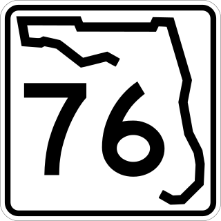
State Road 76, also known and signed as Kanner Highway, is a 31.504-mile-long (50.701 km) northeast-southwest state highway connecting Port Mayaca on the shore of Lake Okeechobee at the intersection with US 98-441 with Stuart on the shore of the St. Lucie River near the Atlantic Ocean and the Treasure Coast at an intersection with US 1. It parallels the nearby St. Lucie Canal, a navigable waterway connecting the lake and the ocean.
Flagler Street is a 12.4-mile (20.0 km) main east–west road in Miami. Flagler Street is the latitudinal baseline that divides all the streets on the Miami-Dade County grid plan as north or south streets. Flagler Street is named after industrialist Henry Flagler and serves as a major commercial east–west highway through central Miami-Dade County, with a mixture of residential neighborhoods and strip malls, the commercial presence increasing as SR 968 approaches downtown Miami.
State Road 13 (SR 13) is a 28.25-mile-long (45.46 km) state highway in the U.S. state of Florida, running north from SR 16 near Green Cove Springs, through Switzerland to Jacksonville on the east shore of the St. Johns River.
U.S. Highway 1 (US 1) in Florida runs 545 miles (877 km) along the state's east coast from Key West to its crossing of the St. Marys River into Georgia north of Boulogne and south of Folkston. US 1 was designated through Florida when the U.S. Numbered Highway System was established in 1926. With the exception of Monroe County, the highway runs through the easternmost tier of counties in the state, connecting numerous towns and cities along its route, including nine county seats. The road is maintained by the Florida Department of Transportation (FDOT).
Interstate 75 (I-75) is a part of the Interstate Highway System that runs from the Hialeah–Miami Lakes border, a few miles northwest of Miami, to Sault Ste. Marie in the Upper Peninsula of Michigan. I-75 begins its national northward journey near Miami, running along the western parts of the Miami metropolitan area before traveling westward across Alligator Alley, resuming its northward direction in Naples, running along Florida's Gulf Coast, and passing the cities of Fort Myers, Punta Gorda, Venice, and Sarasota. The freeway passes through the Tampa Bay area before turning inward toward Ocala, Gainesville, and Lake City before leaving the state and entering Georgia. I-75 runs for 471 miles (758 km) in Florida, making it the longest Interstate in the state and also the longest in any state east of the Mississippi River. The Interstate's speed limit is 70 mph (110 km/h) for its entire length in Florida.
U.S. Highway 19 (US 19) runs about 262 miles (422 km) along Florida's west coast from an interchange with US 41 in Memphis, south of Tampa, and continues to the Georgia border north of Monticello.
State Road 64 extends from City Road 789 near the Gulf of Mexico in Holmes Beach on Anna Maria Island in Manatee County to US 27/US 98 in Avon Park in Highlands County. State Road 64 travels from west to east through the counties of Manatee, Hardee and Highlands.
State Road 390 is a two-lane state highway in Bay County, Florida. The route is signed as east-west but runs more north-south for much of its run. The western (southern) terminus is at the intersection of U.S. Route 98 (US 98)/SR 30 and US 98 BUS/SR 30A in St. Andrews. The highway is carried by Beck Ave from this point until shortly after it crosses SR 368, at which point it becomes St Andrews Blvd. The route winds northeasterly into Lynn Haven, where it is carried by Tennessee Ave at one point. In Lynn Haven, the road eventually turns due east and intersects with SR 77, and continues east until its terminus at US 231/SR 75. The portion between SR 77 and US 231 was signed as SR S-390 before being given to the county in the late 1970s, and back to the state in 2016.
State Road 388 (SR 388) is a 12.3-mile-long (19.8 km) state highway in Bay County, Florida, that runs from SR 79 and West Bay Parkway northeast of West Bay east to SR 77 and Edwards Road southeast of Vicksburg. It is named the Don Johnson Memorial Highway.
References
↑ description in 1945 renumbering document: "From a point on SR30 in Panama City near the East City Limits South to 3rd St. then East on 3rd St. and East and Southeast via Callaway and Wetappo to intersection with SR71 in Wewahitchka in Gulf Co."
This page is based on this Wikipedia article Text is available under the CC BY-SA 4.0 license; additional terms may apply. Images, videos and audio are available under their respective licenses.