List of county roads in Marion County, Florida

Last updated

County blank.svg
County road shields used in Florida
Highway names
Interstates Interstate X (I-X)
US Highways U.S. Highway X (US X)
State State Road X (SR X)
County:County Road X (CR X)
System links

The following is a list of county roads in Marion County, Florida . All county roads are maintained by the county in which they reside.

County routes in Marion County

#Road Name(s)Direction and TerminiNotes
CR 21 jct.svg CR 21 S–N CR 315 Orange Springs CR 21 Putnam County line north-northwest of Orange Springs former SR 21 [1]
CR 25 jct.svg CR 25 SE 110 StreetS–N CR 25 / SE 180 Street Lake County line south-southwest of Weirsdale SR 25 / SR 35 / Baseline Road Belleview Former SR 25 [1]
CR 25A jct.svg CR 25A

NW Gainesville Road
NW Gainesville Road
NW 16th Avenue
W–E
S–N
S–N
US 27 / US 441 (SR 25 / SR 500)
US 301 / US 441 (SR 25 / SR 200)
Dead end
Belleview
Ocala
North of Ocala
CR 25
35th Street
US 441 (SR 25)
East of Belleview
North of Ocala
North-northwest of Reddick
Former SR 25A [1]
CR 35 jct.svg CR 35 NE 55 Avenue
NE 55 Avenue Road
NE 58 Avenue
S–N SR 35 / SR 40 Silver Springs NE 90 Street Road / NE 97 Street Road Indian Lake State Forest north-northeast of Silver Springs Extension of SR 35; FDOT inventories the route as part of SR 35, but it is signed as CR 35.
CR 40 jct.svg CR 40 Cedar StreetW–E CR 40 Levy County line west of Dunnellon US 41 (SR 45) / CR 336 / CR 484 Dunnellon Former SR 40 [1]
CR 42 jct.svg CR 42 W–ESouth Magnolia AvenueWest of Pedro CR 42 Lake County line in Ocala National Forest east-southeast of Linadale Former SR 42 [1]
CR 200A jct.svg CR 200A NW 20th Street
NE Jacksonville Road
S–N US 301 / US 441 (SR 25 / SR 200) Ocala US 301 (SR 25)South-southwest of Citra Former SR 200A [1]
CR 225 jct.svg CR 225 S–N US 27 (SR 500)Southeast of Fellowship CR 318 Irvine Former SR 225 [1]
CR 225A jct.svg CR 225A SW 80th Avenue
NW 70 Avenue Road
S–N SR 40 / SW 80 AvenueWest of Ocala CR 329 South-southeast of Fairfield Former SR 225A [1]
CR 301 jct.svg CR 301 (former)[ citation needed ] [2] Northeast 160th Avenue RoadS–N CR 316 Ocala National Forest east-northeast of Fort McCoy Former SR 301 [3]
CR 312 jct.svg CR 312 SW 87 PlaceW–E CR 475A South of Ocala CR 475 South of Ocala Former SR 312 [1]
CR 314 jct.svg CR 314 NE 7 Street, Sharpe's Ferry RoadW–E SR 35 / NE 7 StreetEast of Ocala SR 19 Salt Springs Former SR 314 [1]
CR 314A jct.svg CR 314A SE 95 Street RoadS–NSE 183 Avenue Road / SE 95 Street Road Ocala National Forest east-southeast of Moss Bluff CR 314 Ocala National Forest east of Cedar Creek Former SR 314A [1]
CR 315 jct.svg CR 315 S–N SR 40 East of Silver Springs CR 315 Putnam County line northeast of Orange Springs Former SR 315 [1]
CR 316 jct.svg CR 316


W–E US 27 (SR 500)
US 301 (SR 200)
CR 200A
West-southwest of Fairfield
North-northwest of Sparr
US 301 (SR 200)
CR 200A
SR 19 / NE 142 Place Road
North-northwest of Sparr
Ocala National Forest in Salt Springs
Former SR 316 [1]
CR 318 jct.svg CR 318 W–E CR 318 / CR 335 Levy County line in East Williston CR 315 South-southwest of Orange Springs Former SR 318 [1]
CR 320 jct.svg CR 320 Northwest Highway 320
Avenue G
W–ELevy-Marion County Line. US 441 former SR 320 [1]
CR 326 jct.svg CR 326 W–ELevy-Marion County Line. I-75 / SR 326 former SR 326 [1]
CR 328 jct.svg CR 328 W–ELevy-Marion County Line. SR 40 former SR 328 [1]
CR 328 jct.svg CR 328 W–ECR 475 US 27 301 441 former SR 328 [1]
CR 329 jct.svg CR 329 S–N CR 200A Marion-Alachua County Line.former SR 329 [1]
CR 335 jct.svg CR 335 S–N US 27 Levy-Marion County Lineformer SR 335 [1]
CR 336 jct.svg CR 336 W–ELevy-Marion County Line. US 41 @ CR 484 Dunnellonformer SR 336 [1]
Overlaps CR 40
CR 450 jct.svg CR 450 W–E CR 42 Marion-Lake County Line.former SR 450 [1]
CR 452 jct.svg CR 452 W–E CR 42 Marion-Lake County Line.former SR 452 [1]
CR 464 jct.svg CR 464 W–E SR 35 @ SR 464 SR 25 former SR 464 [1]
CR 464A jct.svg CR 464A S–N US 27 301 441 Ocala.former SR 464A [1]
inventoried by FDOT as part of CR 4183
CR 464B jct.svg CR 464B W–ELevy-Marion County Line US 27 former SR 464 [1]
CR 464C jct.svg CR 464C W–E SR 25 CR 314A & Southeast 95th StreetCedar Creek(Ocala National Forest)former SR 464 [1]
CR 467 jct.svg CR 467 S–Nformer SR 467 [1]
CR 475 jct.svg CR 475 S–NSumter-Marion County Line US 27 301 441 Ocalaformer SR 475 [1]
CR 475A jct.svg CR 475A S–NCR 475SR 200former SR 475A [1]
CR 475B jct.svg CR 475B W–ECR 475ACR 475former SR 475B [1]
CR 475C jct.svg CR 475C S–NCR 475A SR 200 former SR 475C [1]
CR 484 jct.svg CR 484 W–E US 41, CR 40 & CR 336 Dunnellon US 27 301 441 Belleviewformer SR 484 [1]
CR 500A jct.svg CR 500A SR 40 US 27 (SR 500)former SR 500A [1]
Sharpes Ferry bridge over the Ocklawaha River, on CR 314 in 2007. Marion Cty Sharpes Ferry bridge01.jpg
Sharpes Ferry bridge over the Ocklawaha River, on CR 314 in 2007.

Related Research Articles

<span class="mw-page-title-main">Florida State Road 500</span>

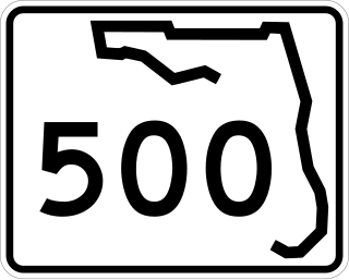
State Road 500 is a state highway running through Florida as a mostly unsigned route under several U.S. Highways. From Chiefland to Williston it is U.S. Highway 27 Alternate. From Williston to Ocala, it is US 27. From Ocala to Holopaw, it is US 441. From Kissimmee to Indialantic it is US 192.

<span class="mw-page-title-main">Florida State Road 916</span>

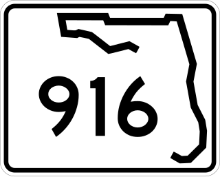
State Road 916, locally known as Northwest 138th Street, West 84th Street, North 135th Street, Opa-locka Boulevard, and Natural Bridge Road is a 10.253 miles (16.501 km) long east–west highway crossing northern Miami-Dade County, Florida. Its western terminus is at an interchange with Interstate 75 (I-75), the Palmetto Expressway, and the Gratigny Parkway on the boundary between Hialeah and Miami Lakes, traveling east to Biscayne Boulevard.

<span class="mw-page-title-main">Sunset Drive</span>

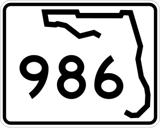
Sunset Drive, also known as Southwest 72nd Street is a 12.5-mile-long (20.1 km) east–west arterial road traversing the southwestern suburbs of Miami, Florida, from the northwestern portions of the Kendall area to Coral Gables. A central portion of Sunset Drive is maintained by the Florida Department of Transportation as State Road 986, which runs from the Homestead Extension (HEFT) underpass to Southwest 69th Avenue and is signed through South Miami to US 1.

<span class="mw-page-title-main">Florida State Road 25</span> Highway in Florida

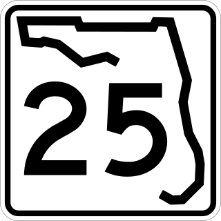
State Road 25 is a state highway in the U.S. state of Florida. It is mainly signed as U.S. Highways:

<span class="mw-page-title-main">Florida State Road 326</span>

State Road 326 is an east–west route in Marion County, Florida, in and around Ocala. The western terminus is near Interstate 75's (I-75) exit 358, and its eastern end is at SR 40 east of Silver Springs. The highway acts as a bypass around Ocala, taking traffic to SR 40 on the edge of the Ocala National Forest.

<span class="mw-page-title-main">Florida State Road 544</span>

State Road 544 (SR 544) is a west–east state road in the U.S. state of Florida. It runs 11.6 miles (18.7 km) from Auburndale to Haines City.

<span class="mw-page-title-main">Florida State Road 464</span>

State Road 464 is a short state and county road in Marion County, Florida. The road is primarily in southern Ocala, but extends outside of the city limits.

References

  1. 1 2 3 4 5 6 7 8 9 10 11 12 13 14 15 16 17 18 19 20 21 22 23 24 25 26 27 28 29 30 31 32 33 34 General Highway Map – Marion County, Florida (PDF) (Map). February 5, 1975. Archived from the original (PDF) on March 4, 2016. Retrieved September 16, 2018.
  2. Google Maps showing Northeast 160th Avenue Road/Hog Valley Road as Marion CR 301
  3. Marion County Official Records