List of county roads in Monroe County, Florida

Last updated

County blank.svg
County road shields used in Florida
Highway names
Interstates Interstate X (I-X)
US Highways U.S. Highway X (US X)
State State Road X (SR X)
County:County Road X (CR-X)
System links

The following is a list of county roads in Monroe County, Florida . All the roads here are maintained by Monroe County Department of Roads & Bridges, [1] although not all routes are marked with standard county road shields. In the case of Monroe County, every county road was formerly a state road.

Contents

County Road 5A

Monroe County 5A.svg

County Road 5A

Location Key West
Length2.5 mi [2]  (4.0 km)

County Road 5A is Flager Avenue from White Street to Roosevelt Boulevard (SR A1A) in Key West. [3]

Route description

Flagler Avenue begins at White Street in Key West and runs northeast. Half a mile later, it intersects First Street and Bertha Street. First Street runs north to U.S. Highway 1 (US 1) and Bertha Street runs south to SR A1A. Continuing east, Flagler Street runs just to the north of Key West International Airport before terminating at Roosevelt Boulevard (SR A1A) just south of US 1 (Overseas Highway). [2]

History

CR 5A was originally designated SR 5A. SR 5A was an auxiliary route to US 1 (which carries the hidden designation SR 5). [4]

Major intersections

The entire route is in Key West.

mi [2] kmDestinationsNotes
0.000.00White Street
0.500.80First Street / Bertha Street – Downtown, BeachesTo US 1 and SR A1A
2.504.02Florida A1A.svgTo plate.svg
US 1.svg
SR A1A (Roosevelt Boulevard) to US 1  Miami
1.000 mi = 1.609 km; 1.000 km = 0.621 mi

County Road 905

Monroe County 905.svg

County Road 905

Location Key LargoNorth Key Largo
Length11.0 mi [5]  (17.7 km)

County Road 905 is Key Largo Drive from US 1 to the Ocean Reef Club near Grayvik. [6]

Route description

CR 905 begins at U.S. Highway 1 (US 1), also known as the Overseas Highway, in Key Largo. From US 1, it heads northeast along Key Largo. Nine miles later, it intersects CR 905A (Card Sound Road) which runs to the mainland over the Card Sound Bridge. CR 905 then continues northwest to the Ocean Reef Club on the north end of Key Largo.

History

The southernmost 8 miles of CR 905 was the original alignment of the Overseas Highway (which was originally designated SR 4A) along with Card Sound Road. The original Overseas Highway, which was the first vehicular access to the Florida Keys came into existence in the 1920s. The Overseas Highway was later designated US 1 in 1938. In 1944, US 1 was rerouted to its current alignment between Florida City and Key Largo via Jewfish Creek (along the former Overseas Railroad). After the realignment, the Card Sound Bridge was taken out of service and the route in northern Key Largo eventually became SR 905. [7] In 1969, a new Card Sound Bridge was built with a realigned Card Sound Road being designated SR 905A.

SR 905 was realigned to the west near Card Sound Road in the 1970s. [8] SR 905 was subsequently turned over to county control. [4]

Major intersections

Locationmi [5] kmDestinationsNotes
Key Largo 0.000.00US 1.svg US 1  Homestead, Florida City, Key Largo, Key West
North Key Largo 9.2014.81North plate county.svg
CR 905A jct.svg
CR 905A north (Card Sound Road) Homestead, Turnpike, Miami
Southern terminus of CR 905A (former SR 905A); to tolled Card Sound Bridge
11.0017.70Ocean Reef ClubContinues north as a private road
1.000 mi = 1.609 km; 1.000 km = 0.621 mi

County Road 905A

Monroe County 905A.svg

County Road 905A

Location North Key Largo
Length4.0 mi [9]  (6.4 km)

County Road 905A is Card Sound Road from the Miami-Dade County line at the Card Sound Bridge to CR 905. [6] It was formerly designated SR 905A. [4]

Route description

Card Sound Road begins at CR 905 in North Key Largo. From here it heads west and crosses the Card Sound Bridge to the Florida mainland. Once across the bridge, it enters Miami-Dade County where it continues as CR 905A to US 1 near Florida City. [9]

History

Card Sound Road was the original alignment of US 1 prior to 1944. When US 1 was rerouted to its current alignment between Florida City and Key Largo via Jewfish Creek (along the former Overseas Railroad), The original Card Sound Bridge was closed to traffic and was later destroyed by a fire. In 1969, the current Card Sound Bridge opened, which restored Card Sound Road as a through route. [7] Though, the rebuilt Card Sound Road intersected SR 905 about 3000 feet north of the original road. [8]

Major intersections

The entire route is in North Key Largo.

mi [9] kmDestinationsNotes
0.000.00CR 905 jct.svg CR 905  Key Largo, Ocean Ridge Club
4.006.44North plate county.svg
CR 905A jct.svg
CR 905A north (Card Sound Bridge)
Tolled bridge; continuation into Miami-Dade County
1.000 mi = 1.609 km; 1.000 km = 0.621 mi

County Road 931

Monroe County 931.svg

County Road 931

Location Marathon

County Road 931 is the former designation for two discontinuous roads in Marathon. The eastern segment is 20th Street and 20th Street Ocean, which previously connected Marathon with Boot Key. The western segment was Sombrero Beach Road from the Corte Del Brisas Traffic Circle to US 1 in Marathon. [10]

Route description

The western segment of CR 931 began at US 1 in Marathon. It heads south and crossed Boot Key Harbor on the Boot Key Harbor Bridge. It continued to the south shore of Boot Key and turned east to the end of Boot Key at Sister's Creek. This segment is largely abandoned since the closure of the Boot Key Harbor Bridge in 2008. [10]

The eastern segment of CR 931 began at a roundabout with Corte Del Brisas near Sombrero Beach. From here, it ran northwest to US 1 in Marathon. The route is now city controlled. [10]

History

Both segments were formerly designated SR 931. [4] The western segment was largely completed in 1960 when the Boot Key Harbor Bridge was built. [11] The bridge was a single-leaf bascule bridge over Boot Key Harbor connecting Key Vaca with Boot Key.

Sombrero Beach Road has since come under city control after Marathon was incorporated in 1999.

In 2008, the Boot Key Harbor Bridge was closed to traffic due to lack of maintenance, severing CR 931 and eliminating the only vehicular access to Boot Key. [11] [12] The state, county, or city of Marathon did not want to finance repairs to the bridge due to the little activity on Boot Key. In 2010, the bridge's bascule span, which had been left in the open position since the closure, was removed. The rest of the abandoned bridge remains standing in Boot Key Harbor. [13]

County Road 939

Monroe County 939.svg

County Road 939

Location Perky–Pirate's Cove
Length2.7 mi [14]  (4.3 km)

County Road 939 currently runs along Sugarloaf Boulevard on Lower Sugarloaf Key. [3]

Route description

Sugarloaf Boulevard begins at US 1 (Overseas Highway) in Perky on Lower Sugarloaf Key. From US 1, it heads southeast passing residential streets to the south end of Sugarloaf Key. It currently ends at CR 939A. [14]

The route previously turned east at CR 939A and crossed on to Upper Sugarloaf Key and reconnected with US 1 on Upper Sugarloaf Key near Pirate's Cove. A segment of this road is still in service on Upper Sugarloaf Key providing access to Pirate's Cove from US 1. [4]

History

Sugarloaf Boulevard and Bat Tower Road were built in the late 1920s. Real estate developer Richter Clyde Perky was developing the town of Perky on Sugarloaf Key near the Overseas Railroad at the time. Perky helped subsidize the construction of the road with Monroe County to connect his town to the Overseas Highway, which at the time ran along present-day CR 939A. [15] The Overseas Highway (US 1) was later rerouted along the route of the Overseas Railroad in 1944. [7] After the realignment of the Overseas Highway, Sugarloaf Boulevard was designated SR 939. SR 939 would be a loop road consisting of Sugarloaf Boulevard and the former Overseas Highway east to Upper Sugarloaf Key, where it reconnected with US 1. [4]

SR 939's original 1920s-era wooden bridge just east of SR 939A was replaced with a concrete bridge in 1966. [16] The 1920s-era wooden bridge over Tarpon Creek further east was subsequently destroyed by a fire and SR 939 was then closed to traffic between SR 939A and Pirate's Cove. The remaining segments of the road are now hiking trails. Remnant wooden pilings of the former bridge over Tarpon Creek still stand. [17]

Sugarloaf Boulevard has since been turned over to county control becoming CR 939.

Major intersections

Locationmi [14] kmDestinationsNotes
Lower Sugarloaf Key 0.00.0US 1.svg US 1 (Overseas Highway)
2.74.3West plate county.svg
CR 939A jct.svg
CR 939A west
Former SR 939A. SR 939 previously continues east.
1.000 mi = 1.609 km; 1.000 km = 0.621 mi

County Road 939A

Monroe County 939A.svg

County Road 939A

Location Saddlebunch KeysLower Sugarloaf Key
Length3.4 mi [18]  (5.5 km)

County Road 939A is a spur route of CR 939 on Lower Sugarloaf Key and the Saddlebunch Keys. It notably serves Sugarloaf Beach. [3]

Route description

CR 939A begins at Sugarloaf Boulevard (CR 939) and runs along the southern coast of Sugarloaf Key. It passes Sugarloaf Beach and Paradise Beach before crossing a small bridge across Sugarloaf Creek on to the Saddlebunch Keys. It comes to a dead end a mile later. [18]

History

CR 939A was originally part of the lower keys segment of the original Overseas Highway. The original Overseas Highway opened in the 1920s and was designated State Road 4A before becoming US 1 in 1938. [7] When lower keys segment of US 1 was rerouted to its current alignment along the former Overseas Railroad in 1944, it was redesignated SR 939A east of Sugarloaf Boulevard (SR 939). [4] The wooden bridge connecting the original highway to Geiger Key further west was removed in the late 1940s. [19] The road west of the current terminus of CR 939A to the west end of the Saddlebunch Keys was subsequently closed to vehicular traffic and is now the Lower Sugarloaf Key Trail. [20] The road's original wooden bridge over Sugarloaf Creek, which separates Sugarloaf Key and the Saddlebunch Keys, was replaced with the current concrete bridge in 1968. [21] The road was later turned over to county control, becoming CR 939A.

County Road 940

Monroe County 940.svg

County Road 940

Location Big Pine Key
Length4.5 mi [22]  (7.2 km)

County Road 940 is Key Deer Boulevard on Big Pine Key. [3]

Route description

Key Deer Boulevard begins at the Overseas Highway (US 1) on Big Pine Key and heads northwest. After 1.5 miles, it intersects with Watson Boulevard, which provides access to No Name Key. Key Deer Boulevard continues northwest into the National Key Deer Refuge and terminates at the north end of Big Pine Key. [22]

History

In the 1930s, present-day Key Deer Boulevard connected the area of Big Pine Key near the Overseas Railroad with the original Overseas Highway (SR 4A), which ran along present-day Watson Boulevard at the time. [23] The Overseas Railroad was abandoned in 1935 and the Overseas Highway was rerouted to the former railroad corridor east of Big Pine Key in 1938. Key Deer Boulevard would then carry the Overseas Highway (US 1) between the new highway and the original highway until 1944, when US 1 was rerouted on to the former railroad east of Big Pine Key. [24] [7] The route was later designated SR 940 before becoming CR 940 when it was turned over to county control. [4]

County Road 941

Monroe County 941.svg

County Road 941

Location Boca Chica KeyRockland Key
Length3.1 mi [25]  (5.0 km)

County Road 941 is Boca Chica Road on Boca Chica Key and Big Coppitt Key. [3]

Route description

Boca Chica Road begins at the Overseas Highway (US 1) on Big Coppitt Key. It heads south to Geiger Key, providing access to residential areas. It then southwest onto Boca Chica Key. On Boca Chica Key, it crosses Geiger Creek and comes to a dead end at Boca Chica Beach Park just south of Naval Air Station Key West.

Boca Chica Road previously continued west of this point another three miles along the south side of Naval Air Station Key West and the shore of Boca Chica Key to Boca Chica Beach, but this segment was closed to vehicular traffic and is now a hiking trial.

History

Both Geiger Road and Boca Chica Road from a point about 400 feet south of Geiger Road were originally part of the original lower keys segment of the Overseas Highway (SR 4A), which was built in the 1920s. The Overseas Highway, which was designated US 1 in 1938, was rerouted to the former right of way of the Overseas Railroad in the lower keys in 1944. [7] The rest of Boca Chica Road north of Geiger Road was then built to connect the original road to the new US 1. By 1946, wooden bridges that carried the original Overseas Highway from Boca Chica Key west to Stock Island and from Geiger Key east to the Saddlebunch Keys were removed by the State Road Department. [19] [26]

Boca Chica Road was later designated SR 941 before becoming CR 941 when it was turned over to county control. [4]

County Road 942

Monroe County 942.svg

County Road 942

Location Summerland Key
Length1.4 mi [27]  (2.3 km)

County Road 942 (CR 942) is Ocean Drive and East Shore Drive in Summerland Key. It begins at US 1 and heads south along East Shore Drive. It runs through a residential community before it turns southwest. At an intersection with West Shore Drive, CR 942 becomes Ocean Drive and runs to the south end of Summerland Key where it terminates at a cul-de-sac. [3] The road was formerly designated SR 942. [4]

See also

Related Research Articles

<span class="mw-page-title-main">Monroe County, Florida</span> County in Florida, United States

Monroe County is a county in the state of Florida. As of the 2020 census, the population was 82,874. Its county seat is Key West. Monroe County includes the islands of the Florida Keys and comprises the Key West-Key Largo Micropolitan Statistical Area. Over 99.9% of the county's population lives on the Florida Keys. The mainland, which is part of the Everglades, comprises 87% of the county's land area and is virtually uninhabited with only 17 people recorded in the 2020 census.

<span class="mw-page-title-main">Florida Keys</span> Coral cay archipelago in Florida, United States

The Florida Keys are a coral cay archipelago off the southern coast of Florida, forming the southernmost part of the continental United States. They begin at the southeastern coast of the Florida peninsula, about 15 miles (24 km) south of Miami and extend in a gentle arc south-southwest and then westward to Key West, the westernmost of the inhabited islands, and on to the uninhabited Dry Tortugas. The islands lie along the Florida Straits, dividing the Atlantic Ocean to the east from the Gulf of Mexico to the northwest, and defining one edge of Florida Bay. The southern part of Key West is 93 miles (150 km) from Cuba. The Keys are located between about 24.3 and 25.5 degrees North latitude.

<span class="mw-page-title-main">Key Largo</span> Island in the upper Florida Keys archipelago

Key Largo is an island in the upper Florida Keys archipelago and is the largest section of the keys, at 33 miles (53 km) long. It is one of the northernmost of the Florida Keys in Monroe County, and the northernmost of the keys connected by U.S. Highway 1. Three census-designated places (CDPs) are on the island of Key Largo: North Key Largo, Key Largo and Tavernier. As of 2010, these three CDPs have a combined population of 13,850. None of Key Largo is an incorporated municipality; it is governed, at the local level, by Monroe County.

<span class="mw-page-title-main">Overseas Highway</span> Highway through the Florida Keys to Key West, Florida, USA

The Overseas Highway is a 113-mile (181.9 km) highway carrying U.S. Route 1 (US 1) through the Florida Keys to Key West. Large parts of it were built on the former right-of-way of the Overseas Railroad, the Key West Extension of the Florida East Coast Railway. Completed in 1912, the Overseas Railroad was heavily damaged and partially destroyed in the 1935 Labor Day hurricane. The Florida East Coast Railway was financially unable to rebuild the destroyed sections, so the roadbed and remaining bridges were sold to the state of Florida for $640,000.

<span class="mw-page-title-main">Florida State Road 80</span> Highway in Florida

State Road 80 is a 123.5 miles (198.8 km) route linking US 41 Business in Fort Myers and State Road A1A in Palm Beach. The road is the northernmost of three linking Southwest Florida to South Florida via the Everglades. Due to increasing traffic, State Road 80 has experienced upgrades and widening in various sections since 2000.
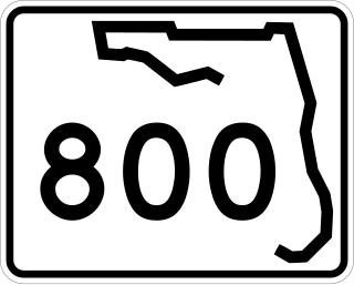
<span class="mw-page-title-main">Dixie Highway (Broward–Palm Beach)</span>

Dixie Highway in Palm Beach and Broward counties carries two segments of the State Road 811 designation by Florida Department of Transportation, as well as the local County Road 811 in southeast Florida. The entire road comprises a section of the Dixie Highway, a National Auto Trail which eventually became a former routing of U.S. Route 1 after the route was shifted east to Federal Highway. One segment of SR 811 is in Broward County and the other is in Palm Beach County, Florida. The segments of SR 811 are supplemented by three shorter segments of CR 811, one of which is unsigned.

<span class="mw-page-title-main">Card Sound Bridge</span> Bridge in Florida, United States of America

Card Sound Bridge is a high-rise toll causeway connecting southern Miami-Dade County and northern Monroe County. It is one of only two ways that motorists can leave or enter the Florida Keys. The toll for two-axle automobiles is USD $1.50 if paid via SunPass. The prior toll plaza was demolished during hurricane Matthew and has been replaced with a toll-by-plate plaza. The toll fee will be charged by plate automatically and sent via the mail to the address on the vehicle registration. The cashless all-electronic tolling system replaced the previous staffed toll booth on October 20, 2018. The toll fee is waived upon evacuating the Keys for hurricanes or in instances in which US 1 is impassable.

<span class="mw-page-title-main">Military Trail (Florida)</span>

Military Trail is a 46.2-mile (74.35 km) long six-lane north–south arterial road in Broward and Palm Beach counties in South Florida. A portion of the road is designated State Road 809 (SR 809), but most of the road within Palm Beach County is locally maintained and signed as County Road 809 (CR 809), while the Broward County section exists without either designation.

<span class="mw-page-title-main">County Road 707 (Treasure Coast)</span> Two segments of road in Florida, US

County Road 707 (CR 707) is a designation applied to two segments of road across three counties on Florida's Treasure Coast. The entire road was formerly designated State Road 707 (SR 707) and has been gradually transferred to county jurisdiction.

<span class="mw-page-title-main">Florida State Road 228</span> Highway in Florida, USA

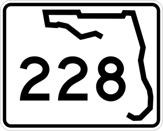
State Road 228 (SR 228) is a 32.532-mile-long (52.355 km) state highway in the northeastern part of the U.S. state of Florida. It exists in two distinct sections, separated by both Baker County Road 228 and Duval CR 228, which are former segments of SR 228.
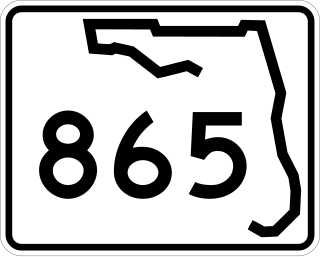
<span class="mw-page-title-main">Florida State Road 776</span> State highway in Florida, United States

State Road 776 (SR 776) is a 25-mile-long (40 km) state highway serving southern Sarasota County and northwestern Charlotte County, Florida. It acts as a loop road of U.S. Route 41 (US 41) that bypasses North Port.

<span class="mw-page-title-main">Florida State Road 758</span> Highway in Florida

State Road 758 and County Road 758 are together an 11.2-mile-long (18.0 km) state road in Sarasota, Florida, United States. It runs from Siesta Key north and east to Sarasota, where it continues east through Bee Ridge. Its eastern terminus is at Interstate 75 where it continues east as a county road with no designation. The full route was previously SR 758.

<span class="mw-page-title-main">Florida State Road 789</span> State highway in Florida, United States

State Road 789 is a 17.5-mile-long road along the Florida’s Gulf Coast that spans Bird Key, St. Armands Key, and Lido Key, in Sarasota; Longboat Key ; and Anna Maria Island. The southern terminus is the intersection of the John Ringling Causeway and Tamiami Trail in Sarasota; the northern terminus is the intersection of Gulf Drive, North and Manatee Avenue., West in Holmes Beach. Much of the northernmost five miles (8 km) has been designated Bradenton Beach Scenic Highway.

<span class="mw-page-title-main">U.S. Route 1 in Florida</span> Highway in Florida

U.S. Highway 1 (US 1) in Florida runs 545 miles (877 km) along the state's east coast from Key West to its crossing of the St. Marys River into Georgia north of Boulogne and south of Folkston. US 1 was designated through Florida when the U.S. Numbered Highway System was established in 1926. With the exception of Monroe County, the highway runs through the easternmost tier of counties in the state, connecting numerous towns and cities along its route, including nine county seats. The road is maintained by the Florida Department of Transportation (FDOT).

References

  1. "Monroe County - Engineering Services / Roads & Bridges". Monroe County, Florida . Retrieved January 2, 2018.
  2. 1 2 3 Google (January 2, 2018). "County Road 5A" (Map). Google Maps . Google. Retrieved January 2, 2018.
  3. 1 2 3 4 5 6 Surveying and Mapping Office, Department of Transportation, State of Florida (February 2014). "General Highway Map, Monroe County, Florida" (PDF). Retrieved January 2, 2018.{{cite web}}: CS1 maint: multiple names: authors list (link)
  4. 1 2 3 4 5 6 7 8 9 10 General Highway Map, Monroe County, February 1966, reprinted September 1978/January 1979
  5. 1 2 Google (January 2, 2018). "County Road 905" (Map). Google Maps . Google. Retrieved January 2, 2018.
  6. 1 2 Surveying and Mapping Office, Department of Transportation, State of Florida (November 1986). "General Highway Map, Monroe County, Florida" (PDF). Retrieved January 2, 2018.{{cite web}}: CS1 maint: multiple names: authors list (link)
  7. 1 2 3 4 5 6 "History Of Overseas Highway". www.keyshistory.org. Archived from the original on November 28, 2005. Retrieved June 14, 2024.
  8. 1 2 Wilkinson, Jerry. "History of the North Key Largo Missile Site". Keys Historeum. Retrieved 14 June 2024.
  9. 1 2 3 Google (January 2, 2018). "County Road 905A" (Map). Google Maps . Google. Retrieved January 2, 2018.
  10. 1 2 3 "Original Overseas Highway". AA Roads. Retrieved 18 June 2024.
  11. 1 2 "Boot Key seen as a potential nature preserve". The Miami Herald. 11 January 2009. Retrieved 18 June 2024.
  12. Boza, Art (January 18, 2014). "Key's LAST Remaining Drawbridge". Shoestring Weekends Blog. Archived from the original on October 6, 2016. Retrieved 13 June 2022.
  13. "Abandoned Drawbridge Being Removed". YouTube. Retrieved 18 June 2024.
  14. 1 2 3 Google (June 2, 2024). "County Road 939" (Map). Google Maps . Google. Retrieved June 2, 2024.
  15. Wilkinson, Jerry. "History of Sugarloaf Key". Keys Historeum. Retrieved 18 June 2024.
  16. "CR-939B over Unnamed Sugarloaf Canal". Des Moines Register. Retrieved 18 June 2024.
  17. "Florida State Road 4a the original Overseas Highway". AA Roads. Retrieved 19 June 2024.
  18. 1 2 Google (June 2, 2024). "County Road 939A" (Map). Google Maps . Google. Retrieved June 2, 2024.
  19. 1 2 "Scenic Highway Next". The Key West Citizen. 18 March 1946. Retrieved 18 June 2024.
  20. "Lower Sugarloaf Key Trail". U.S. Fish & Wildlife Service. Retrieved 18 June 2024.
  21. "Old State Road 4A over Sugarloaf Creek". Des Moines Register. Retrieved 18 June 2024.
  22. 1 2 Google (19 June 2024). "County Road 940" (Map). Google Maps . Google. Retrieved 19 June 2024.
  23. "Monroe 1,1937" (PDF). Florida Center for Instructional Technology. University of South Florida. Retrieved 19 June 2024.
  24. 1940 Census Enumeration District Maps - Florida - Monroe County - ED 44-1 - ED 44-37 (Map). Scale not given. United States Department of Commerce. 1940. Retrieved July 10, 2024.
  25. Google (19 June 2024). "County Road 941" (Map). Google Maps . Google. Retrieved 19 June 2024.
  26. "Tearing Down Old Bridge At Boca Chica". The Key West Citizen. 3 April 1946. Retrieved 19 June 2024.
  27. Google (19 June 2024). "County Road 942" (Map). Google Maps . Google. Retrieved 19 June 2024.