List of crossings of the Dnieper River

Last updated

This is a list of all current crossings of the river Dnieper (or Dnipro) from its source in Russia, through Belarus, to its river delta near the Dnieper Estuary at Kherson, Ukraine.

Contents

Russia

PhotographNameLocationTypeConstructed
BocharovoPedestrian
Bolshevo Domashenka Road Bridge 1.jpg Housewife - Bolshevo Road2010s
Pedestrian2010s
Bolshevo Domashenka Lower Wooden Bridge 1.jpg Pedestrian
Stepankovo Dnieper Bridge 1.jpg Dniprovske - Neronovo Road2014
Neronovo Dnieper Bridge 1.jpg Road
Honyuki - SleptsovoPedestrian
Anosovskogo Lnozavoda Dnieper Bridge 1.jpg Anosovo - Anosovo Flax PlantRoad
Nakhimovskoe Dnieper Bridge 2.jpg Nakhimovske - Gerasimovo Road
Glushkovo Dnieper Bridge.jpg Glushkovo - FedurkinoRoad
Kazarinovo Dnieper Bridge 1.jpg Kazarinovo - VillageRoad
Nadezhda Upper Dnieper Bridge 1.jpg Ponds - HopeRoad2004 [1]
Nadezhda Lower Dnieper Bridge 1.jpg Road1937 [2]
Nikulino Railway Bridge 1.jpg Nikulino - ZabelinoRail
Verkhnedneprovsky Pedestrian Bridge 1.jpg Martinkovo Verkhnedneprovsky Pedestrian
Dorogobuzh New Bridge 1.jpg Polybino - ElyseeRoad
Dorogobuzh - Ivonino (bypass road)Road1997 [3]
Dorogobuzh View of Dnieper.jpg Dorogobuzh RoadBefore 1930 [4]
Soloviovo bridge.jpg Nightingale crossingCowsheds - SolovyovRoad1970
Pridneprovskaya Railway Bridge 1.jpg Yerdytsia - PrydniprovskaRail
Kazarma 368 Km Railway Bridge 1.jpg Barracks 368 km - Falcon MountainRail
Sokolya Gora Smolensk Ringroad Bridge.jpg High - Falcon Mountain

(Smolensk bypass)

Road1980s
Smolensk Krestovozdvizhenskiy Bridge 1.jpg Stepan Razin Street Bridge ("Exaltation of the Cross") Smolensk Road1978 [5]
Smolensk Dnieper Bridge3.jpg Dnieper Bridge [6] Road1961 [5]
Smolensk Pedestrian Bridge 2.jpg Pedestrian2013
Smolensk Bridge in Dzerzhinskogo Street 2.jpg Dzerzhinsky Street BridgeRoad1898 [7] —1941/

1960 [5]

Viden most - panoramio.jpg Gniezno Bridge [8] Demidovka—Smolensk Road
Miganovo Dnieper Bridge.jpg Miganovo — Gusino Road1966 [9]

Belarus

PhotographNameLocationTypeConstructed
Avtomobil'nyi most 3271005.jpeg Dubrowna Road1960s [10] /2009 [11]
Pashino - Dnieper (Orsha bypass)Road1981
Vorsha Mahilyow Street Bridge.jpg Mogilev Street Bridge Orsha Road1957
Bobkova Street BridgeRoad
Rail
Bridge over the Dnieper River in Kopys.jpg Kopys — Alexandria (Shklov district)Road2007 [12]
Shklow Dnieper Bridge.jpg Shklow Road1962 [13]
Mahilyow Bypass Dnieper Bridge 1.jpg Pavlivka - Polykovychi (Mogilev bypass)Road1997 [14]
Mahilyow Railway Bridge.jpg Mogilev Rail1936 [15]
Mahilyow Korolyov Street Bridge2.jpg Queen Street BridgeRoad1996 [16]
Mahilyow Pushkin Avenue Bridge.jpg Yashin Dnieper BridgeRoad1959 [15]
Mahilyow Schmidt Bridge.jpg Schmidt BridgeRoad1967 [15]
Bridge over the Dnieper River in Bychau.jpg Voronino — Bykhaw Road1964
Rahacou, Dniapro (4.07.2009).jpg Rahachow Road1959
Alexandrivka - Lebedivka (bypass Zhlobin)Road2014
Road1970s
Zhlobin Railway Bridge.jpg Zhlobin Rail
Колибівка   Zhlobin Rail
Sinna - Rechytsa Rail
Danube - GoroshkovRoad1958
Road1988

Ukraine

ImageCrossingCarriesLocationConstructedCoordinates

Upper stream (Chernihiv, Kyiv oblasts and Kyiv city)

Belarus-Ukraine border - Source of the Dnieper in Ukraine 51°56′49″N30°48′18″E / 51.947°N 30.8051°E / 51.947; 30.8051 (Belarus-Ukraine border, Dnieper)
Zaliznichnii mist cherez Dnipro cherez derzhavnii kordon UA-BY 3126610.jpeg Nedanchychi Rail BridgeRailroad special purpose Belarus-Ukraine border segment near Slavutych 1930 51°29′59″N30°35′05″E / 51.4998°N 30.5848°E / 51.4998; 30.5848
Slavutych–Kamaryn border crossingRegional roads P56 /R351987 or later 51°23′39″N30°38′28″E / 51.3943°N 30.6411°E / 51.3943; 30.6411
Kiev Hydroelectric Station.jpeg Kyiv Hydroelectric Power Plant Regional road P69 Vyshhorod, Kyiv Oblast 1964 50°35′22″N30°30′24″E / 50.5895°N 30.5067°E / 50.5895; 30.5067
Moskovskyj mist (Kyiv).jpg Pivnichnyi Bridge (Northern)prospekts Stepana Bandery/Romana Shukhevycha Kyiv 3 December 1976 50°29′27″N30°32′12″E / 50.4909°N 30.5368°E / 50.4909; 30.5368
Petrivs'kii mist.JPG Petrivka Rail Bridge Railroad Southwestern Railways 9 November 1929 50°29′02″N30°32′33″E / 50.4838°N 30.5424°E / 50.4838; 30.5424
Podil Bridge & pontoon, Kyiv, 2019.jpg Podilsko-Voskresensky Bridge Road and Metrounder construction since 1999 50°28′22″N30°32′06″E / 50.4728°N 30.535°E / 50.4728; 30.535
Novii mist na Ribal's'kii pivostriv.jpg Havansky Bridge Naberezhno-Rybalska vulytsia 50°28′09″N30°31′38″E / 50.4691°N 30.5271°E / 50.4691; 30.5271
Pishokhidnii mist cherez Dnipro (Kiyiv).JPG Rybalsky Bridgepedestrian (closed)3 July 1957 50°28′24″N30°31′23″E / 50.4733°N 30.523°E / 50.4733; 30.523
80-366-0036 Naberegna Pishohidny.jpg Parkovy Bridgepedestrian 50°27′24″N30°32′03″E / 50.4568°N 30.5342°E / 50.4568; 30.5342
Kyiv Metro Bridge.JPG Kyiv Metro Bridge / Rusanivsky Bridge Kyiv Metro / Brovarskyi prospekt5 November 1965 50°27′24″N30°32′03″E / 50.4568°N 30.5342°E / 50.4568; 30.5342
Venetsiis'kii mist Kiyiv.jpg Venetsiansky Bridgepedestrian 50°26′54″N30°34′31″E / 50.4484°N 30.5753°E / 50.4484; 30.5753
Avtomobil'nyi most cherez Rusanovskii kanal.jpg Rusanivka Channel Bridge, North / Rusanivka Channel Bridge, SouthRusanivska Naberezhna 50°26′47″N30°35′28″E / 50.4464°N 30.591°E / 50.4464; 30.591 / 50°25′57″N30°35′34″E / 50.4324°N 30.5927°E / 50.4324; 30.5927
Rusanivka Channel Bridge, Sidepedestrian traffic, vehicle traffic 50°26′23″N30°36′30″E / 50.4397°N 30.6083°E / 50.4397; 30.6083
Rusanivka Channel Bridge, pedestrian northpedestrian 50°26′38″N30°35′57″E / 50.444°N 30.5991°E / 50.444; 30.5991
Peshekhodnyi most cherez Rusanovskii kanal.jpg Rusanivka Channel Bridge, pedestrian southpedestrian 50°26′04″N30°36′00″E / 50.4345°N 30.6°E / 50.4345; 30.6
Paton bridge (1).jpg Paton Bridge Tabliczka E95.svg E95 5 November 1953 50°25′40″N30°35′00″E / 50.4277°N 30.5834°E / 50.4277; 30.5834
Darnits'kii mist 1.jpg Darnytsia Rail Bridge Railroad Southwestern Railways 1949 50°25′02″N30°35′25″E / 50.4173°N 30.5902°E / 50.4173; 30.5902
Darnits'kii mist2.jpg New Darnytskyi Bridge Railroad Southwestern Railways / Kyiv Metro / Darnytske shose27 September 2010 50°25′01″N30°35′25″E / 50.4169°N 30.5904°E / 50.4169; 30.5904
Pivdennii mist (Kiyiv).jpg Pivdennyi Bridge (Southern)Tabliczka E40.svg E40 25 December 1990 50°23′41″N30°35′35″E / 50.3947°N 30.5931°E / 50.3947; 30.5931

Mid stream (Cherkasy, Kirovohrad, Poltava and Dnipropetrovsk oblasts)

Kaniv Hydroelectric Station.jpg Kaniv Hydroelectric Power Plant P09 / railroad special purpose Kaniv 1972 49°45′43″N31°27′55″E / 49.7619°N 31.4654°E / 49.7619; 31.4654
Cherkasy bridge4.JPG Cherkasy Dam H16 / railroad Odessa Railways Cherkasy 1960 49°28′45″N32°02′21″E / 49.4791°N 32.0392°E / 49.4791; 32.0392
Svitlovodsk7.jpg Kremenchuk Hydroelectric Power Plant T17-03 / railroad Southern Railways Svitlovodsk 1959 49°04′24″N33°15′02″E / 49.0732°N 33.2506°E / 49.0732; 33.2506
Kryukov Bridge.jpg Kryukiv Bridge M22 H08 / railroad Southern Railways Kremenchuk 21 December 1949 49°03′09″N33°25′26″E / 49.0526°N 33.4238°E / 49.0526; 33.4238
New Kremenchuk Bridgeunder construction [17]
Dniprodzerzhynsk GES.jpg Middle Dnieper Hydroelectric Power Plant T04-12 T04-14 / railroad Cisdnieper Railways Kamianske 1964 48°32′48″N34°32′24″E / 48.5466°N 34.5399°E / 48.5466; 34.5399
Bridge Kamianske.jpg Livoberezhny Bridge (Left-bank)prospekt Anoshkina1996 48°32′02″N34°35′43″E / 48.534°N 34.5953°E / 48.534; 34.5953
Kaydacky-bridge Dnipropetrovsk from GOROD.DP.UA.jpg Kaidatsky Bridge Tabliczka E50.svg E50 M04 / city tram Dnipro 10 November 1982 48°29′55″N34°57′57″E / 48.4987°N 34.9659°E / 48.4987; 34.9659
Dnipro Amur Bridge1.jpg Amursky Bridge (Old)vulytsia Karuny / city tram / railroad Cisdnieper Railways 18 Mey 1884 48°29′21″N35°01′44″E / 48.4893°N 35.029°E / 48.4893; 35.029
Central bridge Dnipro.jpg Tsentralny Bridge (New)Slobozhanskyi prospekt5 November 1966 48°28′35″N35°03′22″E / 48.4765°N 35.0562°E / 48.4765; 35.0562
Komsomol's'kii ostriv. Ostrivna chastina parku imeni Tarasa Shevchenka.JPG Merefa-Kherson Bridge Railroad Cisdnieper Railways 21 December 1932 48°28′01″N35°04′56″E / 48.4669°N 35.0823°E / 48.4669; 35.0823
Monastyrsky Island Bridgepedestrian 48°27′55″N35°04′23″E / 48.4652°N 35.073°E / 48.4652; 35.073
Ust-Samarsky Bridge 48°27′22″N35°06′56″E / 48.4561°N 35.1156°E / 48.4561; 35.1156
Pivdenny Bridge 48°24′41″N35°05′58″E / 48.4113°N 35.0995°E / 48.4113; 35.0995
South bridge Dnipropetrovsk from GOROD.DP.UA.jpg South Bridge21 December 2000

Lower stream (Zaporizhia and Kherson oblasts)

Veselki nad Khortitseiu.jpg Dnieper Hydroelectric Station H08 Zaporizhia 1 May 1932 [18] 47°51′49″N35°05′20″E / 47.8636°N 35.089°E / 47.8636; 35.089 / 47°51′45″N35°05′22″E / 47.8626°N 35.0895°E / 47.8626; 35.0895
Dniprohes Pedestrian Bridgepedestrian 47°51′53″N35°05′25″E / 47.8646°N 35.0903°E / 47.8646; 35.0903 / 47°51′46″N35°05′23″E / 47.8627°N 35.0897°E / 47.8627; 35.0897
Preobrazhenskogo1.jpg Zaporizhia Arch Bridge (over Old Dnieper)31 December 1952 [18] 47°51′43″N35°03′45″E / 47.8619°N 35.0625°E / 47.8619; 35.0625
Vogni nichnogo mostu.jpg Preobrazhensky Bridge II (over Old Dnieper)Railroad Cisdnieper Railways / T08-06under construction 47°49′13″N35°04′29″E / 47.8204°N 35.0747°E / 47.8204; 35.0747
New Preobrazhensky Bridge II (over Old Dnieper) 47°49′08″N35°04′38″E / 47.8189°N 35.0773°E / 47.8189; 35.0773
Preobrazhensky Bridge I (over New Dnieper)Railroad Cisdnieper Railways / T08-06 47°50′43″N35°05′01″E / 47.8452°N 35.0835°E / 47.8452; 35.0835
New Preobrazhensky Bridge I (over New Dnieper) 47°50′33″N35°05′07″E / 47.8424°N 35.0853°E / 47.8424; 35.0853
Nikopol–Kamianka-Dniprovska Ferry NikopolKamianka-Dniprovska 47°50′33″N35°05′07″E / 47.8424°N 35.0853°E / 47.8424; 35.0853
Kakhovka HES.jpg Kakhovka Hydroelectric Power Plant Railroad Odessa Railways / P47 Nova Kakhovka 1972 46°46′27″N33°22′27″E / 46.7741°N 33.3741°E / 46.7741; 33.3741
Antonivka Railway Bridge.jpg Antonivka Railway Bridge Railroad Odessa Railways Prydniprovske, Kherson Raion, Kherson Oblast 31 December 1952 46°40′31″N32°47′49″E / 46.6754°N 32.797°E / 46.6754; 32.797
01 09 2006 08 23 Kherson.JPG Antonivka Road Bridge Tabliczka E97.svg E97 M17 Tabliczka E58.svg E58 M14 Antonivka 1985 46°40′11″N32°43′13″E / 46.6697°N 32.7204°E / 46.6697; 32.7204

Related Research Articles

Belarusians Ethnic group

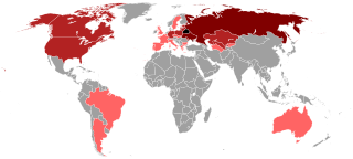
Belarusians, also known formerly as Byelorussians, Belarussians or Belorusians, are an East Slavic ethnic group native to modern-day Belarus and the immediate region. Over 9.5 million people proclaim Belarusian ethnicity worldwide. Nearly 8 million Belarusians reside in Belarus, with the United States and Russia being home to more than half a million Belarusians each.

Dnieper Longest river of Ukraine and Belarus

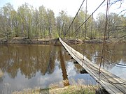
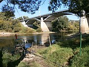
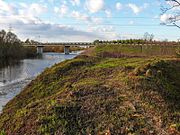
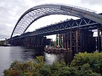
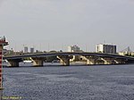
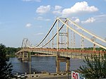
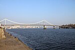
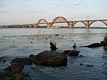
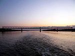
The Dnieper or Dnipro is one of the major rivers of Europe, rising in the Valdai Hills near Smolensk, Russia, before flowing through Belarus and Ukraine to the Black Sea. It is the longest river of Ukraine and Belarus and the fourth-longest river in Europe, after the Volga, Danube, and Ural rivers. The total length is approximately 2,200 km (1,400 mi) with a drainage basin of 504,000 square kilometres (195,000 sq mi).

Kyiv Capital and largest city of Ukraine

Kyiv or Kiev is the capital and most populous city of Ukraine. It is in north-central Ukraine along the Dnieper River. As of 1 January 2021, its population was 2,962,180, making Kyiv the seventh-most populous city in Europe.

Kryvyi Rih City in Ukraine

Kryvyi Rih is the largest city in central Ukraine and 7th most populous city in the country; 2nd biggest city in the country by area. It lies within a large urban area with approximately one million inhabitants and serves as the administrative center of Kryvyi Rih Raion. The city’s population at the beginning of 2022 is estimated at 646,748. It hosts the administration of Kryvyi Rih urban community.

Zaporizhzhia City and administrative center of Zaporizhzhia Oblast, Ukraine

Zaporizhzhia is a city in south-eastern Ukraine, situated on the banks of the Dnieper river. It is the administrative center of the Zaporizhzhia Oblast (region). Zaporizhzhia has a population of 710,052 as of 1 January 2022.

Dnieper River System of Dams Flood control system in Ukraine

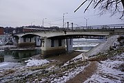
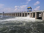
The Dnieper River system of dams was created to prevent uncontrolled flooding and improve water transportation infrastructure. Coordination and operation of all dams on Dnieper is conducted by government company Ukrhydroenergo. The system of dams is also known as Dnieper Cascade of HES. In 1970, the Kyiv dam partially prevented flooding in comparison with the 1931 Kyiv flooding.

The 2009–10 Ukrainian First League was the nineteenth since its establishment. There were 18 teams competing. Two teams were relegated from the 2008–09 Ukrainian Premier League. Three teams were promoted from the 2008–09 Ukrainian Second League. Due to the 2009 flu pandemic which affected Ukraine in late October the PFL decide to break for winter earlier than they originally scheduled. The second half of the season began March 11, 2010.

DTEK Ukrainian energy company

DTEK is the largest private investor in the energy industry in Ukraine. The company's enterprises generate electricity at solar, wind and thermal power plants; extract coal and natural gas, trade energy products in the Ukrainian and foreign markets, distribute and supply electricity to consumers, and develop a grid of supercharger stations for e-vehicles.

Murder of Oksana Makar

The murder of Oksana Makar took place in March 2012 in Ukraine, garnering extensive media coverage both at home and abroad and leading to mass protests. Oksana Makar, aged 18, was attacked by three men in the city of Mykolaiv on 8 March 2012: she was raped, strangled, set alight and left to die, though she survived another three weeks after being taken to hospital. Her case became a cause célèbre in Ukraine when only one of the attackers was charged by the police. The other two, whose parents were reported to be former government officials, were released on police bail, allegedly because of the personal connections of their parents. They were later rearrested after a public outcry, and mass protests on 13 March. Protests demanding justice, to gather funds and encourage blood donations continued after the arrest as well.

The 1st Guards Zvenigorod–Bucharest Red Banner Order of Suvorov Airborne Division was a division of the Soviet Airborne Troops. The division was first formed in December 1942 and fought in the Battle of the Dnieper, the Battle of the Korsun–Cherkassy Pocket, the Uman–Botoșani offensive, the second Jassy–Kishinev offensive, the Battle of Debrecen, the siege of Budapest and the Prague offensive. In August 1945 it was sent east and fought in the Soviet invasion of Manchuria. The division became the 124th Guards Rifle Division in November 1945 and disbanded in 1956.

2016–17 Ukrainian Premier League 26th season of top-tier football league in Vyshcha Liha

The 2016–17 Ukrainian Premier League season is the 26th top-level football club competitions since the fall of the Soviet Union and the ninth since the establishment of the Ukrainian Premier League. The league is scheduled to play its first 18 rounds before the winter break finishing its first stage of tournament in March. The second stage is scheduled to start on 1 April 2017 and finish on 31 May 2017.

Civil volunteer movement helping Ukrainian forces in the war in Donbas Civil society movement to assist Ukrainian soldiers in the Donbas War

The Russo-Ukrainian War gave rise to a civil volunteer movement which provides diverse support to Ukrainian soldiers fighting in Donetsk and Luhansk oblasts.

Alan Kazbekovich Badoev is a Ukrainian movie director, music video director, screenwriter, TV producer, TV presenter and music producer of Ossetian origin. He first gained international recognition in 2006 with his awarded full-length movie debut "OrAngeLove" (Russian: Оранжевая любовь). Today Badoev is most notable for his prize-winning work as music video director. He has directed more than 500 music videos.

Brotherhood (Ukrainian political party) Political party in Ukraine

The Brotherhood is a Ukrainian political party led by Dmytro Korchynsky. Registered by the Ministry of Justice on 5 August 2004. The party represents itself: "Party of Jesus Christ, National Christian Network - a revolutionary Christian community".

References

  1. Вчера состоялось совместное совещание Министерства транспорта РФ и Федерального дорожного агентства по итогам деятельности Росавтодора за 10 месяцев 2004 года. | Министерство транспорта Российской Федерации (in Russian)
  2. К сердцу Москвы — Транспорт России (in Russian)
  3. Город Дорогобуш Archived 2012-04-09 at the Wayback Machine (in Russian)
  4. "Архівована копія". Archived from the original on 22 November 2011. Retrieved 19 June 2011.
  5. 1 2 3 Характеристика искусственных сооружений в г. Смоленска Archived 2016-03-05 at the Wayback Machine (in Russian)
  6. "Фотогалерея города Смоленска". Archived from the original on 18 June 2012. Retrieved 14 October 2012.
  7. "Архівована копія". Archived from the original on 14 November 2011. Retrieved 19 June 2011.
  8. Правила рыболовства для Волжско-Каспийского рыбохозяйственного бассейна [ dead link ](in Russian)
  9. Откритие моста через реку Днепр (in Russian)
  10. Понтонный комфорт
  11. В Дубровно оршанские водолазы очистили Днепр (in Russian)
  12. Копысь (in Russian)
  13. Рост зарплат должен сопровождаться повышением производительности труда и рентабельности — А.Лукашенко Archived 2016-03-04 at the Wayback Machine (in Russian)
  14. Филиал ДСУ № 14 «Открытое акционерное общество „Дорожно-строительный трест № 3“» Archived 2013-07-15 at the Wayback Machine (in Russian)
  15. 1 2 3 Могилевские мосты Archived 9 June 2011 at the Wayback Machine (in Russian)
  16. Когда начнут ремонтировать мосты через Днепр в Могилёве (in Russian)
  17. "У Кременчуці монтують новий бетонний завод для будівництва мосту через Дніпро". uprom.info/. Національний промисловий портал. 2021-09-27. Retrieved 30 September 2021.
  18. 1 2 Адельберг Л. И. Мосты Запорожья. Archived 2012-01-09 at the Wayback Machine — Запорожье: Тандем-У, 2005. — 56 с.