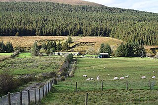
County Mayo is a county in Ireland. In the West of Ireland, in the province of Connacht, it is named after the village of Mayo, now generally known as Mayo Abbey. Mayo County Council is the local authority. The population was 137,231 at the 2022 census. The boundaries of the county, which was formed in 1585, reflect the Mac William Íochtar lordship at that time.

Connacht or Connaught, is one of the four provinces of Ireland, in the west of Ireland. Until the ninth century it consisted of several independent major Gaelic kingdoms.

Castlebar is the county town of County Mayo, Ireland. Developing around a 13th-century castle of the de Barry family, from which the town got its name, the town now acts as a social and economic focal point for the surrounding hinterland. With a population of 13,054 in the 2022 census, Castlebar was one of the fastest growing towns in Ireland in the early 21st century.

The N5 road is a national primary road in Ireland, connecting Longford town with Westport. It is the main access route from Dublin to most of County Mayo, including the county's largest towns, Castlebar, Ballina, and Westport.

Mayobridge is a village within Newry, County Down, Northern Ireland, lying on the small river Clanrye which divides the townlands of Mayo and Bavan. It is located within the Newry and Mourne District Council area - it had a population of 1,069 people in the 2011 Census. It falls within the parish of Clonallan, and historically within the barony of Upper Iveagh Upper.

Costello is one of the ancient baronies of Ireland. Unusually for an Irish barony, it straddles two counties: County Mayo and County Roscommon. It comprises the modern day districts of Kilkelly, Kilmovee, Killeagh, Kilcolman, and Castlemore.

Killala Bay is a bay on the west coast of Ireland, between County Mayo and County Sligo, with Kilcummin Head to the west and Lenadoon Point to the east, which is the estuary for the River Moy. The village of Killala is at the southwest corner of the bay.

The Boyle River is a river in Ireland. Forming part of the Shannon River Basin, it flows from Lough Gara on the Sligo/Roscommon county border and thence through the town of Boyle to Lough Key. From there is continues eastwards through the village of Knockvicar to the River Shannon at Lough Drumharlow, near Carrick-on-Shannon. The length of the Boyle River is 64.4 km (40 mi). The area of its basin is 725 km2.

The R310 road is a regional road in County Mayo, Ireland. South to north the route connects the town of Castlebar to Ballina. En route it crosses over a strait linking Lough Conn and Lough Cullin at Pontoon, part of River Moy outflow.

The R331 road is a regional road in southeast County Mayo, Ireland. The route connects the towns of Claremorris and Ballinrobe, and links the N60 road with the N84 road.

The River Robe is a river in County Mayo, Ireland. It rises near Ballyhaunis, then flows generally west for 64 kilometres (40 mi), where it drains into Lough Mask.
Pollatoomary is the deepest explored underwater cave in Ireland. It has been explored to an underwater depth of 113 metres (371 ft). The explored limit of Pollatoomary is also 23 metres (75 ft) deeper underwater than that of the terminal sump in Wookey Hole Caves in Somerset, England, which previously held the record for the deepest underwater cave in Britain and Ireland.

Ballina is a town in north County Mayo, Ireland. It lies at the mouth of the River Moy near Killala Bay, in the Moy valley and Parish of Kilmoremoy, with the Ox Mountains to the east and the Nephin Beg mountains to the west. The town occupies two baronies; Tirawley on the west bank of the Moy River, and Tireragh, a barony within County Sligo, on its east banks. At the 2022 census, the population of Ballina was 10,556.

Barroosky is a Gaeltacht townland within the civil parish of Kilcommon in County Mayo, Ireland. It is located within the ecclesiastical parish of Kilcommon-Erris. Barroosky townland has an area of approximately 1,923 acres (7.8 km2).
Finny is a small village and townland in County Mayo, Ireland. The village is situated in the civil parish of Ross, in the Barony of Ross. Finny is located on the R300 regional road. The nearby Finny River, rising from the south-east of Loch Na Fooey drains westward into the southwest part of Lough Mask. Finny is approximately 10 km to the west of Clonbur, County Galway, 11 km to the east of Leenaun, County Galway and 17 km south west of Toormakeady, County Mayo.


