
Cape Town is the second most populous city in South Africa after Johannesburg and also the legislative capital of South Africa. Colloquially named the Mother City, it is the largest city of the Western Cape province and forms part of the City of Cape Town metropolitan municipality. The Parliament of South Africa is situated in Cape Town. The other two capitals are located in Gauteng and in the Free State. The city is known for its harbour, for its natural setting in the Cape Floristic Region, and for landmarks such as Table Mountain and Cape Point. Cape Town is home to 64% of the Western Cape's population. The city was named the World Design Capital for 2014 by the International Council of Societies of Industrial Design.

South Africa occupies the southern tip of Africa, its coastline stretching more than 2,850 kilometres from the desert border with Namibia on the Atlantic (western) coast southwards around the tip of Africa and then northeast to the border with Mozambique on the Indian Ocean. The low-lying coastal zone is narrow for much of that distance, soon giving way to a mountainous escarpment that separates the coast from the high inland plateau. In some places, notably the province of KwaZulu-Natal in the east, a greater distance separates the coast from the escarpment. Although most of the country is classified as semi-arid, it has considerable variation in climate as well as topography. The total land area is 1,220,813 km2 (471,359 sq mi). It has the 23rd largest Exclusive Economic Zone of 1,535,538 km2 (592,875 sq mi).

The Western Cape is a province of South Africa, situated on the south-western coast of the country. It is the fourth largest of the nine provinces with an area of 129,449 square kilometres (49,981 sq mi), and the third most populous, with an estimated 7 million inhabitants in 2020. About two-thirds of these inhabitants live in the metropolitan area of Cape Town, which is also the provincial capital. The Western Cape was created in 1994 from part of the former Cape Province, The two largest cities are Cape Town and George.

Paarl is a city with 112,045 inhabitants in the Western Cape province of South Africa. It is the fourth-oldest city and European settlement in the Republic of South Africa and the largest town in the Cape Winelands. Due to the growth of the Mbekweni township, it is now a de facto urban unit with Wellington. It is situated about 60 kilometres (37 mi) northeast of Cape Town in the Western Cape Province and is renowned for its haunting scenic beauty and deep viticulture and fruit-growing heritage.

Uitenhage is a South African town in the Eastern Cape Province. It is well known for the Volkswagen factory located there, which is the biggest car factory on the African continent. Along with the city of Port Elizabeth and the small town of Despatch, it forms the Nelson Mandela Metropolitan Municipality.

Local government in South Africa consists of municipalities of various types. The largest metropolitan areas are governed by metropolitan municipalities, while the rest of the country is divided into district municipalities, each of which consists of several local municipalities. Since the boundary reform at the time of the municipal election of 3 August 2016 there are eight metropolitan municipalities, 44 district municipalities and 205 local municipalities.

Komani, formerly Queenstown, is a town in the middle of the Eastern Cape Province of South Africa, roughly halfway between the smaller towns of Cathcart and Sterkstroom. It is currently the commercial, administrative and educational centre of the surrounding farming district.

The N2 is a national route in South Africa that runs from Cape Town through Port Elizabeth, East London and Durban to Ermelo. It is the main highway along the Indian Ocean coast of the country. Its total distance of 2,255 kilometres (1,401 mi) makes it the longest numbered route in South Africa.

Langa is a township near Cape Town, South Africa. Its name in Xhosa means '[sun]’. It was established in 1919 after the first wave of the Spanish Flu (1918) highlighted the terrible conditions in which some people were living near the N2. Similar to Nyanga, Langa is one of the many areas in South Africa that were designated for Black Africans before the apartheid era. It is the oldest of such suburbs in Cape Town and was the location of much resistance to apartheid. Langa is also where several people were killed on 21 March 1960 same day as the Sharpeville massacre, during the anti-pass campaign. On 21 March 2010, now 50 years later, a monument was unveiled by the government in remembrance of the people who lost their lives.

Ndabeni is an industrial suburb of Cape Town, South Africa, mainly occupied by light industries such as textiles and clothing. It is located about 6 km east of Cape Town city centre and is serviced by a railway station. Ndabeni is bordered to the south east by Pinelands and to the north by Maitland. Its postcode is 7405.
The magistrates' courts are the lowest level of the court system in South Africa. They are the courts of first instance for most criminal cases except for the most serious crimes, and for civil cases where the value of the claim is below a fixed monetary limit.

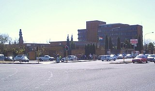
Brackenfell is a town in the Western Cape province of South Africa at the gateway to the Cape Winelands. Organisationally and administratively it is included in the City of Cape Town Metropolitan Municipality as a Northern Suburb and is about 30 kilometres east of Cape Town City Bowl. In Brackenfell a variety of property situated on the slopes of the Bottelary Hills can be found.

Metrorail Western Cape is a network of commuter and suburban rail services in the City of Cape Town Metropolitan Municipality and in the surrounding towns of Malmesbury, Paarl, Stellenbosch and Wellington in the Western Cape province of South Africa.

Nyanga is a township in the Western Cape, South Africa. Its name in Xhosa means ‘moon’ and it is one of the oldest black townships in Cape Town. It was established as a result of the migrant labour system. In 1948 black migrants were forced to settle in Nyanga as Langa became too small. Nyanga was one of the poorest places in Cape Town and is still is one of the dangerous parts of Cape Town. In 2001 its unemployment was estimated at around 56% and HIV/AIDS is a huge community issue. The township is known as the "murder capital" of South Africa.
A series of South African municipal by-elections was held in 2008 for ward seats on local municipal councils throughout the country. These by-elections were held to replace deceased, resigned or incapacitated councillors.

Philippi is a large urban and semi-urban area in the Western Cape, South Africa and is forms part of Cape Town's Cape Flats region. It comprises the Philippi Horticultural Area to the west, and some of Cape Town's larger townships located within its eastern half just south of Gugulethu & Nyanga. The horticultural area is sparsely populated compared to the surrounding city and contains many farms. Urban areas within Philippi include Browns Farm, Samora Machel/Weltevreden Valley North, Heinz Park, Phola Park, and Philippi East.

Ibhayi is a large township near Port Elizabeth, South Africa. It is the largest township in the Eastern Cape province and the ninth largest in South Africa after Mitchells Plain near Cape Town in the Western Cape.
Mongezi Gum – is a South African township artist, working in painting. His exhibits have been displayed mostly in South Africa.

On 21 March 1985, on the 25th anniversary of the Sharpeville massacre, members of the South African Police opened fire on a crowd of people gathered on Maduna Road between Uitenhage and Langa township in the Eastern Cape, South Africa. The crowd had been attending a funeral of one the six who had been slain by the apartheid police on 17 March 1985. They had gathered at Maduna Square and were heading towards the house where the funeral was held when the police blocked the road with two armoured vehicles and ordered the crowd to disperse. When the crowd failed to comply immediately, police opened fire on the crowd, killing 35 people and leaving 27 wounded. The incident became known as the Uitenhage/Langa massacre.

The Northern Suburbs is a group of suburbs and exurbs in the City of Cape Town Metropolitan Municipality. It comprises the sub-districts of Tygerberg and Oostenberg. The region's main and largest town is Bellville.


