Olievenhoutbosch Olieven | |
|---|---|
 Olievenhoutbosch  Olievenhoutbosch | |
| Coordinates: 25°54′34″S28°5′34″E / 25.90944°S 28.09278°E | |
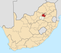
| Country | South Africa |
| Province | Gauteng |
| Municipality | City of Tshwane |
| Main Place | Centurion |
| Founded by | Chief Andries Zonke Choba |
| Government | |
| • Councillor | Frank Tshepiso Kunene |
| Area | |
• Total | 11.39 km2 (4.40 sq mi) |
| Population (2011) [1] | |
• Total | 70,863 |
| • Density | 6,222/km2 (16,110/sq mi) |
| Racial makeup (2011) | |
| • Black African | 98.0% |
| • Coloured | 0.6% |
| • Indian/Asian | 0.2% |
| • White | 0.1% |
| • Other | 1.2% |
| First languages (2011) | |
| • Northern Sotho | 32.6% |
| • Zulu | 14.2% |
| • S. Ndebele | 8.0% |
| • Xhosa | 7.1% |
| • Other | 38.1% |
| Time zone | UTC+2 (SAST) |
| Postal code (street) | 0187 |
| PO box | 0175 |
| Website | www.olievenhoutbosch.co.za |
Olievenhoutbosch (also known as 'Oliven"/ 'Stop12") is a township in Centurion, Gauteng, South Africa on the R55 route. It was established in the 1990s. It is densely populated and is one of the fastest-growing townships in the province. [2]