Sunnyside, Pretoria

Last updated

Sunnyside
Esselenstraat tot Bronbergkerk, Sunnyside.jpg
Robert Sobukwe street in Sunnyside, 2013,
was renamed from Esselen street in 2012.
South Africa Gauteng location map.svg
Red pog.svg
Sunnyside
South Africa adm location map.svg
Red pog.svg
Sunnyside
Coordinates: 25°45′15″S28°12′34″E / 25.75417°S 28.20944°E
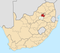
 / -25.75417; 28.20944
Country South Africa
Province Gauteng
Municipality City of Tshwane
Main Place Pretoria
Area
[1]
  Total2.25 km2 (0.87 sq mi)
Population
 (2011) [1]
  Total39,282
  Density17,000/km2 (45,000/sq mi)
Racial makeup (2011)
[1]
   Black African 88.4%
   Coloured 1.7%
   Indian/Asian 0.9%
   White 8.5%
  Other0.6%
First languages (2011)
[1]
  English16%
   Northern Sotho 13.7%
   Venda 10.0%
   Zulu 7.5%
  Other52.8%
Time zone UTC+2 (SAST)
PO box
9585

Sunnyside is one of the oldest suburbs of the city of Pretoria, South Africa. The well-established area is situated east of Nelson Mandela drive (and the Apies River), adjacent to Pretoria Central.

Contents

Development

Sunnyside of the late 19th and early 20th century was a suburb of houses and mansions. Esselen street was named after Ewald Auguste Esselen, the State Attorney of the South African Republic from 1894 to 1895. Since 2012 the street has been renamed to Robert Sobukwe street. The character of the suburb changed with the influx of mainly Afrikaners to Pretoria during the middle to late 20th century, when blocks of high-rise flats transformed the western section. The one time house of the writer and poet Jan F. E. Celliers however survived until 1970. [2]

The suburb now consists mostly of high density residential developments, [3] which in the 21st century ranges from reasonably upmarket to dilapidated. Esselen street is flanked by a strip of retail businesses, restaurants and clubs. The day time street scene is very busy, with heavy pedestrian traffic and hawkers peddling food or wares on street corners. Student residences or communes and residential houses are situated in the quieter eastern part. Like much of the inner city, this suburb's retail, entertainment and nightlife area has become less upmarket since the 1980s, and rundown and dirty in places. [4]

Demographics

The post-Apartheid era saw an influx of local and foreign people of different races to the high density residential areas, which they found affordable. [3] Consequently, a number of languages are now spoken here. The social evils of crime and substance abuse [3] have necessitated beefed up security at all residences, the inhabitants of which are often living in impoverished conditions.

Sunnyside on a map of 1895 The Castle Line atlas of South Africa, Plan of Pretoria, 1895.jpg
Sunnyside on a map of 1895

Related Research Articles

<span class="mw-page-title-main">Pretoria</span> Administrative capital of South Africa

Pretoria, also known as Tshwane, is South Africa's administrative capital, serving as the seat of the executive branch of government, and as the host to all foreign embassies to South Africa.

<span class="mw-page-title-main">Sandton</span> Area in Gauteng province, South Africa

Sandton is a financial, commercial and residential area, located in the northern part of the City of Johannesburg Metropolitan Municipality. Formerly an independent municipality, Sandton's name came from the combination of two of its suburbs, Sandown and Bryanston.

<span class="mw-page-title-main">Robert Sobukwe</span> Founding president of the Pan Africanist Congress (1924–1978)

Robert Mangaliso Sobukwe OMSG was a South African anti-apartheid revolutionary and founding member of the Pan Africanist Congress (PAC), serving as the first president of the organization.

<span class="mw-page-title-main">Rondebosch</span> Place in Western Cape, South Africa

Rondebosch is one of the Southern Suburbs of Cape Town, South Africa. It is primarily a residential suburb, with shopping and business districts as well as the main campus of the University of Cape Town.

<span class="mw-page-title-main">Middelburg, Mpumalanga</span> Town in Mpumalanga, South Africa

Middelburg is a large farming and industrial town in the South African province of Mpumalanga.

Crowthorne is a suburb of Midrand, South Africa. It is located in Region A of the City of Johannesburg Metropolitan Municipality, between Pretoria and Johannesburg on the previously known Carlswald Agricultural Holdings. The region is surrounded by plots, horse breeding societies and agricultural activities; neighbouring areas like Beaulieu, Kyalami, Blue Hills etc. Crowthorne is known for the Crowthorne Shopping Centre, Crowthorne Lodge, new developments by Century Property Developments and several garden centres like the Plantland Nursery.

<span class="mw-page-title-main">Waterkloof</span> Place in Gauteng, South Africa

Waterkloof is an affluent suburb of the city of Pretoria in the Gauteng province of South Africa, located to the east of the city centre. It is named after the original farm that stood there when Pretoria was founded in the 19th Century.

<span class="mw-page-title-main">Brooklyn, Pretoria</span> Place in Gauteng, South Africa

Brooklyn is a suburb of the city of Pretoria, South Africa. It is a well-established and wealthy area, lying to the east of the city centre, encompassing high-end residential properties and several upmarket mall developments. It borders the University of Pretoria to its north and the suburbs of Groenkloof and Waterkloof to its south. Brooklyn is also the location of Pretoria Boys High School. The Brooklyn Mall opened in 1989.

Menlo Park is an upmarket suburb in the city of Pretoria, South Africa. It borders other upmarket areas Waterkloof, Brooklyn and Lynnwood. When it was first established between the 1950s and 1960s, it was the most eastern suburb of Pretoria, but the city has since considerably expanded eastwards. Today these suburbs are known as the Old East and can boast to have some of the city's most high-end residential properties.

<span class="mw-page-title-main">Brackenfell</span> Town in the Western Cape, South Africa

Brackenfell is a town in the Western Cape province of South Africa, situated on the N1 about 30 km north-east of Cape Town and 35 km south-west of Paarl.

<span class="mw-page-title-main">Durbanville</span> Town in Western Cape, South Africa

Durbanville, previously called Pampoenkraal, is a town in the Western Cape province of South Africa, part of the greater Cape Town metropolitan area. It is a semi-rural residential suburb on the north-eastern outskirts of the metropolis surrounded by farms producing wine and wheat.

<span class="mw-page-title-main">Gerard Moerdijk</span> South African architect (1890–1958)

Gerard Leendert Pieter Moerdijk, also known as Gerard Moerdyk, was a South African architect best known for designing the Voortrekker Monument in Pretoria.

<span class="mw-page-title-main">Arcadia, Pretoria</span> Suburb in Pretoria, South Africa

Arcadia is a suburb in Pretoria, South Africa, that is known for its historical buildings, embassies and hotels. The Union Buildings and the president's residence are also situated here.

<span class="mw-page-title-main">Gardens, Cape Town</span> Inner-city suburb of Cape Town in Western Cape, South Africa

Gardens is an affluent inner-city suburb of Cape Town located just to the south of the city centre located in the higher elevations of the "City Bowl" and directly beneath Table Mountain and Lion's Head. It is home to several national museums such as Iziko South African National Gallery and the Iziko South African Museum. The University of Cape Town also houses its Fine Arts department in the suburb, at Michaelis School of Fine Art. Company's Garden, South Africa's oldest garden, a public park and heritage site is a focal point of the suburb. The area is also home to the oldest synagogue in Southern Africa, the Old Shul and its successor, the Gardens Shul, "The Mother Synagogue of South Africa."

<span class="mw-page-title-main">Pretoria North</span> Place in Gauteng, South Africa

Pretoria North is a suburb of the city of Pretoria, Gauteng, South Africa, with a population of 16,972 people according to the 2011 census.

Constantia Park is a residential suburb in the city of Pretoria in the Gauteng province of South Africa. It borders other upmarket areas like Erasmuskloof, Garsfontein, Waterkloof Glen and Lynnwood Glen.

Moreleta Park is a suburb of Pretoria, South Africa, situated 12 kilometres (7 mi) southeast of the city centre. According to the 2011 census, it has a population of 27,539.

<span class="mw-page-title-main">Stellenberg, Bellville</span> Place in Western Cape, South Africa

Stellenberg is a suburb in Bellville, Western Cape South Africa.

<span class="mw-page-title-main">Ewald Auguste Esselen</span> South African barrister

Ewald Auguste Esselen was a South African barrister who served as State Attorney of the South African Republic from 1894 to 1895.

The M6 road is a long metropolitan route in the City of Tshwane in Gauteng, South Africa. It connects Pretoria West with a rural area east of Pretoria via Pretoria CBD, Brooklyn, Lynnwood and Wapadrand.

References

  1. 1 2 3 4 "Sub Place Sunnyside". Census 2011.
  2. Kleijn, Angie. "Toeka se dae: Digter ontsnap in hoë hakke en kappie – en dis nie al nie". bronberger.co.za. Bronberger. Retrieved 14 August 2018.
  3. 1 2 3 Oosthuizen, Liesl (22 July 2015). "Ondernemingsbestuur ploeg terug op Mandeladag". up.ac.za. UP: Departement Ondernemingsbestuur. Retrieved 13 August 2018.
  4. "Jan Rap" (15 December 2011). "Waar is die pret in Pretoria? Die plek het sy siel verloor" . Retrieved 13 August 2018.