Pretoria is one of South Africa’s three capital cities, serving as the seat of the executive branch of government, and as the host to all foreign embassies to South Africa. Cape Town is the legislative capital whereas Bloemfontein is the judicial capital.

Chelsea is a city in Suffolk County, Massachusetts, United States, directly across the Mystic River from the city of Boston. As of the 2020 census, Chelsea had a population of 40,787. With a total area of just 2.46 square miles, Chelsea is the smallest city in Massachusetts in terms of total area. It is the second most densely populated city in Massachusetts, behind Somerville, and is the city with the second-highest percentage of Latino residents in Massachusetts, behind Lawrence.

Fort Greene is a neighborhood in the northwestern part of the New York City borough of Brooklyn. The neighborhood is bounded by Flushing Avenue and the Brooklyn Navy Yard to the north, Flatbush Avenue Extension and Downtown Brooklyn to the west, Atlantic Avenue and Prospect Heights to the south, and Vanderbilt Avenue and Clinton Hill to the east. The Fort Greene Historic District is listed on the New York State Registry and on the National Register of Historic Places, and is a New York City designated historic district.

The Union Buildings form the official seat of the South African Government and also house the offices of the President of South Africa. The imposing buildings are located in Pretoria, atop Meintjieskop at the northern end of Arcadia, close to historic Church Square and the Voortrekker Monument. The large gardens of the Buildings are nestled between Government Avenue, Vermeulen Street East, Church Street, the R104 and Blackwood Street. Fairview Avenue is a closed road through which only officials can enter the Union Buildings. Though not in the centre of Pretoria, the Union Buildings occupy the highest point of Pretoria, and constitute a South African national heritage site.
Laudium is an Indian township in southwest of central Pretoria, in the City of Tshwane Metropolitan Municipality. Claudius is a residential suburb that is effectively an extension of Laudium.

Frankston North is a suburb of Melbourne, Victoria, Australia, 38 km south-east of Melbourne's Central Business District, located within the City of Frankston local government area. Frankston North recorded a population of 5,762 at the 2016 census.

Bayview Village is an affluent neighbourhood in Toronto, Ontario, Canada. It is part of the federal Don Valley North riding and the provincial Don Valley North electoral district, and Toronto electoral Ward 17: Don Valley North. In 2006, it had a population of 15,370.

The suburbs of Johannesburg are officially demarcated areas within the City of Johannesburg Metropolitan Municipality, South Africa. As in other Commonwealth countries, the term suburb refers to a "neighbourhood", although the term has a somewhat stronger meaning in South Africa as most "suburbs" have legally recognised borders and often separate postal codes. The municipal functions for the area, such as municipal policing and social services, are still managed by the city government.
Orange Grove is a suburb of Johannesburg, South Africa. It is located in Region E of the City of Johannesburg Metropolitan Municipality.
Parktown is a suburb of Johannesburg, South Africa, the first suburb north of the inner city. It is affectionately known as one of the Parks, others including Parkview, Parkwood, Westcliff, Parktown North, Parkhurst and Forest Town. Parktown is one of Johannesburg's largest suburbs, neighbouring Hillbrow, Braamfontein and Milpark to the South; Berea and Houghton to the East; Killarney and Forest Town to the North, and Westcliff, Melville and Richmond to the West. Originally established by the Randlords in the 1890s, Parktown is now home to many businesses, hospitals, schools, churches and restaurants, whilst still maintaining quiet residential areas. It is also home to three of the five campuses of the University of the Witwatersrand including the education campus, medical school and Wits Business School. Parktown is now divided into Parktown and Parktown West with Jan Smuts Avenue forming the dividing line. It is located in Region F of the City of Johannesburg Metropolitan Municipality.

Waterkloof is a suburb of the city of Pretoria, South Africa, located to the east of the city centre. It is named after the original farm that stood there when Pretoria was founded in the 19th Century.

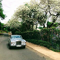
Brooklyn is a suburb of the city of Pretoria, South Africa. It is a well-established area, lying to the east of the city centre, encompassing high-end residential properties and several upmarket mall developments. It borders the University of Pretoria to its north and the suburbs of Groenkloof and Waterkloof to its south. Brooklyn is also the location of Pretoria Boys High School. The Brooklyn Mall opened in 1989.

Fort Rouge is a district of Winnipeg, Manitoba, in Canada. Located in the south-central part of the city, it is bounded on the north by the Assiniboine River, on the east and south by the Red River, and on the west by Stafford Street and Pembina Highway.
Brixton is a predominantly working class suburb of Johannesburg, South Africa. It is the site of the landmark Sentech Tower, and is near the suburbs of Auckland Park and Melville.

Capitol View is an in-town Atlanta neighborhood 2.5 miles from downtown Atlanta, Georgia that was named for its view of the Georgia State Capitol building. Its boundaries include Metropolitan Parkway to the east, Lee Street to the west, and the Beltline to the north. On the south, the border follows Arden Street, Deckner Avenue, and Perkerson Park.

The University of Pretoria is a multi-campus public research university in Pretoria, the administrative and de facto capital of South Africa. The university was established in 1908 as the Pretoria campus of the Johannesburg-based Transvaal University College and is the fourth South African institution in continuous operation to be awarded university status. The university has grown from the original 32 students in a single late Victorian house to approximately 53,000 in 2019. The University was built on 7 suburban campuses on 1,190 hectares.

The Groenkloof Nature Reserve, located adjacent to the Fountains Valley at the southern entrance to Pretoria, was the first game sanctuary in Africa. The reserve of 600 ha is managed by the Department of Nature Conservation. The National Heritage Monument is located within the reserve. It is flanked by Christina de Wit Avenue and Nelson Mandela Drive, that separate it from the Voortrekker Monument and Klapperkop Nature Reserves. In aggregate these reserves conserve some 1,400 ha of bankenveld vegetation which is threatened in Gauteng. The reserve is open to day visitors from 5:30 to 19:00 in summer, and 7:00 to 18:00 in winter.
The following is a timeline of the history of Pretoria, in the City of Tshwane Metropolitan Municipality, Gauteng province, South Africa.

The Bentway, formerly Project: Under Gardiner, is a public trail and corridor space underneath the Gardiner Expressway in Toronto, Ontario, Canada. It is repurposed land that was in sections vacant, rail lines, parking lots and outdoor storage.
M11 is a major metropolitan route in Greater Johannesburg, South Africa. Historically it was the main road between Johannesburg and Pretoria, it now runs along through the central and north-eastern parts of the city from Bassonia, passing through Johannesburg CBD and Hillbrow, passing through numerous older suburbs, including Houghton and Orange Grove and the Alexandra Township as Louis Botha Avenue, before it becomes the (R101) Old Pretoria Road and continues to Midrand and Pretoria.