Erasmia | |
|---|---|
 Erasmia  Erasmia | |
| Coordinates: 25°48′51″S28°5′35″E / 25.81417°S 28.09306°E | |
| Country | South Africa |
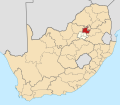
| Province | Gauteng |
| Municipality | City of Tshwane |
| Established | 26 January 2019 |
| Area | |
• Total | 2.93 km2 (1.13 sq mi) |
| Population (2011) [1] | |
• Total | 6,932 |
| • Density | 2,400/km2 (6,100/sq mi) |
| Racial makeup (2011) | |
| • Black African | 12.6% |
| • Coloured | 1.8% |
| • Indian/Asian | 77.0% |
| • White | 7.0% |
| • Other | 1.6% |
| First languages (2011) | |
| • English | 75.3% |
| • Afrikaans | 12.5% |
| • Northern Sotho | 2.5% |
| • Tswana | 1.2% |
| • Other | 8.5% |
| Time zone | UTC+2 (SAST) |
| Postal code (street) | 0183 |
| PO box | 0023 |
Erasmia is a suburb in the northern outskirts of Centurion in the City of Tshwane Metropolitan Municipality. Originally a whites-only area under apartheid, increasing numbers of Indians from neighbouring Laudium moved in, following the abolition of segregation in the early 1990s, and the construction of a direct link road between the two areas. Erasmia lies west of the R55 route. In 2001, 65.72% of the population was Indian, [2] and by 2011, Indians made up 77.03% of the population. [1] The area called Christoburg is for census [1] and other purposes usually treated as part of Erasmia.