Akasia

Last updated
Akasia
South Africa Gauteng location map.svg
Red pog.svg
Akasia
South Africa adm location map.svg
Red pog.svg
Akasia
Africa location map.svg
Red pog.svg
Akasia
Coordinates: 25°38′49″S28°05′59″E / 25.6470°S 28.0998°E / -25.6470; 28.0998
Country South Africa
Province Gauteng
Municipality City of Tshwane
Area
[1]
  Total80.84 km2 (31.21 sq mi)
Population
 (2011) [1]
  Total59,455
  Density740/km2 (1,900/sq mi)
Racial makeup (2011)
[1]
   Black African 73.7%
   Coloured 1.1%
   Indian/Asian 0.8%
   White 23.9%
  Other0.4%
First languages (2011)
[1]
   Tswana 23.8%
   Afrikaans 23.3%
   Northern Sotho 12.4%
   English 9.9%
  Other30.6%
Time zone UTC+2 (SAST)
Postal code (street)
0601

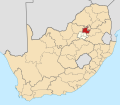
Akasia is a complex of suburbs north of Pretoria, part of the City of Tshwane Metropolitan Municipality. Formerly an independent municipality, [2] the area surrounding Akasia is largely semi-rural and Akasia itself is built on former agricultural holdings.

Contents

History

The first suburb to be built in Akasia is The Orchards. The Orchards was established as a residential township in 1904 and an old Dutch-Reformed church was in the center of the neighborhood. As the city of Pretoria grew in light of industrial expansion in the 1960s more houses were constructed in the northern semi-rural holdings today known as Akasia.

The turning point in the urban development of Akasia was the establishment of the Rosslyn industrial complex in the early 1970s. Rosslyn became a significant industrial complex, housing large industrial corporations such as Nampak, BMW, South African Breweries and Nissan. With the growth of the manufacturing complex came a need for a large skilled and semi-skilled workforce nearby and by the late 1970s the small agricultural holdings in the area were being purchased and transformed into residential offerings with tree lined streets and green parks. The town attained municipal status in 1984, [2] before losing it as part of the post-apartheid reorganisation of local governments, and being incorporated into the City of Tshwane Metropolitan Municipality.

With a success in the sale of housing in The Orchards, there was a plan to build more similar suburban style houses for the large population of artisans and technicians. Soon suburbs such as Karenpark, Amandasig, Theresapark, Ninapark, Clarina, Hesteapark, Flourana, and Chantelle were built.

Demographics

The area's population grew from a mere 400 in the 1950s to over 60,000 in the 2011 census. The people of Akasia were up until the early 1990s mainly white Afrikaans-speaking people. Since the advent of democracy in South Africa, the area has transformed to represent the demographics of the greater area Pretoria North. A development that has arisen in the social construct of the area is the influx of people from other parts of the African continent bringing with them a new cultural flavor to the area. Small Somali shops and Congolese hairdressers have given the largely culturally monogamous area a new traditional dynamic. The relationship between the African migrants and local South Africans in the Akasia area is relatively good as the population in Akasia is well educated and levels of unemployment are low.[ citation needed ]

With an increase in population came an increase in the demand for other support services such as schools, health care facilities, municipal offices, filling stations, shopping and entertainment centers and religious institutions. As a result of these developments, Akasia has changed its character as a dormitory town and is developing a vibe of a more cosmopolitan city of its own.[ citation needed ]

Economy

The area has a growing young population of graduate professionals who are flocking to the cosmopolitan complexes in the Karen Park and Theresapark areas, which brings with it more need for business development and expansion in numerous industries. The area in Karenpark north of the Wonder Park Shopping Mall has great potential for commercial development.[ citation needed ] Office space, high end residential and entertainment offerings in the area will be a very good option for investors in the property development space. Soon the character of Akasia will move from that of a residential area to that of a cosmopolitan development node with glass-draped sky-scrapers and an inter-national appeal.[ citation needed ]

Key features[ citation needed ] include the Wonder Park Shopping Centre, the Winternest train station and drivers testing station, schools such as Hoerskool Akasia, Hoerskool Gert-Marits, Laerskool Theresapark, Laerskool Akasia, Amandasig secondary school and Charlton Vos college. The area is home to two world class[ citation needed ] golf courses: the Hillside Golf Course in Nina Park and the Thornbrook Golf Estate in Theresapark.

Related Research Articles

<span class="mw-page-title-main">Pretoria</span> Administrative capital of South Africa

Pretoria, also known as Tshwane, is South Africa's administrative capital, serving as the seat of the executive branch of government, and as the host to all foreign embassies to South Africa.

<span class="mw-page-title-main">Polokwane</span> City in Limpopo, South Africa

Polokwane, formerly and sometimes also known as Pietersburg, is the capital city of the Limpopo Province in South Africa. It is the country's largest urban centre north of Gauteng. It was one of the nine host cities of the 2010 FIFA World Cup.

<span class="mw-page-title-main">Centurion, South Africa</span> Place in Gauteng, South Africa

Centurion is an area with 236,580 inhabitants in the Gauteng Province of South Africa, between Pretoria and Midrand. Formerly an independent municipality, with its own town council, it has been part of the City of Tshwane Metropolitan Municipality since 2000. Its heart is at the intersection of the N1 and N14 freeways. The R21 freeway also passes through the eastern part of Centurion.

<span class="mw-page-title-main">Midrand</span> Place in Gauteng, South Africa

Midrand is a former municipality in central Gauteng, South Africa. Situated in-between Centurion and Sandton, Midrand now forms part of the City of Johannesburg Metropolitan Municipality.

<span class="mw-page-title-main">Randburg</span> Place in Gauteng, South Africa

Randburg is an area located in the Gauteng province of South Africa. Formerly a separate municipality, its administration devolved to the newly created City of Johannesburg Metropolitan Municipality, along with neighbouring Sandton and Roodepoort, in the late 1990s. During the transitional period of 1996–2000, Randburg was part of the Northern Metropolitan Local Council (MLC).

<span class="mw-page-title-main">Brits, South Africa</span> Town in North West, South Africa

Brits is a town in the North West Province of South Africa. It is situated in a fertile citrus, vegetable and grain-producing area that is irrigated by the waters of the Hartbeespoort Dam. It is close to the City of Tshwane Metropolitan Municipality in Gauteng, which includes Pretoria, and it has the same dialling code as Pretoria. In addition to being a centre for agriculture, the city is home to several heavy industries. A factory of the Italian car manufacturer Alfa Romeo produced cars for the domestic market and export to Asia from 1974 to 1985. The city also plays an important role in the South African mining industry: 94% of South Africa's platinum comes from the Rustenburg and Brits districts, which together produce more platinum than any other single area in the world. In addition, there is a large vanadium mine in the district.

<span class="mw-page-title-main">Vereeniging</span> City in Gauteng, South Africa

Vereeniging is a city located in the south of Gauteng province, South Africa, situated where the Klip River empties into the northern loop of the Vaal River. It is also one of the constituent parts of the Vaal Triangle region and was formerly situated in the Transvaal province. The name Vereeniging is the Dutch word meaning "association".

<span class="mw-page-title-main">Springs, South Africa</span> Place in Gauteng, South Africa

Springs is a former independent city that is now part of the City of Ekurhuleni, based in the east of Johannesburg, in Gauteng Province, South Africa. It lies 50 km (31 mi) east of Johannesburg and 72 km (45 mi) southeast from Pretoria. Its name derives from the large number of springs in the area, and its estimated population is more than 121,610 in 2011. It is situated at 1628 m (5,340 ft) above sea level.

<span class="mw-page-title-main">Strand, Western Cape</span> Seaside town in the Western Cape, South Africa

Strand is a seaside resort town in the Western Cape, South Africa. It forms part of the Eastern Suburbs of the City of Cape Town Metropolitan Municipality, situated on the north-eastern edge of False Bay and near the foot of the Helderberg Mountains. Its geographical position is between Somerset West and Gordon's Bay, and is about 50 km southeast of Cape Town City Bowl. Strand has a population of approximately 50,000. Strand's main attraction is the beach; 5 km of white sandy beach off False Bay.

Randpark is a suburb of Randburg, South Africa. It is located in the northern suburbs of the City of Johannesburg.

Menlo Park is an upmarket suburb in the city of Pretoria, South Africa. It borders other upmarket areas Waterkloof, Brooklyn and Lynnwood. When it was first established between the 1950s and 1960s, it was the most eastern suburb of Pretoria, but the city has since considerably expanded eastwards. Today these suburbs are known as the Old East and can boast to have some of the city's most high-end residential properties.

<span class="mw-page-title-main">Pretoria North</span> Place in Gauteng, South Africa

Pretoria North is a suburb of the city of Pretoria, Gauteng, South Africa, with a population of 16,972 people according to the 2011 census.

The R566 is a Regional Route in South Africa that connects Brits with Pretoria North via Ga-Rankuwa and Rosslyn.

<span class="mw-page-title-main">Rosslyn, South Africa</span> Place in Gauteng, South Africa

Rosslyn is an industrial suburb of Akasia, 29 km north-west of Pretoria and part of the City of Tshwane Metropolitan Municipality in the Gauteng province of South Africa.

Garsfontein is a residential suburb of the city of Pretoria in the Gauteng province of South Africa. It is a well-developed area, lying to the east of the city centre, close to the Menlyn Park shopping center.

The following is a timeline of the history of Pretoria, in the City of Tshwane Metropolitan Municipality, Gauteng province, South Africa.

Danville is a predominantly White suburb, to the west of central Pretoria, in the City of Tshwane Metropolitan Municipality.

<span class="mw-page-title-main">Capital Park, Pretoria</span> Place in Gauteng, South Africa

Capital Park is one of Pretoria's oldest and first suburbs and lies approximately 4 km north of the historic Church Square, behind the Pretoria National Zoo. The neighbourhood is bordered by the Witwatersberge on the south side and the Apies River on the west side. The neighbourhood extends from the Apies River to Johan Heyns Drive. Streets in the neighbourhood are named after early mayors of Pretoria. One of the former mayoral residences is in Capital Park. Capital Park was previously a very popular neighbourhood among Italian as well as Portuguese communities – the Portuguese Church is still in Van Heerden Street (2010). The residential area today is cosmopolitan, with predominantly Afrikaans speaking inhabitants. The CPRTA functions as residents' association to look after the interests of its residents.

The M20 road is a metropolitan route in the City of Tshwane in Gauteng, South Africa. It connects Akasia with Hebron via Soshanguve.

References

  1. 1 2 3 4 "Main Place Akasia". Census 2011.
  2. 1 2 Peter E Raper; Lucie A Moller; Theodorus L du Plessis (8 December 2014). Dictionary of Southern African Place Names. Jonathan Ball Publishers. pp. 46–. ISBN   978-1-86842-550-1.