Heuweloord

Last updated

Heuweloord
South Africa Gauteng location map.svg
Red pog.svg
Heuweloord
South Africa adm location map.svg
Red pog.svg
Heuweloord
Coordinates: 25°53′S28°6′E / 25.883°S 28.100°E
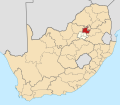
 / -25.883; 28.100
Country South Africa
Province Gauteng
Municipality City of Tshwane
Main Place Centurion
Area
[1]
  Total2.00 km2 (0.77 sq mi)
Population
 (2011) [1]
  Total3,861
  Density1,900/km2 (5,000/sq mi)
Racial makeup (2011)
[1]
   Black African 36.9%
   Coloured 5.6%
   Indian/Asian 32.0%
   White 24.6%
  Other0.9%
First languages (2011)
[1]
   English 44.3%
   Afrikaans 21.3%
   Northern Sotho 7.0%
   Tswana 5.7%
  Other21.8%
Time zone UTC+2 (SAST)
Postal code (street)
0157
PO box
0173

Heuweloord is a suburb in Centurion, South Africa. The suburb is at the intersection of the R55 route and the R114 route.

Related Research Articles

<span class="mw-page-title-main">Mirrabooka, Western Australia</span> Suburb of Perth, Western Australia

Mirrabooka is a suburb of Perth, Western Australia. Its local government area is the City of Stirling. Mirrabooka is an Aboriginal name for the constellation most commonly known as the Southern Cross.

<span class="mw-page-title-main">R25 (South Africa)</span> Road in South Africa

The R25 is a provincial route in South Africa that connects Johannesburg with Groblersdal via Kempton Park, Bapsfontein and Bronkhorstspruit.

<span class="mw-page-title-main">R29 (South Africa)</span> Road in South Africa

The R29 is a provincial route in South Africa that connects Johannesburg with Leandra and Kinross via Germiston, Boksburg, Benoni and Springs. For much of its route it is named Main Reef Road. The R29 used to end near the Golela border post, however the section from Evander to Ermelo is now part of the N17 and the section from Ermelo to the Golela border post just after Pongola is now part of the N2.

<span class="mw-page-title-main">R41 (South Africa)</span> Road in South Africa

The R41 is a provincial route in Gauteng, South Africa, that connects Johannesburg with Randfontein via Roodepoort.

<span class="mw-page-title-main">R55 (South Africa)</span> Road in South Africa

The R55 is a north-south provincial route in Gauteng, South Africa that connects Sandton with Pretoria. It passes Woodmead, Kyalami, Olievenhoutbosch, Heuweloord, Sunderland Ridge, Erasmia, Laudium/Claudius, West Park, the Daspoort Tunnel and Danville. It connects with the M1, N14, and R80 highways. It is also designated as the P66-1 and K71 by the Gauteng Provincial Government.

<span class="mw-page-title-main">Joondalup</span> Suburb of Perth, Western Australia

Joondalup is a suburb of Perth, Western Australia, approximately 26 kilometres (16 mi) north of Perth's central business district. It contains the central business district of the regional City of Joondalup and acts as the primary urban centre of Perth's outer northern suburbs.

Klipriviersberg is a suburb of Johannesburg, South Africa. It is located in Region F of the City of Johannesburg Metropolitan Municipality.

Randpark Ridge is an upmarket suburb of Randburg, South Africa. It is located in the Randburg region of the City of Johannesburg. It fell into the town of Randburg during the apartheid era. Developed in the early 1980s and still relatively new, Randpark Ridge is bordered by several other suburbs including Weltevreden Park, Sundowner, Boskruin, Bromhof, Honeydew and Fairland. It is located on the north-west extremity of Johannesburg.

Wanneroo is a northern suburb of Perth, Western Australia, located within the City of Wanneroo.

<span class="mw-page-title-main">Nedlands, Western Australia</span> Suburb of Perth, Western Australia

Nedlands is an affluent western suburb of Perth, the capital city of Western Australia. It is a part of the local government areas of the City of Nedlands and the City of Perth. It is about 7 kilometres (4 mi) from the Perth CBD via either Thomas Street or Mounts Bay Road.

<span class="mw-page-title-main">Heathwood, Queensland</span> Suburb of Brisbane, Queensland, Australia

Heathwood is an outer south-western suburb in the City of Brisbane, Queensland, Australia. In the 2016 census, Heathwood had a population of 2,794 people.

<span class="mw-page-title-main">Parramatta River ferry services</span>

Parramatta River ferry services connect suburbs along the Parramatta River in Sydney with Circular Quay by commuter ferry. The services are numbered F3 and form part of the Sydney Ferries network.

<span class="mw-page-title-main">Taman Ungku Tun Aminah</span>

Taman Ungku Tun Aminah is a suburb in Skudai, Iskandar Puteri, Johor Bahru District, Johor, Malaysia. It was erected on 1980s after Sultanah Tun Aminah.

Jamia Osmania is a suburb of Hyderabad, India.

<span class="mw-page-title-main">Ottery, Cape Town</span> Suburb of Cape Town, in Western Cape, South Africa

Ottery is a suburb in Cape Town, South Africa. It is on the edge of the Southern Suburbs. The Youngsfield Military Base, Royal Cape Golf Club and Cape Town's 'official' China Town are located in the suburb. Every year the Youngsfield Military Base in Ottery hosts the Cape Argus Junior Cycle Tour on 12 March. The name was derived off the Otter sanctuary which was opened here in the early 1900's, but sadly was closed down as the neighbourhood rapidly expanded later in the century.

<span class="mw-page-title-main">Harlem Avenue</span> Street in Chicago, Illinois, US

Harlem Avenue is a major north–south street located in Chicago and its west, southwest, and northwest suburbs. It stretches from Glenview Road in Glenview to the intersection of East South Street and South Drecksler Road in Peotone, where it diverges into Illinois Route 50. At 54.1 miles (87.1 km), it is the third-longest street in the United States, after Telegraph Road in southeastern Michigan and O Street in Nebraska. For most of its length, it carries Illinois Route 43. There is a stop along the Metra's BNSF Line at Harlem Avenue and Windsor Avenue in Berwyn, Illinois. There is also a major transit center where Metra's UP West Line and the Chicago Transit Authority Green Line share a facility in Oak Park, Illinois. The northern terminus of Harlem Avenue is also nearby the Glenview station for both Metra's Milwaukee District/North Line and Amtrak intercity trains.

<span class="mw-page-title-main">Radial route</span>

A radial route is a public transport route linking a central point in a city or town, usually in the central business district (CBD), with a suburb of that city or town. Such a route can be operated by various forms of public transport, including commuter rail, rapid transit, trams (streetcars), trolleybuses, or motor buses.

The R114 is a regional route in Gauteng, South Africa that runs from Muldersdrift to Centurion. The designation R114 is applied to sections of road that were previously part of the N14 that have been replaced by newly built freeway sections.

Brooklyn is a suburb of Cape Town, Western Cape with a population of 10,941 people. It lies to the north of Maitland, east of the Atlantic Ocean and Paarden Eiland, and west of Air Force Base Ysterplaat. The Black River flows through a section of Brooklyn.

<span class="mw-page-title-main">M9 (Cape Town)</span> Metropolitan route in the City of Cape Town, South Africa

The M9 is a long metropolitan route in the City of Cape Town, South Africa. It connects Sir Lowry's Pass Village with Wynberg via Somerset West, Firgrove, Macassar, Khayelitsha and Nyanga.

References

  1. 1 2 3 4 "Sub Place Heuweloord". Census 2011.