Waterkloof Park | |
|---|---|
 Waterkloof Park  Waterkloof Park | |
| Coordinates: 25°47′29″S28°15′47″E / 25.79139°S 28.26306°E | |
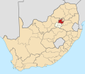
| Country | South Africa |
| Province | Gauteng |
| Municipality | City of Tshwane |
| Main Place | Pretoria |
| Area | |
• Total | 0.35 km2 (0.14 sq mi) |
| Population (2011) [1] | |
• Total | 491 |
| • Density | 1,400/km2 (3,600/sq mi) |
| Racial makeup (2011) | |
| • Black African | 15.9% |
| • Coloured | 1.0% |
| • Indian/Asian | 15.9% |
| • White | 62.5% |
| • Other | 4.7% |
| First languages (2011) | |
| • Afrikaans | 42.0% |
| • English | 25.8% |
| • Sotho | 5.3% |
| • Xhosa | 1.2% |
| • Other | 25.7% |
| Time zone | UTC+2 (SAST) |
Waterkloof Park is a tiny suburb of the city of Pretoria, South Africa. Located southeast of Waterkloof, it is home to some of the city's most expensive real estate.