
Sandton is an upscale commercial and residential district north of the city of Johannesburg, South Africa. It forms part of the City of Johannesburg Metropolitan Municipality. The name of the town came from the combination of two of its suburbs, Sandown and Bryanston. In 1969, Sandton was promulgated as a municipality in its own right, but lost its status as an independent town after the re-organisation of South African local governments after Apartheid ended.
Centurion is an area with 236,580 inhabitants in the Gauteng Province of South Africa, between Pretoria and Midrand. Formerly an independent municipality, with its own town council, it has been part of the City of Tshwane Metropolitan Municipality since 2000. Its heart is at the intersection of the N1 and N14 freeways. The R21 freeway also passes through the eastern part of Centurion.
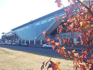
Midrand is a former municipality in central Gauteng, South Africa. Situated in-between Centurion and Sandton, Midrand now forms part of the City of Johannesburg Metropolitan Municipality.
Daniel Jacobus Erasmus was a South African Boer political figure. He served as the acting president of Transvaal between 1871 and 1872.

Bryanston, Gauteng is an affluent residential suburb of Sandton, South Africa north of Johannesburg. First named as an area in 1949, it was established in 1969 as a suburb of Sandton and provided with tarred roads and municipal services, but after municipal boundaries were revised following the end of Apartheid, Sandton was merged with Johannesburg to form part of the City of Johannesburg Metropolitan Municipality. The multi-lane N1 Western Johannesburg Bypass freeway forms its northern boundary with access at William Nicol offramp. It is located in Region E of the City of Johannesburg Metropolitan Municipality.

The suburbs of Johannesburg are officially demarcated areas within the City of Johannesburg Metropolitan Municipality, South Africa. As in other Commonwealth countries, the term suburb refers to a "neighbourhood", although in South Africa most "suburbs" have legally recognised borders and often separate postal codes. The municipal functions for the area, such as municipal policing and social services, are still managed by the city government.

Kempton Park is a city in the East Rand region of Gauteng province, South Africa. It is part of the City of Ekurhuleni Metropolitan Municipality. It is situated south of Tembisa, one of the largest townships in South Africa, which is also part of Ekurhuleni. South Africa's busiest airport, O. R. Tambo International Airport is located in Kempton Park.
Irene is a small village on the eastern outskirts of Centurion, Gauteng, South Africa.

Gautrain is an 80-kilometre (50-mile) higher-speed express commuter rail system in Gauteng, South Africa, which links Johannesburg, Pretoria, Kempton Park and O. R. Tambo International Airport. It takes 15 minutes to travel from Sandton to O. R. Tambo International Airport on the Gautrain and 35 minutes from Pretoria in Tshwane to Park Station in Johannesburg. The Gautrain has 10 stations. Buses, shuttles and midibus services are available to transport passengers to and from all stations excluding the O. R. Tambo International Airport Station.
Melrose Estate is a suburb of Johannesburg, South Africa. It is located in Region 3. Until the early 2000s, the suburb had many fine traditional houses, which are rapidly giving way to cluster house complexes. While probably inevitable, this is slowly defacing the suburb. With the expected building of the Gautrain station in nearby Rosebank, the suburb is likely to disappear as a tree-covered residential area.

Waterkloof is an affluent suburb of the city of Pretoria in the Gauteng province of South Africa, located to the east of the city centre. It is named after the original farm that stood there when Pretoria was founded in the 19th Century.
Plumstead is a residential suburb situated in the Southern Suburbs of Cape Town in the Western Cape Province of South Africa.
Assagay, also spelt Assegay, is a suburb of eThekwini in KwaZulu-Natal, South Africa and forms a part of the Upper Highway Area.
La Lucia is a wealthy suburb located in uMhlanga, north of Durban, in the KwaZulu-Natal province of South Africa. It was named after Lucia Michel. She and her husband Albert Michel founded the sugar cane farm La Lucia.
Greenstone Hill is a suburb on the East Rand of Gauteng Province in the City of Johannesburg Metropolitan Municipality in South Africa. It has only recently been developed although much of the surrounding areas such as Edenvale and Modderfontein have been developed and established for quite some time.
Umbogintwini is a suburb located approximately 23 km south-west of Durban, in KwaZulu-Natal, South Africa.
Elardus Park is a residential suburb of the city of Pretoria, South Africa. It is located to the south of Waterkloof Ridge in a leafy, established area that is home to the city's medium expensive real estate.
Moreleta Park is a suburb of Pretoria, South Africa, situated 12 kilometres (7 mi) southeast of the city centre. According to the 2011 census, it has a population of 27,539.
Erasmia is a suburb in the northern outskirts of Centurion in the City of Tshwane Metropolitan Municipality. Originally a whites-only area under apartheid, increasing numbers of Indians from neighbouring Laudium moved in, following the abolition of segregation in the early 1990s, and the construction of a direct link road between the two areas. Erasmia lies west of the R55 route. In 2001, 65.72% of the population was Indian, and by 2011, Indians made up 77.03% of the population. The area called Christoburg is for census and other purposes usually treated as part of Erasmia.

The Moreleta Kloof Nature Reserve in eastern Pretoria, Gauteng, South Africa, was part of the farm Garsfontein which was acquired by Jacobus Cornelius Rademeyer in 1859. He had married Cornelia Jacoba Susanna Erasmus on 2 Jul 1837 in George, Eastern Cape. Cornelia Erasmus was a daughter of Daniel Jacobus Elardus Erasmus, who was the first settler on the farm Zwartkop, and sister of Daniel Elardus Erasmus who had settled on the farm Doornkloof. Jacobus Rademeyer operated Garsfontein as a dairy farm and Carel Erasmus purchased the farm from him in 1877 and built a house there; the house was later converted into a chapel which is still in use. In 1903, his son-in-law, Johan Marnewick, built another house on the farm; this house has been converted into a restaurant named Rademeyer's. The reserve is managed by the City of Tshwane Metropolitan Municipality and admission is free. The reserve covers 100 hectares.


