Equestria, Pretoria

Last updated

Equestria
South Africa Gauteng location map.svg
Red pog.svg
Equestria
South Africa adm location map.svg
Red pog.svg
Equestria
Africa location map.svg
Red pog.svg
Equestria
Coordinates: 25°45′47″S28°20′13″E / 25.763°S 28.337°E
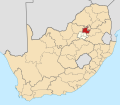
 / -25.763; 28.337
Country South Africa
Province Gauteng
Municipality City of Tshwane
Main Place Pretoria
Area
[1]
  Total3.73 km2 (1.44 sq mi)
Population
 (2011) [1]
  Total4,820
  Density1,300/km2 (3,300/sq mi)
Racial makeup (2011)
[1]
   Black African 31.34%
   Coloured 3.63%
   Indian/Asian 2.86%
   White 60.75%
  Other1.41%
First languages (2011)
[1]
   Afrikaans 48.33%
  English24.09%
   Northern Sotho 5.56%
  Other15.6%
Time zone UTC+2 (SAST)
Postal code (street)
0184

Equestria is a suburb of Pretoria, South Africa, situated approximately 18 kilometres (11 mi) east of the city centre. [2]

Contents

Geography

Equestria is located on the eastern outskirts of Pretoria, bordering on the suburbs of Willow Park, Willow Glen AH and Nellmapius to the north, Willow Glen and Six Fountains to the east, Wapadrand to the south and Die Wilgers to the west. [3]

Retail

Equestria is largely served by The Grove Mall situated to the south of the suburb. [4] Smaller shopping centres serving Equestria include Equestria Shopping Centre situated to the east and Lynnwood Lane situated to the south. [5] [6]

Transport

Equestria is bordered by four routes, namely the N4 (north), M6 (south), M10 (east) and M12 (west). The N4 is the major national route and highway connecting Pretoria Central to the west with eMalahleni to the east. The M6 (Lynnwood Drive) connects Lynnwood to the west with Onbekend to the south-east. The M10 (Solomon Mahlangu Drive) connects Mamelodi to the north with Garsfontein to the south-west and provides access to the N4. The M12 (Simon Vermooten Road) connects Equestria with Waltloo and Mamelodi to the north and provides access to the N4.

Related Research Articles

<span class="mw-page-title-main">N1 Western Bypass (Johannesburg)</span> Road in South Africa

The Western Bypass is a section of the N1 and the Johannesburg Ring Road located in the city of Johannesburg, South Africa. Known at the time as the Concrete Highway, the freeway was initially opened in 1975 as a route to avoid the city centre of Johannesburg and to provide access to the western areas of the Witwatersrand. From the south, the Western Bypass begins at the Diepkloof Interchange in Soweto, where it splits from the N12 freeway and ends at the Buccleuch Interchange, where it merges with the N3 Eastern Bypass, M1 South and N1 Ben Schoeman freeways.

<span class="mw-page-title-main">R21 (South Africa)</span> Road in South Africa

The R21 is a major north–south provincial route in eastern Gauteng Province, South Africa. Built in the early 1970s, it remains one of two freeways linking Pretoria with Johannesburg, via the R24. As the eastern of the two freeways, it links the Pretoria city centre with OR Tambo International Airport, the N12 freeway, and Boksburg. Between the Solomon Mahlangu Drive on-ramp in Monument Park, Pretoria, and the N12 in Boksburg, the R21 is an 8 lane highway and motorway (freeway), with 4 lanes in each direction. It has off-ramps leading to Irene, Olifantsfontein, Benoni, and Kempton Park, including a partial offramp to Atlas Road. The route intersects the N1 Highway near Centurion, the R24 near the airport, the N12 and N17 in Boksburg, and the N3 near Vosloorus on the East Rand, where it ends. The section from the N12 to the N3 is not a freeway. As early as the 1970s there were proposals to extend the R21 freeway further south and the freeway may be linked with the current eastern terminus of the M2 in Germiston in future. It is also designated as the P157.

<span class="mw-page-title-main">R25 (South Africa)</span> Road in South Africa

The R25 is a provincial route in South Africa that connects Johannesburg with Groblersdal via Kempton Park, Bapsfontein and Bronkhorstspruit.

<span class="mw-page-title-main">R55 (South Africa)</span> Road in South Africa

The R55 is a north-south provincial route in Gauteng, South Africa that connects Sandton with Pretoria. It passes Woodmead, Kyalami, Olievenhoutbosch, Heuweloord, Sunderland Ridge, Erasmia, Laudium/Claudius, West Park, the Daspoort Tunnel and Danville. It connects with the M1, N14, and R80 highways. It is also designated as the P66-1 and K71 by the Gauteng Provincial Government.

The R104 is a regional route in South Africa that is the designation for some of the old sections of roads that were previously the N4, prior to upgrading. It connects Rustenburg in the North West province with Witbank in Mpumalanga province via Hartbeespoort, Mooinooi, Pretoria and Bronkhorstspruit. There is also a 50km section in Mpumalanga province connecting Middelburg and Wonderfontein.

<span class="mw-page-title-main">N4 (South Africa)</span> National road in South Africa

The N4 is a national route in South Africa that runs from Skilpadshek on the Botswana border, past Rustenburg, Pretoria, eMalahleni and Mbombela, to Komatipoort on the Mozambique border. It forms the South African section of the Trans-Kalahari Corridor, which runs from Walvis Bay to Maputo, meaning that it links the east and west coasts of Southern Africa.

La Lucia is a wealthy suburb located in uMhlanga, north of Durban, in the KwaZulu-Natal province of South Africa. It was named after Lucia Michel. She and her husband Albert Michel founded the sugar cane farm La Lucia.

The M18 road is a long metropolitan route in Gauteng, South Africa. It connects Pretoria with Thembisa via Centurion and Olifantsfontein.

The M10 road is a long metropolitan route in the City of Tshwane in Gauteng, South Africa. It connects Sunderland Ridge with Mamelodi via Lyttelton and Garsfontein.

The M6 road is a long metropolitan route in the City of Tshwane in Gauteng, South Africa. It connects Pretoria West with a rural area east of Pretoria via Pretoria CBD, Brooklyn, Lynnwood and Wapadrand.

The M30 road is a metropolitan route in the City of Tshwane in Gauteng, South Africa. It connects Brooklyn with Welbekend via Menlyn and Garsfontein.

The M2 road is a metropolitan route in the City of Tshwane in Gauteng, South Africa. It connects the N1 and N4 highways at the Proefplaas Interchange with Proclamation Hill via Hatfield, Pretoria CBD and Pretoria West.

The M8 road is a metropolitan route in the City of Tshwane in Gauteng, South Africa. It connects Capital Park with Mamelodi via Gezina, Villieria and Eersterust.

The M11 road is a short metropolitan route in the City of Tshwane in Gauteng, South Africa. It connects the Pretoria CBD with Faerie Glen and Garsfontein via Sunnyside, Brooklyn and Menlyn.

The M33 road is a short metropolitan route in the City of Tshwane in Gauteng, South Africa. It consists of only one road in Pretoria East, connecting Constantia Park with Lynnwood Ridge.

The M12 road is a metropolitan route in the City of Tshwane in Gauteng, South Africa. It connects Die Wilgers with Waitloo.

The M13 road is a metropolitan route in the City of Tshwane in Gauteng, South Africa. It consists of one street named Rossouw Street in the Die Wilgers suburb of Pretoria.

The M14 road is a metropolitan route in the City of Tshwane in Gauteng, South Africa. It connects Lynnwood Manor with Waitloo via Silverton.

The M16 road is a short metropolitan route in the City of Tshwane in Gauteng, South Africa. It connects Lynnwood Manor with Scientia.

References

  1. 1 2 3 4 "Sub Place Equestria". Census 2011.
  2. "City of Tshwane restores 90% of power to Pretoria East after substation fire". News24. 17 July 2018. Retrieved 21 December 2018.
  3. "Census 2011: Main Place: Pretoria". census2011.adrianfrith.com. Retrieved 8 October 2023.
  4. "The Grove Mall". thegrovemall.co.za. Retrieved 8 October 2023.
  5. "Equestria Shopping Centre | Retail Shops to let | Rennie Knight Frank". www.rennieproperty.co.za. Retrieved 8 October 2023.
  6. "Lynnwood Lane". lynnwoodlane.co.za. Retrieved 8 October 2023.