
Roseville is the most populous city in Placer County, California, located within the Sacramento metropolitan area. As of 2019, the US Census Bureau estimated the city's population to be 141,500. Interstate 80 runs through Roseville and State Route 65 runs through part of the northern edge of the city.
Roseville is a city in Macomb County in the U.S. state of Michigan. A northern suburb of Detroit, Roseville is located roughly 13 miles (20.9 km) northeast of downtown Detroit. As of the 2020 census, the city had a population of 47,710.

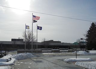
Roseville is a city in Ramsey County, Minnesota, United States. It is one of two Twin Cities suburbs that are adjacent to both Saint Paul and Minneapolis. The land comprising Falcon Heights, Lauderdale, and southern Roseville was unincorporated until Roseville incorporated in 1948 and Falcon Heights and Lauderdale incorporated in 1949. The population was 36,254 at the 2020 census.

Roseville railway station is located on the North Shore line, serving the Sydney suburb of Roseville. It is served by Sydney Trains T1 North Shore line and T9 Northern line services.

Roseville Chase is a suburb on the Upper North Shore of Sydney in the state of New South Wales, Australia 11 kilometres north-west of the Sydney central business district, in the local government area of Ku-ring-gai Council. Roseville is a separate suburb to the west.

Roseville is a suburb on the Upper North Shore of Sydney in the state of New South Wales, Australia 12 kilometres (7.5 mi) north-west of the Sydney central business district, in the local government areas of Ku-ring-gai and Willoughby. Roseville Chase is a separate suburb to the east.
Killarney Heights is a suburb of Northern Sydney, situated on Middle Harbour, in the state of New South Wales, Australia. Killarney Heights is 12 kilometres north-east of the Sydney central business district in the local government area of Northern Beaches Council. Killarney Heights is part of the Forest District, colloquially known as The Forest.

Davidson is an electoral district of the Legislative Assembly in the Australian state of New South Wales. It is represented by Matt Cross of the Liberal Party.

Roseville College is an independent Anglican day school for girls, located in the suburb of Roseville, on the North Shore of Sydney, New South Wales, Australia.
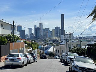
Teneriffe is an inner suburb of Brisbane, Queensland, Australia, 2.5 kilometres (1.6 mi) north-east of the CBD. In the 2016 census, Teneriffe had a population of 5,335 people.

The Roseville Bridge, is a pre-stressed concrete box girder road bridge that carries Warringah Road, part of the A38 across Middle Harbour, located adjacent to the suburb of Roseville, in Sydney, New South Wales, Australia. The bridge is one of two crossings of Middle Harbour, the other being the Spit Bridge.
Roseville Joint Union High School District is a California school district that consists of 6 comprehensive high schools, 1 independent study high school, 1 continuation high school and an adult school. The district covers the city of Roseville and the unincorporated community of Granite Bay, two suburbs of Sacramento that are located in Placer County, and the eastern side of the suburb of Antelope in northern Sacramento County.
KFSG is an AM radio station broadcasting a Brokered programming format featuring Spanish Religious and Multilingual shows. KFSG is licensed to Roseville, California and serves the Sacramento metropolitan area. The station is owned by Way Broadcasting Licensee, LLC., part of New York City-based Multicultural Broadcasting.

Bennett Lake is a lake located in Roseville, Minnesota, a suburb of the Twin Cities. It occupies 28 acres (11 ha) acres and is known for its shore fishing. The lake is adjacent to Roseville Central Park, the city's largest park.

Stratford is a rural locality in the Mid-Coast Council local government area in the Hunter Region of New South Wales, Australia. The largest population centre in the area is the town of Stratford, which is approximately 14 kilometres (9 mi) south of Gloucester and 109 km (68 mi) north of Newcastle. Stratford, which is next to the Avon River, is on Bucketts Way, 66 km (41 mi) from the Pacific Highway, the nearest major highway.

Mary A. Gardner Holland, also known as Mary G. Holland, was a Union nurse during the American Civil War.

The California Zephyr is a long-distance passenger train operated by Amtrak between Chicago and the San Francisco Bay Area, via Omaha, Denver, Salt Lake City, and Reno. At 2,438 miles (3,924 km), it is Amtrak's longest daily route, and second-longest overall after the Texas Eagle's triweekly continuation from San Antonio to Los Angeles, with travel time between the termini taking approximately 511⁄2 hours. Amtrak claims the route as one of its most scenic, with views of the upper Colorado River valley in the Rocky Mountains, and the Sierra Nevada. The modern train is the second iteration of a train named California Zephyr; the original train was privately operated and ran on a different route through Nevada and California.

Transportation in the Sacramento metropolitan area consists of a variety of different modes of travel in El Dorado County, Placer County, Sacramento County, and Yolo County, which are the four counties that comprise the Sacramento metropolitan area.
The M1 road is a short metropolitan route in the City of Tshwane in Gauteng, South Africa. It connects Pretoria West and the Pretoria CBD with Pretoria North via Mayville.


