Waterkloof Glen | |
|---|---|
 Waterkloof Glen  Waterkloof Glen | |
| Coordinates: 25°47′45″S28°16′50″E / 25.79583°S 28.28056°E | |
| Country | South Africa |
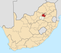
| Province | Gauteng |
| Municipality | City of Tshwane |
| Main Place | Pretoria |
| Area | |
• Total | 2.35 km2 (0.91 sq mi) |
| Population (2011) [1] | |
• Total | 4,083 |
| • Density | 1,700/km2 (4,500/sq mi) |
| Racial makeup (2011) | |
| • Black African | 27.0% |
| • Coloured | 1.9% |
| • Indian/Asian | 2.4% |
| • White | 66.2% |
| • Other | 2.6% |
| First languages (2011) | |
| • Afrikaans | 46.9% |
| • English | 29.7% |
| • Northern Sotho | 2.9% |
| • Zulu | 2.8% |
| • Other | 17.7% |
| Time zone | UTC+2 (SAST) |
| Postal code (street) | 0181 |
| PO box | 0010 |
Waterkloof Glen is a suburb of the city of Pretoria, South Africa. It is located in a leafy, established area, with Constantia Park, Garsfontein and Menlyn as neighbouring suburbs.