Listed buildings in Asby, Eden

Last updated

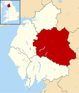
Asby is a civil parish in the Eden District, Cumbria, England. It contains 22 buildings that are recorded in the National Heritage List for England. Of these, one is listed at Grade I, the highest of the three grades, four are at Grade II*, the middle grade, and the others are at Grade II, the lowest grade. The parish contains the small villages of Great Asby and Little Asby, and is otherwise almost completely rural. Most of the listed buildings are houses and associated structures, farmhouses and farm buildings. The other listed buildings comprise a church, a lych gate, almshouses, a roadbridge, a footbridge, and two wells.

Asby, Eden

Asby is a civil parish in the Eden district of Cumbria, England. Historically part of Westmorland, it includes the villages of Great Asby and Little Asby. According to the 2001 census the parish had a population of 280, and this had increased to 309 at the 2011 Census.

Civil parish territorial designation and lowest tier of local government in England, UK

In England, a civil parish is a type of administrative parish used for local government, they are a territorial designation which is the lowest tier of local government below districts and counties, or their combined form, the unitary authority. Civil parishes can trace their origin to the ancient system of ecclesiastical parishes which historically played a role in both civil and ecclesiastical administration; civil and religious parishes were formally split into two types in the 19th century and are now entirely separate. The unit was devised and rolled out across England in the 1860s.

Eden District District in England

Eden is a local government district in Cumbria, England. Its council is based in Penrith. It is named after the River Eden which flows north through the district toward Carlisle.

Contents

Key

Map all coordinates using: OpenStreetMap  ·  Google Maps
Download coordinates as: KML  ·  GPX
Grade Criteria [1]
I Buildings of exceptional interest, sometimes considered to be internationally important
II* Particularly important buildings of more than special interest
II Buildings of national importance and special interest

Buildings

Name and locationPhotographDateNotesGrade
Well, Grange Hall
54°29′33″N2°29′13″W / 54.49238°N 2.48696°W / 54.49238; -2.48696 (Well, Grange Hall)
This consists of a well house over a spring. It is built in stone with an entrance on the east side, and it has a stone roof with a stone with cruciform moulding closing the ridge. The spring rises through a square opening in the floor. The well house is surrounded by a drystone wall with an opening facing the entrance. [2]
Grange Hall and adjoining buildings
54°29′33″N2°29′18″W / 54.49256°N 2.48840°W / 54.49256; -2.48840 (Grange Hall)
Grange Hall. Asby.jpg
This originated as a tower house and a grange of Byland Abbey. It is in stone with quoins, a parapet, and a slate roof. The main part has three storeys and four bays, and there are wings to the front and the back. In the east front is a 15th-century five-light oriel window, and most of the other windows are mullioned. [3] [4]
Old Rectory
54°30′45″N2°29′42″W / 54.51262°N 2.49504°W / 54.51262; -2.49504 (Old Rectory)
The former rectory originated as a solar tower, the hall range was added probably in the 17th century, and an extension to the south was added in 1866. The house is in stone with a slate roof, and has a U-shaped plan. The tower has thick walls, a massive plinth, quoins, a tunnel vault and a chamfered doorway with a hood mould. In the gable end is a two-light arched window with Geometrical tracery, and the other windows have flat tops and mullions. [5] [6]
Gaythorne Hall
54°30′49″N2°32′34″W / 54.51360°N 2.54268°W / 54.51360; -2.54268 (Gaythorne Hall)
Gaythorne Hall (geograph 1882234).jpg
A large house on an isolated site, in stone with quoins and a slate roof. It has a square plan, with projecting stair towers on the sides. The entrance front has two storeys with a cellar and attics, five bays, and a central two-storey porch with a round-headed entrance and a moulded surround. At the rear the house has three storeys and a single-storey porch. The windows are mullioned or mullioned and transomed, and some have hood moulds. [7] [8]
Barn, Fell View Farm
54°28′52″N2°28′00″W / 54.48100°N 2.46675°W / 54.48100; -2.46675 (Barn, Fell View Farm)
Originally a house, later converted into a farm building. It is in stone with quoins and a slate roof. The original door has a false four-centred head. External steps lead up to a loft door. All the windows have chamfered stone surrounds and mullions. [9]
Elm Tree Old Farmhouse and byre
54°30′47″N2°29′46″W / 54.51313°N 2.49625°W / 54.51313; -2.49625 (Elm Tree Old Farmhouse)
1694A barn was added to the left of the farmhouse in the end of the 18th century, and a kitchen was added to the right in the early 19th century. The buildings are in stone with a slate roof and have two storeys. The original part is on a large plinth, it has three bays and a central door with a dated and initialled lintel. [10]
Asby Hall, area railings and gate
54°30′49″N2°29′30″W / 54.51374°N 2.49167°W / 54.51374; -2.49167 (Asby Hall)
1694A house, enlarged in the mid-18th century, in stone with quoins and a slate roof, incorporating earlier 17th-century material. There are three storeys and a symmetrical front of three bays. The central doorway has Tuscan pilasters, and a segmental head with a coat of arms above. The windows are sashes. The area in front of the house has a low wall with railings, and a central double gate with an ornate overthrow. [11] [12]
White House
54°30′46″N2°29′49″W / 54.51267°N 2.49689°W / 54.51267; -2.49689 (White House)
1748A stone house that has been divided into two dwellings, with quoins, a slate roof, and two storeys. The original house has four bays, three sash windows in each floor, and an inscribed dated panel above the door. At the rear is a rendered gabled extension. To the right of the original house is a former byre with two casement windows in the lower floor and one above. On the east front are external steps leading up to a first floor doorway. [13]
Low Whygill Head Farmhouse and barn
54°29′30″N2°27′30″W / 54.49156°N 2.45824°W / 54.49156; -2.45824 (Low Whygill Head)
1749The farmhouse and outbuildings are in stone with roofs of slate or corrugated iron. Some of the windows are mullioned, others are 20th-century casements. Above a doorway is an initialled and dated panel. Adjacent to the house is a byre and external steps leading to a hayloft above. [14]
Byre range, northeast of Asby Hall
54°30′50″N2°29′30″W / 54.51394°N 2.49157°W / 54.51394; -2.49157 (Byre range, northeast of Asby Hall)
The farm building is in stone with quoins, and it has a slate roof with a stone ridge. The building is in a single storey, and it contains two doors and four windows. [15]
Barn range, northwest of Asby Hall
54°30′50″N2°29′31″W / 54.51383°N 2.49204°W / 54.51383; -2.49204 (Barn range, northwest of Asby Hall)
A range of farm buildings in stone with a slate roof that has stone copings and a stone ridge. There are 1 12 storeys, and the range contains wagon entrances, doors with hood moulds, loft doors, and windows. [16]
High Whygill Head Farmhouse and barn
54°29′30″N2°27′40″W / 54.49158°N 2.46114°W / 54.49158; -2.46114 (High Whygill Head)
Whygill Head Farm - geograph.org.uk - 209721.jpg
1774The farmhouse is pebbledashed with a slate roof, and has two storeys and a symmetrical three-bay front. The central doorway has pilasters and a segmental canopy. It is flanked by three-light mullioned windows, and in the upper floor are two two-light windows. At the rear is a wing that continues as a byre with a hayloft above. In the gable is a datestone and dove holes. [17]
Barn, Grange Hall
54°29′33″N2°29′17″W / 54.49257°N 2.48801°W / 54.49257; -2.48801 (Barn, Grange Hall)
The barn, to the east of the hall, was extended to the north in the late 19th century. It is in stone with a slate roof, and has a later outshut at the south end. The openings include doorways and a later garage door. [18]
St Helen's Almshouses
54°30′50″N2°29′36″W / 54.51400°N 2.49321°W / 54.51400; -2.49321 (St Helen's Almshouses)
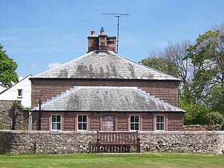
Alms House, Great Asby - geograph.org.uk - 1502657.jpg
1811A stone building divided into four almshouses, the main block is square, with quoins, two storeys and a pyramidal slate roof. On the north and south sides are two sash windows in each floor. On the east and west sides is a single-storey lean-to with a hipped roof, four sash windows, and doors on the sides. On the west front is an inscribed panel. [11] [19]
Byre/barn, southeast of Asby Hall
54°30′49″N2°29′29″W / 54.51366°N 2.49126°W / 54.51366; -2.49126 (Byre/barn, southeast of Asby Hall)
The farm building is in stone with quoins and a slate roof. It has two storeys, two plank doors, and a segmental-headed wagon door with a loft door above. [20]
Fell View Farmhouse and adjoining buildings
54°28′52″N2°28′01″W / 54.48115°N 2.46687°W / 54.48115; -2.46687 (Fell View Farmhouse)
A rendered stone farmhouse that has a slate roof with stone copings. There are two storeys and three bays. On the front is a doorway, a two-light mullioned window to the right, a traceried stair window with a semicircular head, imposts, and a keystone, and two sash windows in the upper floor. At the rear is a door with a wooden cornice on consoles. To the north is a group of outbuildings, and to the south is a store, both of which have wagon entries with segmental heads. [21]
Wall, railings and gate posts,
Asby Hall
54°30′51″N2°29′31″W / 54.51407°N 2.49208°W / 54.51407; -2.49208 (Wall, railings and gate posts, Asby Hall)
The gateway is flanked by rusticated stone piers with cornices. These are linked to similar end piers by a low wall with cast iron railings. [11] [22]
Footbridge over Dale Beck
54°30′40″N2°29′54″W / 54.51105°N 2.49827°W / 54.51105; -2.49827 (Footbridge over Dale Beck)
Footbridge, Asby.jpg
The bridge carries a footpath over a stream. It consists of large stone slabs, and has massive abutments and low parapets. The footway is between 2 feet (0.61 m) and 3 feet (0.91 m) wide. [23]
St Peter's Church
54°30′48″N2°29′42″W / 54.51338°N 2.49494°W / 54.51338; -2.49494 (St Peter's Church)
Gt Asby Church - geograph.org.uk - 142285.jpg
1865–66The church was built on the site of an earlier church and was designed by W. and J. Hay in Gothic Revival style. It is built in sandstone with stepped buttresses and has a slate roof with stone copings. The church consists of a nave, a south aisle with an ornate porch, and a chancel. At the west end is a bellcote carried on an arch round the west window. [5] [24]
Lychgate
54°30′48″N2°29′43″W / 54.51328°N 2.49537°W / 54.51328; -2.49537 (Lychgate)
Great Asby Church - geograph.org.uk - 1107055.jpg
1866The lychgate is at the entrance to the churchyard of St Peter's Church. It has braced wooden uprights supporting a hipped slate roof with open gablets and wrought iron crosses. The gates are wooden with wrought iron fittings. [25]
Bridge over Potts Beck
54°29′33″N2°26′42″W / 54.49263°N 2.44498°W / 54.49263; -2.44498 (Bridge over Potts Beck)
1875The bridge carries a road over a stream. It is in stone and consists of a single span with a segmental arch. In the parapet is an inscribed and dated parish boundary stone. [26]
St Helen's Well
54°30′50″N2°29′35″W / 54.51382°N 2.49305°W / 54.51382; -2.49305 (St Helen's Well)
St Helen's Well, Asby.jpg
UncertainA rectangular enclosure around a spring. On three sides there is a wall with a sandstone coping surmounted by limestone flags, and in the north wall is a wrought iron gate. Water rises from a large rectangular opening, and leaves by two outlets. [27]

Related Research Articles

Ainstable is a civil parish in the Eden District, Cumbria, England. It contains 21 buildings that are recorded in the National Heritage List for England. Of these, one is listed at Grade I, the highest of the three grades, two are at Grade II*, the middle grade, and the others are at Grade II, the lowest grade. The parish contains the villages of Ainstable, Croglin and Newbiggin, the hamlets of Dale, Walmersyke, Ruckcroft and Longdales, part of the village of Armathwaite, and the surrounding countryside. The oldest listed building in the parish originated as a Benedictine Nunnery, and has been altered and since used for other purposes. The other listed buildings consist of houses, farmhouses and associated structures, a bridge, a war memorial, a lych gate, and two churches.

Bampton is a civil parish in the Eden District, Cumbria, England. It contains 33 buildings that are recorded in the National Heritage List for England. Of these, one is listed at Grade II*, the middle grade of the three grades, and the others are at Grade II, the lowest grade. The parish contains the villages of Bampton and Bampton Grange and smaller settlements, but is mainly rural. Most of the listed buildings are houses and associated structures, farmhouses and farm buildings in the villages and scattered around the countryside. The other listed buildings include a former boundary cross, a church, a monument in the churchyard, two bridges, a public house, and a limekiln.

Castle Sowerby is a civil parish in the Eden District, Cumbria, England. It contains 19 buildings that are recorded in the National Heritage List for England. Of these, one is listed at Grade I, the highest of the three grades, two are at Grade II*, the middle grade, and the others are at Grade II, the lowest grade. The parish is almost entirely rural, and most of the listed buildings are houses, farmhouses, and farm buildings scattered around the parish. The other listed buildings are a church and a bridge.

Colby is a civil parish in the Eden District, Cumbria, England. It contains three buildings that are recorded in the National Heritage List for England. Of these, one is listed at Grade II*, the middle of the three grades, and the others are at Grade II, the lowest grade. The parish contains the village of Colby and the surrounding countryside, and the listed buildings consist of farmhouses and farm buildings.

Crosby Ravensworth is a civil parish in the Eden District, Cumbria, England. It contains 53 buildings that are recorded in the National Heritage List for England. Of these, one is listed at Grade I, the highest of the three grades, six are at Grade II*, the middle grade, and the others are at Grade II, the lowest grade. The parish contains the villages of Crosby Ravensworth, Maulds Meaburn, Reagill, the small settlement of Oddendale, and the surrounding countryside. Most of the listed buildings are country houses, smaller houses, and associated structures, farmhouses and farm buildings. The other listed buildings include a church and items in the churchyard, bridges, monuments, a village hall, and a parish boundary stone.

Dufton is a civil parish in the Eden District, Cumbria, England. It contains eleven listed buildings that are recorded in the National Heritage List for England. All the listed buildings are designated at Grade II, the lowest of the three grades, which is applied to "buildings of national importance and special interest". The parish contains the village of Dufton and the surrounding countryside. Most of the listed buildings are houses and associated structures, farmhouses and farm buildings in the village centre. Also in the village is a listed pump. Away from the centre of the village, and listed, are a church, its rectory and structures in the rectory garden.

Hoff is a civil parish in the Eden District, Cumbria, England. It contains nine listed buildings that are recorded in the National Heritage List for England. Of these, three are listed at Grade II*, the middle of the three grades, and the others are at Grade II, the lowest grade. The parish is mainly rural, with scattered communities, and the listed buildings are all houses, farmhouses, or farm buildings.

Kirkby Thore is a civil parish in the Eden District, Cumbria, England. It contains 14 listed buildings that are recorded in the National Heritage List for England. Of these, two are listed at Grade II*, the middle of the three grades, and the others are at Grade II, the lowest grade. The parish contains the village of Kirkby Thore and the surrounding countryside. Most of the listed buildings are in the village, and consist of houses and associated structures, farmhouses, farm buildings, a church, a house that originated as a medieval hall, a community hall, an animal pound and an associated structure, and a structure built from Roman material. The listed buildings outside the village are a farm and associated farm buildings.

Little Strickland is a civil parish in the Eden District, Cumbria, England. It contains eleven listed buildings that are recorded in the National Heritage List for England. Of these, one is listed at Grade II*, the middle of the three grades, and the others are at Grade II, the lowest grade. The parish contains the village of Little Strickland and the surrounding countryside. The listed buildings comprise houses, farmhouses, farm buildings, and a church and associated structures.

Milburn is a civil parish in the Eden District, Cumbria, England. It contains 15 listed buildings that are recorded in the National Heritage List for England. Of these, one is listed at Grade I, the highest of the three grades, and the others are at Grade II, the lowest grade. The parish contains the village of Milburn and the surrounding countryside. The largest building in the parish is Howgill House, originally a fortified house, and later a country house; this and structures associated with it are listed. Apart from a church, all the other listed buildings are located in the village and are centred round The Green.

Murton is a civil parish in the Eden District, Cumbria, England. It contains eleven listed buildings that are recorded in the National Heritage List for England. Of these, two are listed at Grade II*, the middle of the three grades, and the others are at Grade II, the lowest grade. The parish contains the villages of Murton and Hilton and the hamlet of Brackenber, and is otherwise rural. Most of the listed buildings are houses and associated structures, farmhouses and farm buildings, the other buildings consisting of two village pumps, a bridge, and a disused railway viaduct.

Newbiggin is a civil parish in the Eden District, Cumbria, England. It contains 14 listed buildings that are recorded in the National Heritage List for England. Of these, one is listed at Grade II*, the middle of the three grades, and the others are at Grade II, the lowest grade. The parish includes the village of Newbiggin and the surrounding countryside. The most important building is Newbiggin Hall, originally a tower house and later a country house; the hall and associated structures are listed. The other listed buildings Include a church, items in the churchyard, a chapel, a bridge, farmhouses and farm buildings.

Newby is a civil parish in the Eden District, Cumbria, England. It contains 14 listed buildings that are recorded in the National Heritage List for England. Of these, two are listed at Grade II*, the middle of the three grades, and the others are at Grade II, the lowest grade. The parish includes the village of Newby and the surrounding countryside. Most of the listed buildings are houses and associated structures, farmhouses and farm buildings, the other listing buildings consisting of the walls and memorials of a Friends' burial ground.

Orton is a civil parish in the Eden District, Cumbria, England. It contains 15 listed buildings that are recorded in the National Heritage List for England. Of these, two are listed at Grade II*, the middle of the three grades, and the others are at Grade II, the lowest grade. The parish contains the village of Orton, and smaller settlements including Kelleth, Raisbeck, and Greenholme, but is almost completely rural. Most of the listed buildings are houses and associated structures, farmhouses and farm buildings. The other listed buildings are a church, a packhorse bridge, a marker stone, and two former schools.

Ousby is a civil parish in the Eden District, Cumbria, England. It contains 15 listed buildings that are recorded in the National Heritage List for England. All the listed buildings are designated at Grade II, the lowest of the three grades, which is applied to "buildings of national importance and special interest". The parish includes the villages of Ousby and Melmerby, together with the surrounding countryside, and hills and fells to the east. The listed buildings consist of two churches, two medieval cross bases, houses, farmhouses and farm buildings, a former post office, an inn, and a former shepherd's hut, later used as a walkers' hut.

Shap is a civil parish in the Eden District, Cumbria, England. It contains 31 listed buildings that are recorded in the National Heritage List for England. Of these, one is listed at Grade II*, the middle of the three grades, and the others are at Grade II, the lowest grade. The parish contains the village of Shap, the hamlet of Keld, and the surrounding countryside. Most of the listed buildings are houses and associated structures, farmhouses and farm buildings. The other listed buildings include a church and items in the churchyard, a chapel, a hotel, a former market hall, a war memorial, and four mileposts.

Shap Rural is a civil parish in the Eden District, Cumbria, England. It contains eleven listed buildings that are recorded in the National Heritage List for England. All the listed buildings are designated at Grade II, the lowest of the three grades, which is applied to "buildings of national importance and special interest". The parish is almost entirely rural, and the listed buildings consist of farm houses and farm buildings, three bridges, a lime kiln, and a monument.

Skelton is a civil parish in the Eden District, Cumbria, England. It contains 56 listed buildings that are recorded in the National Heritage List for England. Of these, three are listed at Grade I, the highest of the three grades, three are at Grade II*, the middle grade, and the others are at Grade II, the lowest grade. The parish is mainly rural, and contains a number of villages and smaller settlements, including Skelton, Ellonby, Lamonby, Unthank, Unthank End, Laithes, and Ivegill. Most of the listed buildings are country houses and smaller houses with associated structures, farmhouses and farm buildings. The other listed buildings include churches and structures in the churchyards, a chapel, a bridge, a boundary stone, and a war memorial lych gate.

Waitby is a civil parish in the Eden District, Cumbria, England. It contains nine listed buildings that are recorded in the National Heritage List for England. Of these, one is listed at Grade II*, the middle of the three grades, and the others are at Grade II, the lowest grade. The parish contains the villages of Waitby and Smardale and is otherwise rural. The listed buildings consist of houses and associated structures, farmhouses and farm buildings, and a bridge, a boundary stone, and a former school.

Winton is a civil parish in the Eden District, Cumbria, England. It contains twelve listed buildings that are recorded in the National Heritage List for England. Of these, one is listed at Grade II*, the middle of the three grades, and the others are at Grade II, the lowest grade. The parish includes the village of Winton, and is otherwise rural. The listed buildings consist of houses and associated structures, farmhouses and farm buildings, and a pinfold, a boundary stone, and a former school.
References

Citations

Sources

Historic England Executive non-departmental public body of the British Government, tasked with protecting the historical environment of England

Historic England is an executive non-departmental public body of the British Government sponsored by the Department for Culture, Media and Sport (DCMS). It is tasked with protecting the historical environment of England by preserving and listing historic buildings, ancient monuments and advising central and local government.

The National Heritage List for England (NHLE) is England’s official list of buildings, monuments, parks and gardens, wrecks, battlefields and World Heritage Sites. It is maintained by Historic England and brings together these different designations as a single resource even though they vary in the type of legal protection afforded to each. Conservation areas do not appear on the NHLE since they are designated by the relevant local planning authority.

Nikolaus Pevsner German-born British scholar

Sir Nikolaus Bernhard Leon Pevsner was a German, later British scholar of the history of art, especially of architecture.