"}" id="mwBw">
Llandecwyn () is a hamlet near Penrhyndeudraeth in Gwynedd, Wales.
The bulk of the population (between 40 and 50 houses) is now located around Cilfor close to the A496 road and served by Llandecwyn railway station, with a cluster of under ten houses around the road junction at Capel Brontecwyn half a mile up the hill to the southeast, and other isolated houses and farms scattered across the hillsides. Formerly, there was a sizeable population closer to the Anglican church of Saint Tecwyn and the lakes: Llyn Tecwyn Isaf and Llyn Tecwyn Uchaf. The church now stands alone, three-quarters of a mile due east of Cilfor. There is a children's play area at Cilfor, but there are no shops or schools.
The former parish of Llandecwyn stretched from the estuary of the Afon Dwyryd at Pont Briwet to the hills of the Rhinogs. It included the Bryn Bwbach road from Capel Brontecwyn to Eisingrug, a section of the main A496 road between Llandecwyn and Talsarnau, and a section of the main A496 road between Llandecwyn and Maentwrog. It also included land across the River Dwyryd: the area of Cefn Coch and around Rhiw Goch and the road to Llanfrothen. Most of the former parish is now part of the Bro Ardudwy ministry area, [1] which includes Harlech, a few kilometres to the southwest, and Barmouth.
Pen Llandecwyn, the small hill between Saint Tecwyn's church and Llyn Tecwyn Uchaf, is 203 m (666 ft) high. [2]
The church, dedicated to Saint Tecwyn, lies at an altitude of a little over 150 m, and is the only ancient church in Ardudwy not on the coast (although the present building is Victorian). It has views over the large Dwyryd estuary towards Portmerion. The church only operates for a few services each year, but as part of the national Small Pilgrimage Places network, [3] it marks the end of the 7 km pilgrimage route, Saint Tecwyn's Way. This starts at the church of Llanfihangel-y-traethau to the southwest, which has a window depicting the saint coming ashore in his coracle.
Also within Llandecwyn, there is a Welsh Presbyterian chapel called Bryn Tecwyn which had weekly services until December 2017. This is down on the A496, and is where the bus stop and the village war memorial are located. [4] [5] [6]
Formerly Llandecwyn had other churches. Llenyrch Methodist Chapel was built in 1861 as a Sunday school and was open until the 1920s. It is now a private house. [7] Brontecwyn Chapel (Wesleyan Methodist) was the home of the Llandecwyn Revolt School. The chapel closed in the 1990s and is now a holiday rental cottage. [8] Capel Bach, Brontecwyn, is now a woodstore for a larger house. [9] Capel Newydd (Calvinistic Methodist), was a few yards from Capel Bach, but is now a ruin. [10]
Llandecwyn was the focus for a power struggle between the UK Government which was Conservative and largely Anglican, and the local Merionethshire County Council, which was largely Liberal and non-conformist. The Education Act 1902 forced local councils to pay for all schools, including church schools. The council was loath to support the school at St Tecwyn's church, so tried to close it down. A government inquiry followed which decided that Llandecwyn did not need a school. The council in response opened a school, the 'Revolt School', at Brontecwyn Chapel, which rapidly grew larger than the 'National School' at the church. A Liberal landslide in the 1906 general election swept the Conservatives from power, the Revolt School was deemed a success, and the county was given permission to build a new council school at Llandecwyn. [11]
The local landowners were the Wynn family of Maes y Neuadd, who were descended from the 13th Century Osbwrn Wyddel ('Osborn the Irishman'). They were related to the Oakleys of Tan y Bwlch and the Vaughns of Cors y Gedol. [12]
Other notable residents of Llandecwyn have included:
Mary Evans (1735 – 1789), was a mystic and cult leader, known as 'y Fantell Wen' (Whitemantle). She was either a servant at Maentwrog rectory, or lived at Breichiau between Llys Tecwyn Uchaf and Ceunant Llennyrch. [20] (Breichiau Copper Mine was located at NGR SH650386). She claimed to be betrothed to Christ, and led a group of followers in ceremonies on Manod Mawr and other hills. Her cult spread to Ffestiniog, Penmachno and Harlech. She died at Talsarnau despite having stated that she would never die, and was buried in Llanfihangel churchyard. Although her followers preserved scraps of her clothing as relics, the sect soon died out.
The impressive ring cairn of Bryn Cader Faner ( SH648353 ) is one of several ancient sites in the hills within the parish: [21]
Bedd Dorti (Dorti's grave) is a mound alongside the old road from Llandecwyn to Maentwrog, near Llyn Tecwyn Uchaf. The mound is associated with Dorti'r Wrach (Dorti the Witch) who lived in the area in the 17th century. According to legend, Dorti was killed by being thrown off the high rocks above Llyn Tecwyn Uchaf in a cask, and she was buried where the cask landed. [22]
The mound is covered with white stones, and there is a tradition that passers-by must add another stone or they will die within a year. A section of the mound has been exposed by passing vehicles, and it is thought that it is a natural mound that was topped by a small cairn of white quartz stones, suggesting that it may be a prehistoric funerary monument. [22] [23]
Tywyn, formerly spelled Towyn, is a town, community, and seaside resort on the Cardigan Bay coast of southern Gwynedd, Wales. It was previously in the historic county of Merionethshire. It is famous as the location of the Cadfan Stone, a stone cross with the earliest known example of written Welsh, and the home of the Talyllyn Railway.
The River Dwyryd, is a river in Gwynedd, Wales which flows principally westwards; draining to the sea into Tremadog Bay, south of Porthmadog.
Penrhyndeudraeth is a small town and community in the Welsh county of Gwynedd. The town is close to the mouth of the River Dwyryd on the A487 nearly 3 miles (4.8 km) east of Porthmadog, and had a population of 2,150 at the 2011 census, increased from 2,031 in 2001. The community includes the villages of Minffordd and Portmeirion.
Maentwrog is a village and community in the Welsh county of Merionethshire, lying in the Vale of Ffestiniog just below Blaenau Ffestiniog, within the Snowdonia National Park. The River Dwyryd runs alongside the village. Its population of 585 in 2001 increased to 631 at the 2011 Census. The Community of Maentwrog includes the village of Gellilydan.
Chwilog is a village in Gwynedd, north Wales, and located on the Llŷn Peninsula. It is in the community of Llanystumdwy, near Criccieth, and in the medieval commote of Eifionydd, named after a 5th-century ruler. It is within the Dwyfor Meirionnydd constituency in the UK Parliament and in the Senedd. The name means 'abounding in beetles' and was perhaps transferred from an earlier name of the river.
Dyffryn Ardudwy is a village, community and electoral ward in the Ardudwy area of Gwynedd, Wales. It comprises several small, almost conjoined, villages including Coed Ystumgwern, Llanenddwyn, Llanddwywe, Talybont and Dyffryn Ardudwy. It is situated on the main A496 coast road between Harlech and Barmouth. The ward had a population of 1,540 according to the 2011 census.
Talsarnau is a village and community in the Ardudwy area of Gwynedd in Wales. Its population was 525 in 2001, and had increased to 550 at the 2011 Census.
Llithfaen is a village on the North West of Wales on the Llŷn Peninsula in Gwynedd, Wales, in the historic county of Caernarfonshire. It is within the community of Pistyll.
The A496 is a major coastal and mountainous road in southern Snowdonia.
Eisingrug is a rural hamlet near Harlech, Gwynedd, Wales. It is located to the southeast of Porthmadog.
Gellilydan is a village in the Welsh county of Gwynedd, in Maentwrog community. It lies 4 miles (6 km) south-south-east of Blaenau Ffestiniog and 1.2 miles (2 km) north of Llyn Trawsfynydd and the disused Trawsfynydd nuclear power station. It is near the junction of two trunk roads, the A487 and the A470.
Cwmerfyn is a hamlet in the community of Trefeurig, Ceredigion, Wales, nine miles (14 km) by road east of Aberystwyth. Historically Cwmerfyn was a lead ore mining village.
The Diocese of Bangor is a diocese of the Church in Wales in North West Wales. The diocese covers Anglesey, most of Caernarfonshire and Merionethshire and the western part of Montgomeryshire.
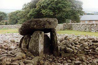
Llanfihangel-y-traethau was a parish in Ardudwy, Gwynedd, north-west Wales centred on a church of the same name in the village of Ynys. The original parish church was built in the 12th century on a tidal island. Later the land rose and connected the island to the mainland. Today it is part of the Bro Ardudwy ministry area, which includes Harlech, a few miles (kilometres) to the southwest, and Barmouth. The church has a window depicting Saint Tecwyn and is the start of the Saint Tecwyn's Way, a pilgrimage route ending at Saint Tecwyn's church in Llandecwyn.
Bro Ardudwy is a Ministry Area of the Church in Wales which is part of the Diocese of Bangor. It is located within the Meirionydd Synod.
The Afon Ysgethin is a short river in Gwynedd, Wales. Flowing entirely within Snowdonia National Park it rises beneath the peaks of Y Llethr and Diffwys within the Rhinogs mountain range and runs in a generally ESE direction towards Cardigan Bay.