Lodomillo Township, Clayton County, Iowa

Last updated

Lodomillo Township
Map highlighting Lodomillo Township, Clayton County, Iowa.svg
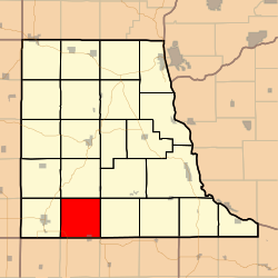
Location in Clayton County
Coordinates: 42°41′05″N091°25′41″W / 42.68472°N 91.42806°W / 42.68472; -91.42806
Country Flag of the United States (23px).png  United States
State Flag of Iowa.svg Iowa
County Clayton
Area
  Total
36.50 sq mi (94.54 km2)
  Land36.49 sq mi (94.52 km2)
  Water0.0077 sq mi (0.02 km2)  0.02%
Elevation
1,161 ft (354 m)
Population
 (2000)
  Total
719
  Density20/sq mi (7.6/km2)
GNIS feature ID 0468294

Lodomillo Township is a township in Clayton County, Iowa, United States. As of the 2000 census, its population was 719.

Contents

History

The origin of the name Lodomillo is unclear. It might mean "load a mill" or "load of watermelons". [1]

Geography

Lodomillo Township covers an area of 36.5 square miles (95 km2).

Cities and towns

Edgewood is divided by Iowa Highway 3; the south half of the town is in Honey Creek Township, Delaware County.

Adjacent townships

Cemeteries

According to the USGS, the township contains two cemeteries: Green Hill and Noble.

Major highways

Notes

  1. Price, Realto E. (1916). History of Clayton County, Iowa: From the Earliest Historical Times Down to the Present. Robert O. Law Company. pp.  318.

References