
Effigy Mounds National Monument preserves more than 200 prehistoric mounds built by Native Americans. Numerous effigy mounds are shaped like animals, including bears and birds. These were built mostly in the first millennium, by peoples of the Woodland Culture. In 2017, they were featured in the America the Beautiful Quarters Program.
Clayton County is a county located in the U.S. state of Iowa. As of the 2010 census, the population was 18,129. Its county seat is Elkader. The county was established in 1837 and was named in honor of John M. Clayton, United States Senator from Delaware and later Secretary of State under President Zachary Taylor.

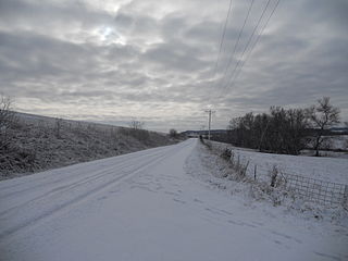
Littleport is an unincorporated community and former city in Clayton County, Iowa, United States. After the Volga River flood of May 16, 1999, much of the town was destroyed and most residents moved away. At the 2000 Census, there were 26 residents. As of the 1960 Census, there had been 119 residents. There had been 139 people in 1950 and more than 200 people in 1916. The town was laid out in 1857 by Dennis Quigley and platted on May 21, 1860, but remained of little importance until the coming of the railroad in 1874. The town was not officially incorporated until 1907. Around this time, it had three general stores, a bank, blacksmith shop, Catholic church, German Lutheran church, an independent school district and a creamery. Somewhat later, it also had two taverns. It was officially disincorporated in 2005.

This is a list of properties and historic districts in Iowa that are listed on the National Register of Historic Places. There are listings in all of Iowa's 99 counties, adding up to over 2,300 total.

Thomas Updegraff was an attorney and five-term Republican member of the U.S. House of Representatives from northeastern Iowa. His two periods of service were separated by ten years out of Congress.

Clayton Township is a township in Clayton County, Iowa, USA. As of the 2000 census, its population was 312.

This is a list of the National Register of Historic Places listings in Clayton County, Iowa.
Clayton Center is an unincorporated community located in Clayton County, Iowa, United States. The area was settled by a German colony, approximately five miles east of Elkader. In April 1856, the land was surveyed by Lewis Brockman, who established the location as the, "southeast quarter of section 8, township 93 north, range 3 west." Clayton Center was then platted on June 27, 1857 by Fred Hartmann.

Gunder is an unincorporated community in Clayton County, Iowa, United States. The Turkey River flows south of Gunder, and Roberts Creek, a tributary, to the north. The county seat of Elkader lies approximately 10 miles to the southeast.
Watson is an unincorporated community in Clayton County, Iowa, United States. The county seat of Elkader lies approximately 15 miles to the southwest.
McGregor Heights is an unincorporated community in Clayton County, Iowa, United States. McGregor Heights lies on the Mississippi River, and on Iowa's border with Wisconsin. The county seat of Elkader lies 17 miles to the southwest.

Ceres is an unincorporated community in Clayton County, Iowa, United States. Ceres once had a post office, which has since been abandoned. The county seat of Elkader lies approximately 11 miles to the west.
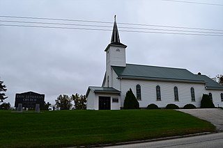
Saint Sebald is an unincorporated community in Clayton County, Iowa, United States. Saint Sebald has one Lutheran church and a cemetery. The county seat of Elkader lies approximately 11 miles to the northeast.
Updegraff is an unincorporated community in Clayton County, Iowa, United States. The county seat of Elkader lies approximately 15 miles to the northwest.
Wood is an unincorporated community in Clayton County, Iowa, United States. The county seat of Elkader lies 14 miles to the north.
Highland is an unincorporated community in Clayton County, Iowa, United States. The county seat of Elkader lies approximately 10 miles to the southeast.
Turkey River is an unincorporated community in Clayton County, Iowa, United States. The community of Turkey River borders the Mississippi River, and the Turkey River. Turkey River also is situated on Iowa's border with Wisconsin.
Thomasville is an unincorporated community in Clayton County, Iowa, United States. Thomasville lies approximately 11 miles away from the county seat of Elkader.
Valley Community School District was a school district headquartered in Elgin, Iowa. The district was located in sections of Fayette and Clayton counties, and served Elgin, Clermont, and Wadena.

Clayton Ridge Community School District is a rural public school district in Clayton County, Iowa, serving Guttenberg, Garnavillo, Clayton, North Buena Vista, and Osterdock. In addition, Clayton Center is zoned to Clayton Ridge schools, as well as areas around Garber. The school mascot is the Eagles, and the colors are green, black and silver.


