
Washington County is a county located in the U.S. state of Iowa. As of the 2020 census, the population was 22,565. The county seat is Washington.
Clayton County is a county located in the U.S. state of Iowa. As of the 2020 census, the population was 17,043. Its county seat is Elkader. The county was established in 1837 and was named in honor of John M. Clayton, United States Senator from Delaware and later Secretary of State under President Zachary Taylor.

Highland Township is a township in Clayton County, Iowa, USA. As of the 2019 census, its population was 249.

Fairfield Township is one of twenty townships in Fayette County, Iowa, USA. As of the 2010 census, its population was 652.

Illyria Township is one of twenty townships in Fayette County, Iowa, USA. As of the 2010 census, its population was 532.

Pleasant Valley Township is one of twenty townships in Fayette County, Iowa, USA. As of the 2010 census, its population was 1,002.
Giard is an unincorporated community in Clayton County, Iowa, United States. Its elevation is 1,122 feet (342 m), and it is located at 43°0′20″N91°17′21″W. A post office was established in the community on September 28, 1854; after being disestablished, it was restored on August 7, 1914, and operated until January 15, 1925, except for a short hiatus at the end of 1918.
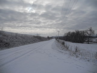
Froelich is an unincorporated community in Clayton County, Iowa, United States.
Clayton Center is an unincorporated community located in Clayton County, Iowa, United States.
Mederville is an unincorporated community in Clayton County, Iowa, United States.
Osborne is an unincorporated community in Clayton County, Iowa, United States.
Motor is an unincorporated community in Clayton County, Iowa, United States. The townsite is also a nationally recognized historic district listed as a historic site on the National Register of Historic Places in 1977.
Gunder is an unincorporated community in Clayton County, Iowa, United States. The Turkey River flows south of Gunder, and Roberts Creek, a tributary, to the north. The county seat of Elkader lies approximately 10 miles to the southeast.
Watson is an unincorporated community in Clayton County, Iowa, United States. The county seat of Elkader lies approximately 15 miles to the southwest.

Ceres is an unincorporated community in Clayton County, Iowa, United States. Ceres once had a post office, which has since been abandoned. The county seat of Elkader lies approximately 11 miles to the west.
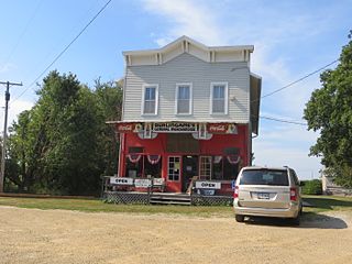
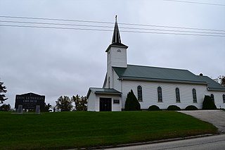
Saint Sebald is an unincorporated community in Clayton County, Iowa, United States. Saint Sebald has one Lutheran church and a cemetery. The county seat of Elkader lies approximately 11 miles to the northeast.
Updegraff is an unincorporated community in Clayton County, Iowa, United States. The county seat of Elkader lies approximately 15 miles to the northwest.
Wood is an unincorporated community in Clayton County, Iowa, United States. The county seat of Elkader lies 14 miles (23 km) to the north.
Turkey River is an unincorporated community in Clayton County, Iowa, United States. The community of Turkey River borders the Mississippi River, and the Turkey River. Turkey River also is situated on Iowa's border with Wisconsin.
Thomasville is an unincorporated community in Clayton County, Iowa, United States. Thomasville lies approximately 11 miles away from the county seat of Elkader.


