McGregor is a city in Clayton County, Iowa, United States. The population was 871 at the 2010 census. McGregor is located on the Mississippi River across from Prairie du Chien, Wisconsin. Pike's Peak State Park is located just south of the city. Just to the north of McGregor is the city of Marquette. The community of McGregor Heights lies in the southern parts of the city limits.
Iowa Highway 13 is a north–south highway in eastern Iowa. It has a length of 85 1⁄4 miles (137.2 km). The southern terminus of Iowa Highway 13 is at U.S. Route 30 (US 30) south of Bertram and southeast of Cedar Rapids. The northern terminus is at US 52 in rural Clayton County near the towns of Monona and Farmersburg near the intersection of US 52 and US 18.

Thomas Updegraff was an attorney and five-term Republican member of the U.S. House of Representatives from northeastern Iowa. His two periods of service were separated by ten years out of Congress.
Iowa Highway 76 is a state highway located in northeastern Iowa, most of which is in Allamakee County. The 49-mile-long (79 km) highway connects McGregor to Eitzen, Minnesota via Waukon. It begins in McGregor at an intersection with U.S. Highway 18; the first 4 1⁄4 miles (6.8 km) of the route are signed as U.S. Highway 18 Business (US 18 Bus.). It crosses into Minnesota near Eitzen and continues as Trunk Highway 76.

Mendon Township is a township in Clayton County, Iowa, USA. As of the 2000 census, its population was 1,890.
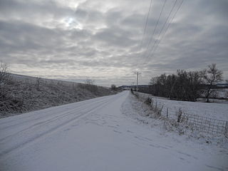
Iowa Highway 340 connected U.S. Highway 18 Business in McGregor to Pikes Peak State Park. It was designated in 1936 to connect Pikes Peak State Park to the primary highway system, which it did until it was turned over to Clayton County in 2003. It was turned over along with 700 miles (1,100 km) of other short highways that primarily served local traffic. It was mostly replaced by County Road X56. Aside from a short connector to the state park gate, the route was a part of the Great River Road.

Callum William McGregor is a Scottish professional footballer who plays for Scottish Premiership club Celtic as a central midfielder. He has previously played for Notts County on loan and has represented Scotland at every youth international stage and at full level.

The Garnavillo Township Bridge is a historic structure located west of Garnavillo, Iowa, United States. It spans an unnamed stream for 20 feet (6.1 m). Around the turn of the 20th-century Clayton County embarked on a project to replace its old bridges. On short crossing like this one they generally chose simple timber stringer structures. But for this one, and several others, they chose to take advantage of the large limestone deposits in the county. They contracted with stonemason A.C. Boyle of McGregor, Iowa to build this single deck arch bridge for $1,462.72. It replaced an old combination truss span. This bridge also been replaced, but it remains in place underneath the newer bridge. It was listed on the National Register of Historic Places in 1998.
The American School of Wild Life Protection Historic District is a nationally recognized historic district located on the north side of McGregor, Iowa, United States. It was listed on the National Register of Historic Places in 1991. At the time of its nomination the district consisted of 30 resources, including 17 contributing buildings, one contributing site, one contributing structure, nine noncontributing buildings, two noncontributing sites. The American School of Wild Life Protection was established in 1919 in a resort area known as McGregor Heights. The purpose of the school was to promote resource conservation values among the public. It grew out legislation in 1918 that established state parks in Iowa. The school also promoted the idea of establishing a national park in the Upper Mississippi River Valley, and after that did not come about, the Upper Mississippi River National Wildlife and Fish Refuge. The school continued in existence until 1941.
Gunder is an unincorporated community in Clayton County, Iowa, United States. The Turkey River flows south of Gunder, and Roberts Creek, a tributary, to the north. The county seat of Elkader lies about 10 miles to the southeast.
Watson is an unincorporated community in Clayton County, Iowa, United States. The county seat of Elkader lies about a little over 15 miles to the southwest.
Eckards is an unincorporated community in Clayton County, Iowa, United States. Eckards lies on the Mississippi River, and on Iowa's border with Wisconsin. The county seat of Elkader lies about a little over 15 miles to the west.
Ceres an unincorporated community in Clayton County, Iowa, United States. Ceres once had a post office, but has since been abandoned. The county seat of Elkader lies a little over 11 miles to the west.
Saint Sebald is an unincorporated community in Clayton County, Iowa, United States. Saint Sebald has one lutheran church and a cemetery. The county seat of Elkader lies a little under 11 miles to the northeast.
Updegraff is an unincorporated community in Clayton County, Iowa, United States. The county seat of Elkader lies a little under 15 miles to the northwest.
Wood is an unincorporated community in Clayton County, Iowa, United States. The county seat of Elkader lies a 14 miles to the north.
Highland is an unincorporated community in Clayton County, Iowa, United States. The county seat of Elkader lies a little over 10 miles to the southeast.
Thomasville is an unincorporated community in Clayton County, Iowa, United States. Thomasville lies a little over 11 miles away from the county seat of Elkader.