Canton is an unincorporated community in Jackson and Jones counties, Iowa, United States. There is a restaurant there, and no other businesses or services.
Elvira is an unincorporated community in Clinton County, Iowa, United States. It falls within the Clinton zip code (52732).
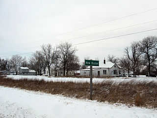
New Boston is an unincorporated community in central Lee County, Iowa, United States. It lies in the southeast corner of Iowa, along U.S. Highway 218 and southwest of the city of Fort Madison, the county seat of Lee County. New Boston is located nearby to the unincorporated communities of Argyle, Iowa and Charleston, Iowa. The community is part of the Fort Madison–Keokuk, IA-MO Micropolitan Statistical Area. There are no commercial establishments in New Boston, although this is the home of Liberty Baptist Church.
Centerdale is an unincorporated community in Cedar County, Iowa, United States.
Plato is an unincorporated community in Cedar County, Iowa, United States. Plato is located at 41°44′17″N91°18′31″W.
Buchanan is an unincorporated community in Cedar County, Iowa, United States.
Maple Hill is an unincorporated community in Emmet County, Iowa, United States.
Monteith is an unincorporated community in Guthrie County, Iowa, United States.
Barney is an unincorporated community in Madison County, Iowa, in the United States.
Maud is an unincorporated community in Allamakee County, Iowa, United States.
Elon is an unincorporated community in Allamakee County, Iowa, United States.
Dean is an unincorporated community in Appanoose County, Iowa, United States.
Olaf is an unincorporated community in Wright County, Iowa, United States.
Faulkner is an unincorporated community in Osceola Township, Franklin County, Iowa, United States. Faulkner is located along county highways C55 and S56, 4.5 miles (7.2 km) north-northwest of Ackley.
Albaton is an unincorporated community in Fairview Township, Monona County, Iowa, United States. Albaton is located in the northwest corner of the county, 4.8 miles (7.7 km) southwest of Sloan.
Lorah is an unincorporated community in Pymosa Township, Cass County, Iowa, United States. Lorah is located along U.S. routes 6 and 71, 5.5 miles (8.9 km) north-northeast of Atlantic.
Lyman is an unincorporated community in Noble Township, Cass County, Iowa, United States. Lyman is located along U.S. Route 71 and Iowa Highway 92, 12 miles (19 km) south of Atlantic.
Ladoga is an unincorporated community in Washington Township, Taylor County, Iowa, United States. Ladoga is located along County Route J35, 3 miles (4.8 km) west-southwest of Gravity.
Norwood is an unincorporated community in Otter Creek Township, Lucas County, Iowa, United States. Norwood is located along U.S. Route 65, 6.2 miles (10.0 km) north of Lucas.
Douglas is an unincorporated community in Fayette County, Iowa, United States. It is located near the junction of County Road B44 and Maple Road, three miles southwest of Eldorado.


