Low-water crossing

Last updated
A low-water crossing in Fargo, North Dakota, United States of America during a routine flooding event on the Red River of the North. The water level was at 29.5', just below the threshold for a major flood as defined by the National Weather Service. Fargo-Moorhead Troll Bridge during 2023 Spring Flood.jpg
A low-water crossing in Fargo, North Dakota, United States of America during a routine flooding event on the Red River of the North. The water level was at 29.5', just below the threshold for a major flood as defined by the National Weather Service.
Low-water crossing (vented ford) at Chew Stoke, Somerset, United Kingdom Irishbridge1.JPG
Low-water crossing (vented ford) at Chew Stoke, Somerset, United Kingdom
Roanoke River low water bridge, USA Roanoke River low water crossing.jpg
Roanoke River low water bridge, USA
The drovers' road from Abergwesyn to Tregaron, Wales, United Kingdom, crosses the Afon Irfon via the Irish bridge at the foot of the Devil's Staircase Afon Irfon, below the Devil's Staircase, Powys - geograph.org.uk - 1071151.jpg
The drovers' road from Abergwesyn to Tregaron, Wales, United Kingdom, crosses the Afon Irfon via the Irish bridge at the foot of the Devil's Staircase
Shared pedestrian/cycle way over the Yass River in Yass, New South Wales, Australia Culverts under yass river walkway weir.JPG
Shared pedestrian/cycle way over the Yass River in Yass, New South Wales, Australia

A low-water crossing (also known as an Irish bridge or Irish Crossing, causeway in Australia, low-level crossing or low-water bridge) is a low-elevation roadway traversing over a waterbody that stays dry above the water when the flow is low, but is designed to get submerged under high-flow conditions such as floods. This type of crossing is much cheaper to build than a high bridge that keeps the road surface consistently above the highest water level, and is usually deployed in semi-arid areas where high-volume rainfall is rare and the existing channel is shallow (which requires extra ramping on the banks to build a more elevated bridge and thus costs more), particularly in developing countries.

Contents

Low-water crossings are essentially elevated floodways, functioning like causeways under normal conditions and serving as limited fords during high-discharge conditions. They are generally considered unsafe for traffic during floods due to the potentially fast and turbulent currents flowing over the road surface, and can be dangerous even after the flood has receded because silt, mud and debris left on the road by the water can reduce traction and cause skidding risks for both vehicles and pedestrians.

In Japan, a Konnyaku bridge is a type of low-water crossing.

Construction

The low-water crossing was developed from the traditional ford. A ford permits vehicular traffic to cross a waterway with wet wheels. In some countries the term “low-water crossing” implies that the crossing is usually dry, while “ford” implies that the crossing is usually wet.

The simplest type of low water crossing is called an unvented ford or drift. This type of low water crossing is used mainly for shallow waterways or dry streambeds. It consists of an improved surface of gravel, gravel-filled geotextile grid, paving blocks, or concrete slabs positioned to match the slope and elevation of the adjacent waterway and floodplain.

To cross somewhat deeper waterways, a type of low water crossing called a vented ford can be constructed with culverts. The size of the culverts (often concrete pipes) is usually selected to allow the water to flow below the roadway and provide a dry crossing surface for most of the year. During periods of high water flow (e.g. spring runoff or flash floods), water will flow over the top of the crossing, as the culverts are not large enough to carry these flood-type runoff events.

A more elaborate low-water bridge will usually be an engineered concrete structure. There are thousands of such structures in the arid climates of the western United States; some of them accommodate four-lane city streets or highways. Typically, a low-water bridge that accommodates a high daily volume of vehicular traffic will be underwater only a few days per decade.

A low-water bridge renders the waterway non-navigable. In almost all cases this is not a practical concern, since the waterway would be non-navigable except during flood conditions anyway.

A low-water bridge is sometimes called a submersible bridge, but this is a misnomer. A true submersible bridge is used on navigable waterways and is actively lowered into the water.

Safety

The concept behind low-water crossings is that they are convenient and safe to use in normal conditions. Once the water level rises to the point where it crosses the bridge surface, the bridge is generally unsafe to use due to high current. The force of the moving water may be strong enough to physically push the vehicle off the bridge: the higher the percentage of the vehicle in the water, the more likely the water's force will take the vehicle off the bridge and send it downriver with substantial damage. An additional risk for trying to cross a bridge under water, especially when more than a couple of feet deep, is the possibility of the vehicle's engine stalling. As people will typically try to then get out of the vehicle, they may step into water currents that cause them to fall or be pulled down into the water. As the current during floods is often quite strong, it may sweep them downriver and carry them into debris, possibly causing injury or death.

In developed countries this will usually be indicated by warning signs. An additional hazard is that the bridge surface may become completely obscured by the water, making it relatively easy to fall off the bridge surface into the deeper and more hazardous water on either side. As a consequence, the line of the submerged bridge is often marked with poles or other structures to indicate its course to unwary travelers and emergency users even when submerged.

Despite the obvious dangers and warnings given there are still a significant number of emergencies and even deaths attributable to the unwary use of low-water bridges during flood conditions.

One attempted solution/deterrent is the Stupid Motorist Law in the American state of Arizona. Drivers who become stranded on flooded low-water bridges are charged with the cost incurred by emergency services to come to their rescue.

Fish passage at low-water crossings

Since 1980, the ecological impact of road crossings on natural streams and rivers has been recognised. Baffles may be installed along the culvert to provide some fish-friendly alternative. [1] [2] But baffles can reduce drastically the culvert discharge capacity for a given afflux, [3] thus increasing substantially the total cost of the culvert structure to achieve the same design discharge and afflux, or increasing the risk of road flooding in an existing structure.

External links/references

Related Research Articles

<span class="mw-page-title-main">River Don, Yorkshire</span> River in South Yorkshire and the East Riding of Yorkshire, England

The River Don is a river in South Yorkshire and the East Riding of Yorkshire, England. It rises in the Pennines, west of Dunford Bridge, and flows for 69 miles (111 km) eastwards, through the Don Valley, via Penistone, Sheffield, Rotherham, Mexborough, Conisbrough, Doncaster and Stainforth. It originally joined the Trent, but was re-engineered by Cornelius Vermuyden as the Dutch River in the 1620s, and now joins the River Ouse at Goole. Don Valley is a UK parliamentary constituency near the Doncaster stretch of the river.

<span class="mw-page-title-main">Weir</span> Artificial river barrier

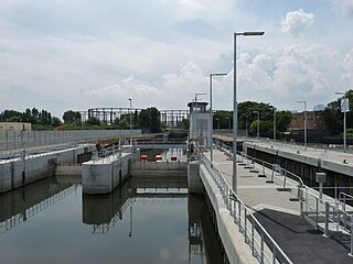
A weir or low-head dam is a barrier across the width of a river that alters the flow characteristics of water and usually results in a change in the height of the river level. Weirs are also used to control the flow of water for outlets of lakes, ponds, and reservoirs. There are many weir designs, but commonly water flows freely over the top of the weir crest before cascading down to a lower level. There is no single definition as to what constitutes a weir.

<span class="mw-page-title-main">Fish ladder</span> Structure to allow fish to migrate upriver around barriers

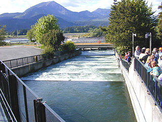
A fish ladder, also known as a fishway, fish pass, fish steps, or fish cannon is a structure on or around artificial and natural barriers to facilitate diadromous fishes' natural migration as well as movements of potamodromous species. Most fishways enable fish to pass around the barriers by swimming and leaping up a series of relatively low steps into the waters on the other side. The velocity of water falling over the steps has to be great enough to attract the fish to the ladder, but it cannot be so great that it washes fish back downstream or exhausts them to the point of inability to continue their journey upriver.

<span class="mw-page-title-main">Shoalhaven River</span> River in Australia

The Shoalhaven River is a perennial river that rises from the Southern Tablelands and flows into an open mature wave dominated barrier estuary near Nowra on the South Coast of New South Wales, Australia.

<span class="mw-page-title-main">Channel (geography)</span> Type of landform in which part of a body of water is confined to a relatively narrow but long region

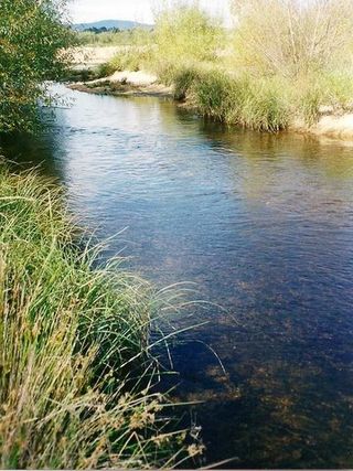
In physical geography and hydrology, a channel is a landform on which a relatively narrow body of water is situated, such as a river, river delta or strait. While channel typically refers to a natural formation, the cognate term canal denotes a similar artificial structure.

<span class="mw-page-title-main">Pumping station</span> Facilities including pumps and equipment for pumping fluids from one place to another

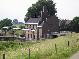
Pumping stations, also called pumphouses, are public utility buildings containing pumps and equipment for pumping fluids from one place to another. They are critical in a variety of infrastructure systems, such as water supply, drainage of low-lying land, canals and removal of sewage to processing sites. A pumping station is an integral part of a pumped-storage hydroelectricity installation.

Riparian water rights is a system for allocating water among those who possess land along its path. It has its origins in English common law. Riparian water rights exist in many jurisdictions with a common law heritage, such as Canada, Australia, New Zealand, and states in the eastern United States.

<span class="mw-page-title-main">Culvert</span> Structure to channel water past an obstacle

A culvert is a structure that channels water past an obstacle or to a subterranean waterway. Typically embedded so as to be surrounded by soil, a culvert may be made from a pipe, reinforced concrete or other material. In the United Kingdom, the word can also be used for a longer artificially buried watercourse.

<span class="mw-page-title-main">Tailwater</span> Waters located immediately downstream from a hydraulic structure

Tailwater refers to waters located immediately downstream from a hydraulic structure, such as a dam, spillway, bridge or culvert. Generally measured and reported as the average water depth downstream of a hydraulic structure, tailwater can vary based on the outlet from the structure as well as downstream influences that may restrict or advance the usual flow of water from the structure. The creation of a tailwater will have significant impacts on both the abiotic and biotic conditions of the waterway.

<span class="mw-page-title-main">Tees Barrage</span> Bridge and dam over the River Tees in England

The Tees Barrage is a barrage and road bridge across the River Tees, Northern England, just upriver of Blue House Point and is used to control the flow of the river, preventing flooding and the effects of tidal change. It is between the towns of Stockton-on-Tees and Thornaby, road access is only by the latter with limited road access to the Tees's north bank.

<span class="mw-page-title-main">Navigability</span> Capacity of a body of water to allow the passage of vessels at a given time

A body of water, such as a river, canal or lake, is navigable if it is deep, wide and calm enough for a water vessel to pass safely. Navigability is also referred to in the broader context of a body of water having sufficient under keel clearance for a vessel.

<span class="mw-page-title-main">River Colne, Essex</span> River in Essex, England

The River Colne is a small river that runs through Essex, England and passes through Colchester. It is not a tributary of any other river, instead having an estuary that joins the sea near Brightlingsea. The river's name is of Celtic origin, combining the word for rock "cal" with a remnant of the word "afon", or river, giving the meaning "stony river". However, another authority states that the river's name was originally Colonia Fluvius, the "waterway of the Colonia": a reference to Colchester's status in Roman times. There are two other rivers in the UK that share the same name.

<span class="mw-page-title-main">River engineering</span> Study of human intervention in the course, characteristics, or flow of rivers

River engineering is a discipline of civil engineering which studies human intervention in the course, characteristics, or flow of a river with the intention of producing some defined benefit. People have intervened in the natural course and behaviour of rivers since before recorded history—to manage the water resources, to protect against flooding, or to make passage along or across rivers easier. Since the Yuan Dynasty and Ancient Roman times, rivers have been used as a source of hydropower. From the late 20th century, the practice of river engineering has responded to environmental concerns broader than immediate human benefit. Some river engineering projects have focused exclusively on the restoration or protection of natural characteristics and habitats.

<span class="mw-page-title-main">Maidenhead Waterways</span>

The Maidenhead Waterways are a system of canals in Maidenhead, England. Formerly disused, plans to restore and upgrade them were announced in 2011. The works would initially make the waterways navigable by small craft, and over time by larger craft, as limitations to navigation are gradually removed.

<span class="mw-page-title-main">Barotse Floodplain</span> Major floodplain in Central Africa

The Barotse Floodplain, also known as the Bulozi Plain, Lyondo or the Zambezi Floodplain, is one of Africa's great wetlands, on the Zambezi River in the Western Province of Zambia. It is a designated Ramsar site, regarded as being of high conservation value.

<span class="mw-page-title-main">Drop structure</span> Structure that lowers elevation of water in a controlled fashion

A drop structure, also known as a grade control, sill, or weir, is a manmade structure, typically small and built on minor streams, or as part of a dam's spillway, to pass water to a lower elevation while controlling the energy and velocity of the water as it passes over. Unlike most dams, drop structures are usually not built for water impoundment, diversion, or raising the water level. Mostly built on watercourses with steep gradients, they serve other purposes such as water oxygenation and erosion prevention.

<span class="mw-page-title-main">River</span> Natural flowing watercourse

A river is a natural flowing watercourse, usually a freshwater stream, flowing on the Earth's land surface or inside caves towards another waterbody at a lower elevation, such as an ocean, sea, bay, lake, wetland, or another river. In some cases, a river flows into the ground or becomes dry at the end of its course without reaching another body of water. Small rivers can be referred to by names such as creek, brook, and rivulet. There are no official definitions for these various generic terms for a watercourse as applied to geographic features, although in some countries or communities, a stream is customarily referred to by one of these names as determined by its size. Many names for small rivers are specific to geographic location; examples are "run" in some parts of the United States, "burn" in Scotland and Northeast England, and "beck" in Northern England. Sometimes a river is defined as being larger than a creek, but not always; the language is vague.

<span class="mw-page-title-main">Ford (crossing)</span> Shallow place with good footing where a river or stream may be crossed by wading

A ford is a shallow place with good footing where a river or stream may be crossed by wading, or inside a vehicle getting its wheels wet. A ford may occur naturally or be constructed. Fords may be impassable during high water. A low-water crossing is a low bridge that allows crossing over a river or stream when water is low but may be treated as a ford when the river is high and water covers the crossing.

<span class="mw-page-title-main">Floodway (road)</span> Road that is subjected to flooding

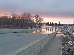
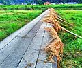
A floodway is a flood plain crossing for a road, built at or close to the natural ground level. It is similar to a causeway, but crosses a shallow depression that is subject to flooding, rather than a waterway or tidal water.

Stream crossings are the numerous instances where small perennial or intermittent streams are crossed by roads, pipelines, railways, or any other thing which might restrict the flow of the steam in ordinary or flood conditions. Crossings over any dry channel which might carry flood water is included. Any structure over or in a stream which results in limitations on the movement of fish or other ecological elements can be an issue.

References

  1. Olsen, A. and Tullis, B. (2013). "Laboratory Study of Fish Passage and Discharge Capacity in Slip-Lined, Baffled Culverts". Journal of Hydraulic Engineering. 139 (4): 424–432. doi:10.1061/(asce)hy.1943-7900.0000697. ISSN   0733-9429.{{cite journal}}: CS1 maint: multiple names: authors list (link)
  2. Chanson, H. and Uys, W. (2016). Baffle Designs to Facilitate Fish Passage in Box Culverts: A Preliminary Study. pp. 295–304. doi:10.15142/T300628160828. ISBN   978-1-884575-75-4.{{cite book}}: |journal= ignored (help)CS1 maint: multiple names: authors list (link)
  3. Larinier, M. (2002). "Fish Passage through Culverts, Rock Weirs and Estuarine Obstructions". Bulletin Français de la Pêche et de la Pisciculture. 364 (18): 119–134. doi: 10.1051/kmae/2002097 .