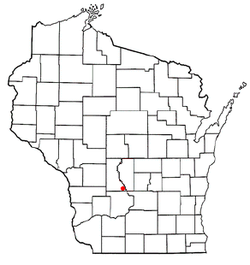
Lyndon, Wisconsin | |
---|---|
Coordinates: 43°40′28″N89°51′27″W / 43.67444°N 89.85750°W | |
Country | United States |
State | Wisconsin |
County | Juneau |
Area | |
• Total | 29.6 sq mi (76.8 km2) |
• Land | 28.3 sq mi (73.4 km2) |
• Water | 1.3 sq mi (3.4 km2) |
Elevation | 968 ft (295 m) |
Population (2000) | |
• Total | 1,217 |
• Density | 42.9/sq mi (16.6/km2) |
Time zone | UTC-6 (Central (CST)) |
• Summer (DST) | UTC-5 (CDT) |
Area code | 608 |
FIPS code | 55-46525 [2] |
GNIS feature ID | 1583612 [1] |
Lyndon is a town in Juneau County, Wisconsin, United States. The population was 1,217 at the 2000 census. The unincorporated community of Indian Heights is located in the town.
According to the United States Census Bureau, the town has a total area of 29.6 square miles (76.8 km2), of which, 28.3 square miles (73.4 km2) of it is land and 1.3 square miles (3.4 km2) of it (4.39%) is water.
As of the census [2] of 2000, there were 1,217 people, 440 households, and 332 families residing in the town. The population density was 42.9 people per square mile (16.6/km2). There were 534 housing units at an average density of 18.8 per square mile (7.3/km2). The racial makeup of the town was 80.69% White, 0.90% African American, 15.20% Native American, 0.08% Asian, 1.81% from other races, and 1.31% from two or more races. Hispanic or Latino of any race were 2.63% of the population.
There were 440 households, out of which 37.0% had children under the age of 18 living with them, 59.3% were married couples living together, 10.7% had a female householder with no husband present, and 24.5% were non-families. 18.6% of all households were made up of individuals, and 5.2% had someone living alone who was 65 years of age or older. The average household size was 2.77 and the average family size was 3.11.
In the town, the population was spread out, with 29.3% under the age of 18, 7.8% from 18 to 24, 28.4% from 25 to 44, 25.7% from 45 to 64, and 8.7% who were 65 years of age or older. The median age was 35 years. For every 100 females, there were 105.6 males. For every 100 females age 18 and over, there were 104.8 males.
The median income for a household in the town was $42,639, and the median income for a family was $49,583. Males had a median income of $31,250 versus $20,446 for females. The per capita income for the town was $17,014. About 2.6% of families and 5.1% of the population were below the poverty line, including 5.8% of those under age 18 and 3.9% of those age 65 or over.
It is in the service area of the School District of Wisconsin Dells, [3] which operates Spring Hill Middle School and Wisconsin Dells High School.
Coosada is a town in Elmore County, Alabama, United States. At the 2020 census, the population was 1,217. It is part of the Montgomery Metropolitan Statistical Area.
Mount Olive, also spelled Mt. Olive is an unincorporated community and a census-designated place (CDP) in Jefferson County, Alabama. Its location is in the suburbs of Birmingham. As of the 2010 census, the population of the community is 4,079. Mount Olive is bordered on the south and the east by the town of Gardendale, and in fact, some areas that had previously been in Mount Olive have been annexed into Gardendale over the years. Running along part of the border between Mt. Olive and Gardendale is the major expressway, Interstate 65. Eventually, part of Birmingham's Northern Beltline will cut through northwestern sections of Mt. Olive. Mt. Olive has its own elementary school, and was formerly the home of a junior high school.
Spring Lake Township is a township in Scott County, Minnesota, United States. The population was 3,681 at the 2000 census.
Wolfdale is a census-designated place (CDP) in Washington County, Pennsylvania, United States. The population was 2,888 at the 2010 census.
Dell Rapids is a city in Minnehaha County, South Dakota, United States. The population was 3,996 at the 2020 census. It is known as "The Little City with the Big Attractions."
Dell Prairie is a town in Adams County in the U.S. state of Wisconsin. The population was 1,631 at the 2020 census, up from 1,590 at the 2010 census. The unincorporated community of Plainville is located in the town.
Jackson is a town in Adams County in the U.S. state of Wisconsin. The population was 1,141 at the 2020 census, up from 1,003 at the 2010 census.
New Haven is a town in Adams County in the U.S. state of Wisconsin. The population was 680 at the 2020 census, up from 655 at the 2010 census. The unincorporated community of Big Spring is located in the town.
Springville is a town in Adams County in the U.S. state of Wisconsin. The population was 1,283 at the 2020 census, down from 1,318 at the 2010 census.
The Town of Newport is located in Columbia County, Wisconsin, United States. The population was 681 at the 2000 census. The ghost town of Moe Settlement was located in the town.
Wheeler is a village in Dunn County, Wisconsin, United States, along the Hay River. The population was 348 at the 2010 census.
Monticello is a village in Green County, Wisconsin, United States. The population was 1,217 as of the 2010 census.
Dellona is a town in Sauk County, Wisconsin, United States. The population was 1,199 at the 2000 census. The unincorporated community of Dellwood is located in the town.
Delton, originally called New Buffalo, is a town in Sauk County, Wisconsin, United States. The population was 2,024 at the 2000 census.
Lake Delton is a village located on the Wisconsin River in Sauk County, Wisconsin, United States. The population was 3,501 at the 2020 census. Lake Delton, along with the nearby Wisconsin Dells, is a resort area and a center for tourism in the upper Midwest. Lake Delton is included in the Baraboo Micropolitan Area which comprises part of the larger Madison Combined Statistical Area.
Washington is a town in Shawano County, Wisconsin, United States. The population was 1,903 at the 2000 census.
Random Lake is a village in Sheboygan County, Wisconsin, United States. The population was 1,594 at the 2010 census. It is part of the Sheboygan, Wisconsin Metropolitan Statistical Area.
The Town of Mount Hope is a town in Grant County, Wisconsin, United States. The population was 225 at the 2000 census. The village of Mount Hope and the unincorporated community of Shady Dell are located in the town.
Westfield is a village in Marquette County, Wisconsin, United States. The population was 1,254 at the 2010 census. The village is located mostly within the Town of Westfield. A small portion extends east into the adjacent Town of Harris. The Marquette County fairgrounds is located within the village limits on the south side.
Woodland is a town in Aroostook County, Maine, United States. The population was 1,217 at the 2020 census. Because the state of Maine has a law stating that no two towns may share the same name, Woodland of Aroostook County and Woodland of Washington County found themselves before the Maine Supreme Judicial Court in the late 1990s. Because it was founded as a township first, Woodland of Aroostook County was allowed to keep its name and Woodland of Washington County was ordered by the court to choose a new name: Baileyville.