
The Alert pigfish is a species of marine ray finned fish, a pigfish belonging to the family Congiopodidae. It is the only species in the monotypic genus Alertichthys. This species is endemic to the waters around New Zealand.
Romahapa is a locality in the Catlins region of Otago in New Zealand's South Island. It is located between the towns of Balclutha and Owaka. The last shop closed in 1977.
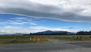
Ealing is a lightly populated rural locality on the bank of the Rangitata River in the Canterbury region of New Zealand's South Island. It has a community hall, a small combined Protestant faith church and a rural fire unit based in the centre of the town. Ealing was settled as a railway village in the 1870s whilst the Main South Line's bridge over the Rangitata River was being built. Along with the schools in nearby Lynnford and Maronan, the local school was shut due to population decline during the 1930s and students sent to the primary school in Hinds, a small nearby town to the northeast and Carew in the west. The former school building is now the church. Ealing is more a common locality than a settlement, with the area being referred to as the "Ealing district". Each year a Guy Fawkes Night fireworks display and a Christmas party in Ealing District Hall are held to foster community spirit.
Anama is a sparsely populated locality in the Canterbury region of New Zealand's South Island. It is on the Hinds River, with the Ashburton River / Hakatere not far to the north in nearby Mount Somers. Other nearby settlements include Valetta to the east, Mayfield to the south, and Montalto to the west. Anama School celebrated its centenary in March 2002.
Hedgehope is a locality in the central Southland region of New Zealand's South Island.
Roslyn Bush is a lightly populated locality on the northeastern outskirts of the city of Invercargill in the Southland region of New Zealand's South Island. Other nearby settlements include Makarewa to the west, Myross Bush to the southwest, Kennington to the south, Longbush and Woodlands to the east, and Rakahouka to the northeast.
Valetta is a lightly populated locality in the mid-Canterbury region of New Zealand's South Island. It is located in an agricultural area on the southern side of the Ashburton River / Hakatere. Another river, the Hinds River, is to Valetta's southwest. Nearby settlements include Mount Somers to the northwest, Anama to the west, Mayfield to the southwest, and Punawai to the southeast. Its name is a misspelling of Valletta, the capital of Malta.
The Hinds River is a river in the Canterbury region of New Zealand. Its north and south branches drain the eastern flank of the Moorhouse Range, part of the Southern Alps, and their confluence is near Anama and Mayfield. The river then flows across the Canterbury Plains towards the Pacific Ocean, passing through the small town of Hinds along the way. In Hinds, State Highway 1 and the Main South Line railway cross the river. The river's mouth is located between the localities of Longbeach and Lowcliffe.

Eiffelton is a lightly populated locality in the Mid-Canterbury region of New Zealand's South Island.

Hinds is a small town in the Mid-Canterbury region of New Zealand's South Island. It is located on the Canterbury Plains on the south bank of the Hinds River, which reaches the Pacific Ocean between the nearby localities of Longbeach and Lowcliffe. Other localities around Hinds include Ealing to the west, Willowby, Windermere, and Winslow to the northeast, and Eiffelton to the southeast.
Lowcliffe is a lightly populated locality in the mid-Canterbury region of New Zealand's South Island. It is situated on the shore of the Pacific Ocean between the mouths of the Hinds and Rangitata Rivers. Nearby settlements include Coldstream to the west by the Rangitata River, Longbeach to the east on the other side of the Hinds River's mouth, and Hinds to the north. The closest towns of significant size are Ashburton to the northeast and Geraldine to the west.
Willowby is a lightly populated locality in the Canterbury region of New Zealand's South Island. It is situated in Mid-Canterbury, south of Ashburton, the major town of the area. Other nearby settlements include Hinds and Lynnford to the southwest, Eiffelton to the south, and Huntingdon to the east.
Wheatstone is a locality in the Canterbury region of New Zealand's South Island. It is located on the Canterbury Plains south of Ashburton, on the banks of the Ashburton River / Hakatere. Other nearby settlements include Huntingdon to the north, Eiffelton and Flemington to the west, Ashton and Waterton to the south, and Riverside and Wakanui to the east on the opposite side of the Ashburton River / Hakatere. Wheatstone is slightly inland from the coastline of the Pacific Ocean.
Waterton is a former town in the Canterbury region of New Zealand's South Island. It is still officially recognised as a locality.
Avoca is a locality in the Canterbury region of New Zealand. It is situated along the Midland Railway Line between Craigieburn and Staircase. There are no permanent residents, but it once supported a small number of railway staff.

The Kokatahi River is a river of the West Coast Region of New Zealand's South Island. A major tributary of the Hokitika River, it flows northwest from its origins on the northern slopes of Mount Ambrose, reaching the Hokitika River 12 kilometres from the latter's mouth at Hokitika. The two rivers between them share one of the West Coast's larger floodplains.

The Whitcombe River is a river of the West Coast Region of New Zealand's South Island. It flows north to reach the Hokitika River 30 kilometres south of Hokitika.
TeMoana is a locality in the Canterbury Region of the South Island of New Zealand. It is located about 15 kilometres (9.3 mi) west of Geraldine and bordered by Gapes Valley and Pleasant Valley to the south and Four Peaks to the north. The south branch of the Hae Hae Te Moana River runs through the area.
Kakahu is a locality in the Canterbury region in the South Island of New Zealand. It is located about 22 kilometers (13.6 mi) west of Geraldine. It is well known for its rich historical and geological history.
