Hinds, New Zealand

Last updated

Hinds
Rural settlement
Hinds 44.jpg
Hinds is located 44 degrees south of the equator
Hinds, New Zealand
Coordinates: 44°00′S171°34′E / 44.000°S 171.567°E / -44.000; 171.567
Country New Zealand
Region Canterbury
Territorial authority Ashburton District
WardEastern
Electorates
Government
  Territorial authority Ashburton District Council
  Regional council Environment Canterbury
   Mayor of Ashburton Neil Brown
   Rangitata MP James Meager
   Te Tai Tonga MP Tākuta Ferris
Area
[1]
  Total2.18 km2 (0.84 sq mi)
Population
 (June 2023) [2]
  Total340
  Density160/km2 (400/sq mi)

Hinds is a small town in the Mid-Canterbury region of New Zealand's South Island. It is located on the Canterbury Plains on the south bank of the Hinds River, which reaches the Pacific Ocean between the nearby localities of Longbeach and Lowcliffe. Other localities around Hinds include Ealing to the west, Willowby, Windermere, and Winslow to the northeast, and Eiffelton to the southeast.

Contents

Naming

The township and the surrounding district are named after the Hinds River. [3] The river in turn was named after the Reverend Samuel Hinds, a member of the Canterbury Association that organised the settlement of Canterbury. [4]

History

State Highway 1 and the Main South Line railway pass through Hinds. Passenger trains have not regularly operated through Hinds since the cancellation of the daily Southerner service on 10 February 2002, but freight trains run multiple times every day. The town also has a primary school; it dates from 1881 and the original classrooms are still in use. The school's size was boosted in the 1930s when rural schools in Ealing, Maronan, and Lynnford were closed and their students sent to Hinds. There were plans to build a secondary school in Hinds, but these never eventuated and the primary school gained land set aside for the secondary school. [5]

In 2011 with the closure of the rural school in Lowcliffe their students were sent to Hinds.

Demographics

Hinds is described by Statistics New Zealand as a rural settlement, and covers 2.18 km2 (0.84 sq mi). [1] It had an estimated population of 340 as of June 2023, [2] with a population density of 156 people per km2. Hinds is part of the Ealing-Lowcliffe statistical area. [6]

Historical population
YearPop.±% p.a.
2006282    
2013300+0.89%
2018291−0.61%
Source: [7]
Hinds is home of a number of agricultural firms Hinds 28.jpg
Hinds is home of a number of agricultural firms
Hinds celebrating Hinds Hinds 27.jpg
Hinds celebrating Hinds

Hinds had a population of 291 at the 2018 New Zealand census, a decrease of 9 people (−3.0%) since the 2013 census, and an increase of 9 people (3.2%) since the 2006 census. There were 114 households, comprising 153 males and 138 females, giving a sex ratio of 1.11 males per female, with 57 people (19.6%) aged under 15 years, 54 (18.6%) aged 15 to 29, 150 (51.5%) aged 30 to 64, and 36 (12.4%) aged 65 or older.

Ethnicities were 90.7% European/Pākehā, 14.4% Māori, 2.1% Pasifika, 2.1% Asian, and 1.0% other ethnicities. People may identify with more than one ethnicity.

Although some people chose not to answer the census's question about religious affiliation, 55.7% had no religion, 30.9% were Christian, 1.0% had Māori religious beliefs, 2.1% were Hindu, 1.0% were Muslim and 1.0% had other religions.

Of those at least 15 years old, 9 (3.8%) people had a bachelor's or higher degree, and 75 (32.1%) people had no formal qualifications. 21 people (9.0%) earned over $70,000 compared to 17.2% nationally. The employment status of those at least 15 was that 129 (55.1%) people were employed full-time, 39 (16.7%) were part-time, and 12 (5.1%) were unemployed. [7]

Education

Hinds School is a full primary school catering for years 1 to 8. [8] It has 143 students as of February 2024. [9] The school opened in 1881. [10]

Related Research Articles

Glenavy is a small town in the South Island of New Zealand. It is located at the southern extreme of the Canterbury region on the alluvial fan of the Waitaki River, three kilometres from the river's outflow into the Pacific Ocean.

Ealing is a lightly populated rural locality on the bank of the Rangitata River in the Canterbury region of New Zealand's South Island. It has a community hall, a small combined Protestant faith church and a rural fire unit based in the centre of the town. Ealing was settled as a railway village in the 1870s whilst the Main South Line's bridge over the Rangitata River was being built. Along with the schools in nearby Lynnford and Maronan, the local school was shut due to population decline during the 1930s and students sent to the primary school in Hinds, a small nearby town to the northeast and Carew in the west. The former school building is now the church. Ealing is more a common locality than a settlement, with the area being referred to as the "Ealing district". Each year a Guy Fawkes Night fireworks display and a Christmas party in Ealing District Hall are held to foster community spirit.

Doyleston is a minor Canterbury town in the South Island of New Zealand. It was named after Joseph Hastings Doyle, a publican from Christchurch who moved to the locality. Doyleston promised to be one of the main townships in the Ellesmere area, but before long Leeston overtook it and some businesses moved there. Doyleston had a school for many years, but it consolidated with Leeston School in the late 1930s.

<span class="mw-page-title-main">Duntroon, New Zealand</span> Town in Canterbury, New Zealand

Duntroon is a small farming-town in the Waitaki District of New Zealand's South Island. Although traditionally considered a North Otago town, it is located as of 2018 within the farthest southern reaches of Canterbury. Just north of the town runs the Waitaki River, which forms the traditional border between the two regions, although the official border has moved south to put most of Waitaki District, including Duntroon, within Canterbury. To the east of the village runs the Maerewhenua River. Near the village are the Earthquakes, a limestone-cliff formation.

<span class="mw-page-title-main">Kirwee</span> Settlement in Canterbury, New Zealand

Kirwee is a town located west of Christchurch in the Canterbury region of New Zealand's South Island. It was named after Karwi in India by retired British Army colonel De Renzie Brett. Kirwee is also home to the South Island Agricultural Field Days, held biennially.

<span class="mw-page-title-main">Waddington, New Zealand</span> Settlement in Canterbury, New Zealand

Waddington is a small village located in the Selwyn District of the Canterbury region of New Zealand's South Island, near the Waimakariri Gorge.

<span class="mw-page-title-main">Waikari</span> Town in Canterbury, New Zealand

Waikari is a small town in the Canterbury region of New Zealand's South Island.

<span class="mw-page-title-main">Nūhaka</span> Settlement in Hawkes Bay Region, New Zealand

Nūhaka is a small settlement in the northern Hawke's Bay Region of New Zealand's eastern North Island, lying on State Highway 2 between Wairoa and Gisborne. The road to Mahia turns off the highway at Nūhaka.

<span class="mw-page-title-main">Waikuku</span> Town in Canterbury, New Zealand

Waikuku is a small town in the Canterbury region of New Zealand, which sits 28 km north of central Christchurch. Waikuku lies 11.8 km (7.3 mi) south of Leithfield on state highway 1 and 3 km (1.9 mi) north of Woodend. In 1901 there were 86 people resident in Waikuku according to that year's census. Waikuku settlement had a population of 156 people at the time of the 2018 Census. It is popular with both those that commute into work in Christchurch each day and with owners of holiday houses. Waikuku was home to rope and twine works. This business started off using flax from local swamps. It closed in 1987. The nearby sandy beach and pine forests are popular with surfers, swimmers, campers and horse-riders, and the large estuary of the Ashley River hosts many species of birds.

<span class="mw-page-title-main">Cust, New Zealand</span> Town in Canterbury, New Zealand

Cust is a rural village in the South Island of New Zealand. It is located in North Canterbury and comes under seat of the Waimakariri District Council. It is located approximately 16 km east of Oxford and 17 km west of Rangiora. The town is named after Sir Edward Cust, who was a member of the Canterbury Association which organised European settlement of the area around 1850. Earlier names for the town were Moeraki Downs and Middleton-on-the-Cust.

<span class="mw-page-title-main">Prebbleton</span> Minor urban area in Canterbury, New Zealand

Prebbleton is a small town in the Selwyn District in the Canterbury Region of New Zealand. It is 11 km southwest of the centre of Christchurch and about 2 km south of the outlying industrial suburb of Hornby.

Pareora is a small town in the South Island of New Zealand. It is located close to State Highway 1, which bypasses the western edge of the town, and close to the Pacific Ocean coast, five kilometres north of Saint Andrews and 10 kilometres south of Timaru. The Pareora River reaches the ocean just to the south of the township.

<span class="mw-page-title-main">Timaru District</span> Territorial authority district in South Island, New Zealand

Timaru District is a local government district on New Zealand's South Island, administered by the Timaru District Council. It is part of the larger Canterbury Region. Timaru district was formed in 1989 from the amalgamation of Timaru City, Geraldine district, Temuka district and Stratham district.

<span class="mw-page-title-main">Saint Andrews, Canterbury</span> Rural settlement in Canterbury, New Zealand

St Andrews is a small town in the south Canterbury region of New Zealand's South Island. It is located on State Highway 1 five kilometres south of Pareora and 17 kilometres south of Timaru. It was linked to Timaru by rail in 1876, and grew after the subdivision of the Pareora Run. It remains a rural service town.

Waikaia, formerly known as Switzers, is a town in the Southland region of New Zealand's South Island. From 1909 until 1959, it was the terminus of the Waikaia Branch railway. The population in the 2013 census was 99, unchanged from the previous census in 2006.

<span class="mw-page-title-main">Ashley, New Zealand</span> Settlement in Canterbury, New Zealand

Ashley is a small town in North Canterbury, in the South Island of New Zealand. It used to have a railway station on the Main North Line that runs through the village.

<span class="mw-page-title-main">Waikuku Beach</span> Town in Canterbury, New Zealand

Waikuku Beach is a small settlement on the coast of the Canterbury region of New Zealand, about 3 km (1.9 mi) east of the settlement of Waikuku.

<span class="mw-page-title-main">Takamatua</span> Town in Canterbury, New Zealand

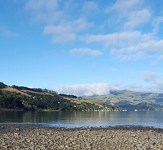
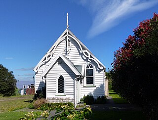
Takamatua, with an initial European name of German Bay, is a small town situated in Akaroa Harbour on Banks Peninsula in New Zealand. The main road to Akaroa passes through this locality. It is 3 kilometres (1.9 mi) north of Akaroa township.

Waihou is a rural settlement in the Matamata-Piako District and Waikato region of New Zealand's North Island.

Milford Huts is a bach community in the Timaru district and Canterbury region of New Zealand's South Island. Milford Huts is on the northern side of the Ōpihi River mouth, 7.5 kilometres southeast of Temuka by road.

References

  1. 1 2 "ArcGIS Web Application". statsnz.maps.arcgis.com. Retrieved 31 October 2021.
  2. 1 2 "Subnational population estimates (RC, SA2), by age and sex, at 30 June 1996-2023 (2023 boundaries)". Statistics New Zealand . Retrieved 25 October 2023. (regional councils); "Subnational population estimates (TA, SA2), by age and sex, at 30 June 1996-2023 (2023 boundaries)". Statistics New Zealand . Retrieved 25 October 2023. (territorial authorities); "Subnational population estimates (urban rural), by age and sex, at 30 June 1996-2023 (2023 boundaries)". Statistics New Zealand . Retrieved 25 October 2023. (urban areas)
  3. Cyclopedia Company Limited (1903). "Hinds". The Cyclopedia of New Zealand : Canterbury Provincial District. Christchurch: The Cyclopedia of New Zealand . Retrieved 25 March 2013.
  4. Reed, A. W. (2010). Peter Dowling (ed.). Place Names of New Zealand. Rosedale, North Shore: Raupo. p. 167. ISBN   9780143204107.
  5. Hinds School - About the School Archived 7 April 2007 at the Wayback Machine , accessed 20 March 2007
  6. 2018 Census place summary: Ealing-Lowcliffe
  7. 1 2 "Statistical area 1 dataset for 2018 Census". Statistics New Zealand. March 2020. 7027113 and 7027115.
  8. Education Counts: Hinds School
  9. "New Zealand Schools Directory". New Zealand Ministry of Education. Retrieved 14 March 2024.
  10. Gilbert Donaldson, ed. (1981). "Hinds School centennial, 1881-1981". Hinds School.