
Aoraki / Mount Cook is the highest mountain in New Zealand. Its height, as of 2014, is listed as 3,724 metres. It sits in the Southern Alps, the mountain range that runs the length of the South Island. A popular tourist destination, it is also a favourite challenge for mountain climbers. Aoraki / Mount Cook consists of three summits: from south to north, the Low Peak, the Middle Peak and the High Peak. The summits lie slightly south and east of the main divide of the Southern Alps, with the Tasman Glacier to the east and the Hooker Glacier to the southwest. Mount Cook is ranked 10th in the world by topographic isolation.

Ashburton is a large town in the Canterbury Region, on the east coast of the South Island of New Zealand. The town is the seat of the Ashburton District. It is 85 kilometres (53 mi) south west of Christchurch and is sometimes regarded as a satellite town of Christchurch.

Timaru is a port city in the southern Canterbury Region of New Zealand, located 157 km (98 mi) southwest of Christchurch and about 196 km (122 mi) northeast of Dunedin on the eastern Pacific coast of the South Island. The Timaru urban area is home to 28,900 people, and is the largest urban area in South Canterbury, and the third-largest in the Canterbury Region overall, after Christchurch and Rolleston. The town is the seat of the Timaru District, which includes the surrounding rural area and the towns of Geraldine, Pleasant Point and Temuka, which combined have a total population of 48,900.

Geraldine is a town in the Canterbury region in the South Island of New Zealand. It is about 140 km south of Christchurch, and inland from Timaru, which is 38 km to the south. Geraldine is located on State Highway 79 between the Orari and Hae Hae Te Moana Rivers and 45 kilometres to the east of Fairlie.

Hanmer Springs is a small town in the Canterbury region of the South Island of New Zealand. The Māori name for Hanmer Springs is Te Whakatakanga o te Ngārahu o te ahi a Tamatea, which means “where the ashes of Tamate’s (sic) fire lay”, referring to Tamatea, the captain of the canoe Tākitimu.

The Haast River / Awarua is a river on the West Coast of the South Island of New Zealand. The Māori name for the river is Awarua. It drains the western watershed of the Haast Pass. The Haast River is 100 kilometres (62 mi) in length, and enters the Tasman Sea near Haast township. The river's main tributary is the Landsborough River.
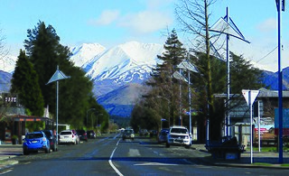
Methven is a small town in the Canterbury region of the South Island of New Zealand. It is located near the western edge of the Canterbury Plains, 35 km (22 mi) north of Ashburton and 95 km (59 mi) west of Christchurch, and at an elevation of 320 m (1,050 ft). The town is a service centre for agriculture in the surrounding area, and is a base for skiing at the nearby Mount Hutt skifield. The town slogan is "Amazing Space".

Tasman Glacier is the largest glacier in New Zealand, and one of several large glaciers which flow south and east towards the Mackenzie Basin from the Southern Alps in New Zealand's South Island.

The Plains Vintage Railway & Historical Museum is a heritage railway and recreated historic village in the Tinwald Domain, Tinwald, New Zealand. The railway runs on approximately three kilometres of rural railway line that was once part of the Mount Somers Branch. The village and railway are open regularly to the public. The railway utilises preserved and restored locomotives and rolling stock once used on New Zealand's national railway network, while the village shows visitors how life was lived in New Zealand's pioneering past.
The Mount Somers Branch, sometimes known as the Springburn Branch, was a branch line railway in the region of Canterbury, New Zealand. The line was built in stages from 1878, reaching Mount Somers in 1885. A further section to Springburn was added in 1889; this closed in 1957, followed by the rest of the line in 1968. A portion has been preserved as the Plains Vintage Railway.
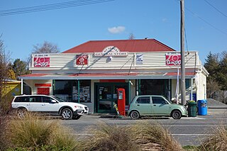
Mount Somers is a small town in Canterbury, New Zealand, nestled in the foothills of the Southern Alps. The population in the 2021 census was 160. Due to its scenic location, it has seen growth in the number of holiday homes.
Ashburton Forks, formerly known as Spreadeagle, is a defined locality on the Canterbury Plains between the forks of the Ashburton / Hakatere Rivers and within the Ashburton District of the Canterbury Province of New Zealand's South Island. It is approximately 50 km west of Ashburton and about 17 km from the foot of the Southern Alps.

The Mid Canterbury Rugby Football Union (MCRFU) is a rugby province in the South Island of New Zealand.

The Hoffmann kiln is a series of batch process kilns. Hoffmann kilns are the most common kiln used in production of bricks and some other ceramic products. Patented by German Friedrich Hoffmann for brickmaking in 1858, it was later used for lime-burning, and was known as the Hoffmann continuous kiln.

Environment Canterbury, frequently abbreviated to ECan, is the promotional name for the Canterbury Regional Council. It is the regional council for Canterbury, the largest region in the South Island of New Zealand. It is part of New Zealand's structure of local government.

Barrhill is a lightly populated locality in the Canterbury region of New Zealand's South Island. It is situated on the Canterbury Plains, on the right bank of the Rakaia River, about 17 kilometres (11 mi) inland from Rakaia. It was founded by Cathcart Wason in the mid-1870s and named by him after his old home Barrhill in South Ayrshire, Scotland. Wason set it up as a model village for the workers of his large sheep farm. The population of the village peaked in the mid-1880s before the general recession initiated a downturn for the village. Wason had expected for the Methven Branch railway to run past Barrhill, but the line was built in 1880 on an alignment many miles away, which caused Barrhill population to decrease.
Kakahu is a locality in the Canterbury region in the South Island of New Zealand. It is located about 22 kilometers (13.6 mi) west of Geraldine. It is well known for its rich historical and geological history.

The Rangitata Diversion Race or RDR is a combined irrigation and power generation scheme that diverts water from the Rangitata River to irrigate over 66,000 hectares of farmland in Mid-Canterbury, New Zealand. The RDR project was the first major river diversion in New Zealand, and the largest irrigation scheme in the country. It was originally constructed by the Public Works Department between 1937 and 1944. The main canal is 67 km long, 10 m wide and 3 m deep.
Rendell Ian McIntosh is a New Zealand historian and former track athlete. He won three national athletics championship titles and represented his country at the 1974 British Commonwealth Games in the 400 metres hurdles. He later instigated the running of the Auckland Marathon across the Auckland Harbour Bridge, and became the manager of the historic house Alberton in the Auckland suburb of Mount Albert.


