The Shag Point Branch was a short branch off the Main South Line on the east coast of the South Island of New Zealand. It left the main line about nine kilometres north of Palmerston at the small settlement of Shag Point to provide railway access to a nearby supply of coal. It was built in 1879 and ran until 1934.
The Wyndham Branch, also known as the Glenham Branch, was a branch line railway in Southland, New Zealand. The first section was opened in 1882 and it operated until 1962. Although its name would imply that it terminated in Wyndham, an extension to a terminus in Glenham operated for forty years. It was operated by the New Zealand Railways Department.
The Waimate Branch was a branch line railway built in southern Canterbury, New Zealand to link the Main South Line with the town of Waimate, the centre of the surrounding rural area. It opened in 1877 and operated until 1966; for some of this time, it included an extension to Waihao Downs that was known as the Waimate Gorge Branch or Waihao Downs Branch. When the line closed, Waimate received the dubious distinction of being New Zealand's first major town to lose its railway line.

The Foxton Branch was a railway line in New Zealand. It began life as a tramway, reopened as a railway on 27 April 1876, and operated until 18 July 1959. At Himatangi there was a junction with the Sanson Tramway, a line operated by the Manawatu County Council that was never upgraded to the status of a railway.
The Ngapara and Tokarahi Branches were two connected railway branch lines in northern Otago, New Zealand, part of the national rail network. The Ngapara Branch opened in 1877 and almost all of it closed in 1959; the remaining few kilometres, called the Waiareka Industrial Line, were removed in 1997. The Tokarahi Branch branched off the Ngapara Branch. It operated from 1887 until 1930 and was originally known as the Livingstone Branch, though it never progressed beyond Tokarahi to Livingstone. In early 2008 there is a proposal to reinstate the first 4.5 km of the Ngapara Branch.
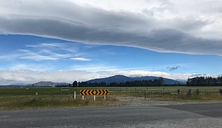
The Methven Branch was a branch line railway that was part of New Zealand's national rail network in Canterbury. It opened in 1880 and operated until 1976.
The Catlins River Branch was a branch line railway that formed part of New Zealand's national rail network. It ran through the Catlins region in southwestern Otago and was built in sections between 1879 and 1915. It closed in 1971 except for the first four kilometres, which remain open as the Finegand Branch. Along the line was the Hunts Road tunnel, the southernmost tunnel in New Zealand.

The Waikaia Branch, also known as the Switzers Branch, was a branch line railway in Southland, New Zealand. Proposed as early as the 1870s, it was not opened until 1909 and was operated by the New Zealand Railways Department for half a century until its closure in 1959.
The Mossburn Branch was a branch line railway in New Zealand from Lumsden on the Kingston Branch to the town of Mossburn in northern Southland. Construction began in 1879, Mossburn was reached in 1887, and the line closed in 1982. It was operated by the New Zealand Railways Department.
The Hedgehope Branch, also known as the Browns Branch, was a branch line railway in Southland, New Zealand that started life in the 1880s as a privately owned bush tramway. It opened as a railway in 1899 and operated until 1968, though the section beyond Browns closed in 1953. It connected with the national rail network in Winton on the Kingston Branch.

The Whitecliffs Branch was an 18.4 kilometres (11.4 mi) long branch line railway that formed part of New Zealand's national rail network in the Canterbury region of the South Island. It was more industrial than the many rural branches on the South Island's east coast whose traffic primarily derived from agriculture, and it operated from 1875 until 1962.
Anama is a sparsely populated locality in the Canterbury region of New Zealand's South Island. It is on the Hinds River, with the Ashburton River / Hakatere not far to the north in nearby Mount Somers. Other nearby settlements include Valetta to the east, Mayfield to the south, and Montalto to the west. Anama School celebrated its centenary in March 2002.
Valetta is a lightly populated locality in the mid-Canterbury region of New Zealand's South Island. It is located in an agricultural area on the southern side of the Ashburton River / Hakatere. Another river, the Hinds River, is to Valetta's southwest. Nearby settlements include Mount Somers to the northwest, Anama to the west, Mayfield to the southwest, and Punawai to the southeast. Its name is a misspelling of Valletta, the capital of Malta.
The Rewanui Branch, sometimes referred to as the Rewanui Incline and known as the Point Elizabeth Branch in its early years, was a branch line railway located in the West Coast region of New Zealand's South Island. It branched from the Midland Line near its western terminus in Greymouth and ran up to Rewanui in the Paparoa Ranges. The branch closed in 1985 but the first six kilometres to Runanga remain in operation as part of the Rapahoe Branch.

The Seddonville Branch, later truncated as the Ngākawau Branch, is a branch line railway in the West Coast region of New Zealand's South Island. Construction began in 1874 and it reached its terminus at the Mokihinui Mine just beyond Seddonville in 1895. In 1981 it was closed past Ngākawau and effectively became an extension of the Stillwater–Westport Line, since formalised as the Stillwater–Ngākawau Line.
The Conns Creek Branch was a 2.7 kilometre branch line railway in the West Coast region of New Zealand's South Island. It diverged from the Seddonville Branch at Waimangaroa and followed the southern bank of the Waimangaroa River to the line's terminus at Conns Creek at the foot of the Denniston Incline. The line operated from 1877 until 1967 and existed for the sole purpose of conveying coal from mines to the port of Westport.

The Thames Branch railway line connected Thames, New Zealand, with Hamilton and was originally part of the East Coast Main Trunk railway. Part of the line between Morrinsville and Waitoa remains open and is in use as the Waitoa Branch line, connecting to the Fonterra Dairy Factory at Waitoa.

The Cape Foulwind Railway was a branch railway line west of Westport to Cape Foulwind. In 1886 the Westport Harbour Board built the line to their quarry to transport rocks to their breakwaters in the Buller River. In 1888 it was linked to Westport by a road-rail bridge over the Buller River. The iron bridge was planked with kauri forming a 12 ft (3.7 m) wide road. The bridge cost £13,794 and was 1,040 ft (320 m) long. By 1888 it was said to be carrying a considerable passenger traffic, using two coaches. In 1914 a new section of line including a tunnel was built to a new quarry south of the Cape.
The Ngatapa Branch was a secondary branch line railway 18.5 kilometres (11.5 mi) long that for a short time formed part of the national rail network in Poverty Bay in the North Island of New Zealand. The Ngatapa branch diverged from the Moutohora branch line about 6 kilometres (3.7 mi) from Gisborne and ran a further 12.5 kilometres (7.8 mi) across the coastal flat to a terminus at Ngatapa. It was sometimes referred to as the Ngapata branch.
The Mount Egmont Branch was a short but steep branch railway line in Taranaki, New Zealand, built to supply rail ballast for the Taranaki and Whanganui districts from a quarry on Mount Taranaki. Although officially known as a branch, the line was more akin to an industrial siding, with only ballast being carried.
