State Route 1 (SR 1) is a major north–south state highway that runs along most of the Pacific coastline of the U.S. state of California. At a total of just over 656 miles (1,056 km), it is the longest state route in California, and the second-longest in the US after Montana Highway 200. SR 1 has several portions designated as either Pacific Coast Highway (PCH), Cabrillo Highway, Shoreline Highway, or Coast Highway. Its southern terminus is at Interstate 5 (I-5) near Dana Point in Orange County and its northern terminus is at U.S. Route 101 (US 101) near Leggett in Mendocino County. SR 1 also at times runs concurrently with US 101, most notably through a 54-mile (87 km) stretch in Ventura and Santa Barbara counties, and across the Golden Gate Bridge.

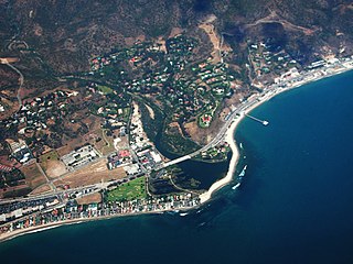
Malibu is a beach city in the Santa Monica Mountains region of Los Angeles County, California, situated about 30 miles (48 km) west of Downtown Los Angeles. It is known for its Mediterranean climate and its 21-mile (34 km) strip of the Malibu coast, incorporated in 1991 into the City of Malibu. The exclusive Malibu Colony has been historically home to Hollywood celebrities. People in the entertainment industry and other affluent residents live throughout the city, yet many residents are middle class. Most Malibu residents live from a half-mile to within a few hundred yards of Pacific Coast Highway, which traverses the city, with some residents living up to one mile away from the beach up narrow canyons. As of the 2010 census, the city population was 12,645.

Pepperdine University is a private research university affiliated with Churches of Christ whose main campus is located near Malibu, California. Founded by entrepreneur George Pepperdine in South Los Angeles in 1937, the school expanded to Malibu in 1972. Courses are now taught at a main Malibu campus, four graduate campuses in Southern California, a center in Washington, DC, and international campuses in Buenos Aires, Argentina; London, United Kingdom; Heidelberg, Germany; Florence, Italy; and Lausanne, Switzerland.

Pacific Palisades is a neighborhood in the Westside region of Los Angeles, California, situated about 20 miles (32 km) west of Downtown Los Angeles.

Topanga is a census-designated place (CDP) in western Los Angeles County, California, United States. Located in the Santa Monica Mountains, the community exists in Topanga Canyon and the surrounding hills. The narrow southern portion of Topanga at the coast is between the city of Malibu and the Los Angeles neighborhood of Pacific Palisades. As of the 2020 census the population of the Topanga CDP was 8,560. The ZIP code is 90290 and the area code is primarily 310, with 818 only at the north end of the canyon. It is in the 3rd County Supervisorial district.

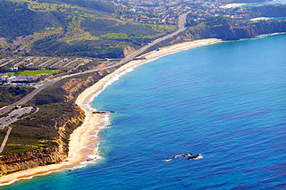
Crystal Cove State Park is a state park of California, United States, encompassing 3.2 miles (5.1 km) of Pacific coastline, inland chaparral canyons, and the Crystal Cove Historic District of beach houses. The park is located in Newport Beach, and is part of the larger South Coast Wilderness area. Crystal Cove is a stretch of coastal cliffs and a beachfront cove situated between the Pacific Coast Highway and the Pacific Ocean just north of Laguna Beach. The 3,936-acre (1,593 ha) park was established in 1979. The entire park hosts a total of 3 miles of beaches and tide pools, a 1,400 acre marine Conservation Area as well as underwater park, 400 acres of bluffs, and 2,400 acres of canyons.

Leo Carrillo State Park is a state park in Los Angeles County, California, United States. Situated along the Malibu coast, the park is a component of Santa Monica Mountains National Recreation Area. With 1.5 miles (2.4 km) of beach, the parkland stretches into the Santa Monica Mountains. The park has expanded into Ventura County and also includes management of County Line Beach. California State Route 1 runs through the park, where it intersects with the western terminus of the Mulholland Highway. The 2,513-acre (1,017 ha) park was established in 1953. It is named for actor and conservationist Leo Carrillo (1880–1961), who served on the State Parks commission.

The Santa Monica Mountains National Recreation Area is a United States national recreation area containing many individual parks and open space preserves, located primarily in the Santa Monica Mountains of Southern California. The SMMNRA is in the greater Los Angeles region, with two thirds of the parklands in northwest Los Angeles County, and the remaining third, including a Simi Hills extension, in southeastern Ventura County.

State Route 27, commonly known by its street name Topanga Canyon Boulevard, is a state highway in the U.S. state of California that runs from the Pacific Coast Highway at Topanga State Beach near Pacific Palisades, through the Topanga Canyon in Topanga, and continuing through Woodland Hills, Canoga Park, West Hills, and Chatsworth to the Ronald Reagan Freeway.

Malibu Lagoon State Beach in Malibu, California, United States, is also known as Surfrider Beach. It was dedicated as the first World Surfing Reserve on October 9, 2010. The 110-acre (45 ha) site was established as a California state park in 1951. It lies within the Santa Monica Mountains National Recreation Area.

Malibu High School (MHS) is a public high school in Malibu, California. The school is one of three high schools in the Santa Monica–Malibu Unified School District and serves students in the city of Malibu and surrounding communities.

The Adamson House and its associated land, which was known as Vaquero Hill in the nineteenth century, is a historic house and gardens in Malibu, California. The residence and estate is on the coast, within Malibu Lagoon State Beach park.

There are 9 routes assigned to the "N" zone of the California Route Marker Program, which designates county routes in California. The "N" zone includes county highways lying in Los Angeles and Orange counties.

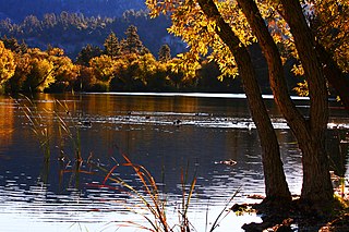
Malibou Lake is a small reservoir surrounded by a residential development in the Santa Monica Mountains near Agoura Hills, California. Adjacent to Malibu Creek State Park and within the Santa Monica Mountains National Recreation Area, it is situated between Malibu Beach and the Conejo Valley. It was created in 1922 after the Malibu Lake Club Dam was built at the confluence of two creeks. The lake, and community of 250 residents are private.

Gladstones Malibu is an American seafood restaurant located on The Pacific Coast Highway (California) in Pacific Palisades, California. The original restaurant was opened in 1972.

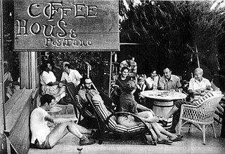
The Coffee House Positano was a cafe on the southern border of Malibu, California. It was opened in 1957 by Mike Dutton, a radio pioneer, and his wife, Lorees, an aspiring writer. Located on the cliff side of the Pacific Coast Highway on a 140-acre, undeveloped piece of land,. Positano quickly became a success even though there was no sign on the highway to indicate where it was located and the Duttons never advertised its existence. People learned of it strictly by word of mouth. Positano was fundamentally different from the some forty other coffee houses that could be found in the greater Los Angeles area. These places tended to appeal to a young crowd and were generally focused on folk music. particularly folk rock. While Positano offered some of the same things as other coffee houses – exotic coffees, deserts, sandwiches, chess games, a bookstore, poetry readings, and a place to hang out, the Duttons offered an amazing array of other activities – from avant garde theater performances like Picasso’s one-act play, Desire Trapped by the Tail, to a regularly scheduled evenings of political debate with speakers who ranged from communists to John Birchers. Writers, university professors and politicians often spoke about a vast array of topics—like anthropologist Count Taylor on the rise of black identity in the US—or authors such as John Howard Lawson, Lawrence Lipton and Anais Nin, who would read from their new works. Paintings were always on display and for sale. On the days when Positano was closed, various classes like life drawing were taught by artists such as Keith Finch. The jazz and folk music at Positano was spontaneous and free. People simply appeared, play their music and left. For two seasons, Playhouse Positano operated as an open- air theater.
County Line Beach is beach park located in Solromar, an unincorporated community of Ventura County. This stretch of sandy beach is easily accessible from the adjacent Pacific Coast Highway. This popular surf spot is administered as part of Leo Carrillo State Park. The beach lies within the south coast portion of the Ventura County amidst a mostly rugged coastline that is some of the most striking and diverse coastal terrain in the County. The beach lies at the mouth of a canyon in the Santa Monica Mountains that hug the shore along the Ventura County's south coast.

Solromar is a small unincorporated community in Ventura County, California, United States. Located at the north end of the Malibu coast, the community is just up the coast from Leo Carillo State Park. The community lies on a narrow coastal terrace along Pacific Coast Highway amidst some of the most diverse coastal terrain in Ventura County.

The Hueneme, Malibu & Port Los Angeles Railway was a standard-gauge, 15-mile railroad in Malibu, California. It was founded by Frederick Hastings Rindge (1857–1905) and operated on his 13,000-acre ranch along the coast, which encompassed most of what is today Malibu. He struggled for years to keep trespassers off of his land, and feared that the Southern Pacific Company would use the power of eminent domain to build a railroad through his property. This threat animated Rindge to plan his own railroad to thwart the efforts of the Southern Pacific. This was part of his overall effort to keep outsiders off of his ranch and spoil what he considered to be paradise.
Rhoda May Knight Rindge,, also known as May Rindge or May K., was an American businesswoman. She was known as the Queen of Malibu as well as the Founding Mother of Malibu and L.A.'s first high-profile female environmentalist. She holds the distinction of being the first female to serve as president of a railroad company. Additionally, she founded Marblehead Land Company in 1921, and most notably, the Malibu Potteries in 1926, the first business in Malibu. The company originated Malibu tile, and the venture became one of Southern California's most successful of its kind alongside Catalina Pottery, Gladding, McBean, and Batchelder tile.


