Maguayo | |
---|---|
Barrio | |
Coordinates: 18°24′49″N66°16′28″W / 18.41348°N 66.274399°W [1] | |
Commonwealth | Puerto Rico |
Municipality | Dorado |
Area | |
• Total | 3.88 sq mi (10.0 km2) |
• Land | 3.86 sq mi (10.0 km2) |
• Water | 0.02 sq mi (0.05 km2) |
Elevation | 135 ft (41 m) |
Population (2010) | |
• Total | 4,496 |
• Density | 1,164.8/sq mi (449.7/km2) |
Source: 2010 Census | |
Time zone | UTC−4 (AST) |
ZIP Code | 00646 |
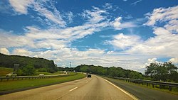
Maguayo is a barrio in the municipality of Dorado, Puerto Rico. Its population in 2010 was 4,496. [3] [4] [5]
Maguayo was in Spain's gazetteers [6] until Puerto Rico was ceded by Spain in the aftermath of the Spanish–American War under the terms of the Treaty of Paris of 1898 and became an unincorporated territory of the United States. In 1899, the United States Department of War conducted a census of Puerto Rico finding that the population of Maguayo barrio was 764. [7]
Census | Pop. | Note | %± |
---|---|---|---|
1900 | 764 | — | |
1910 | 876 | 14.7% | |
1920 | 1,116 | 27.4% | |
1930 | 1,478 | 32.4% | |
1940 | 1,770 | 19.8% | |
1950 | 2,378 | 34.4% | |
1960 | 2,428 | 2.1% | |
1970 | 2,645 | 8.9% | |
1980 | 2,948 | 11.5% | |
1990 | 3,826 | 29.8% | |
2000 | 4,711 | 23.1% | |
2010 | 4,496 | −4.6% | |
U.S. Decennial Census 1899 (shown as 1900) [8] 1910-1930 [9] 1930-1950 [10] 1980-2000 [11] 2010 [12] |
In 2017, after Hurricane Maria destroyed infrastructure and disrupted electrical and water services, residents of Maguayo were getting water from a well that is on the List of Superfund sites (a site containing toxic substances) until officials from the Environmental Protection Agency secured the location. [13]
Barrios (which are, in contemporary times, roughly comparable to minor civil divisions) [14] in turn are further subdivided into smaller local populated place areas/units called sectores (sectors in English). The types of sectores may vary, from normally sector to urbanización to reparto to barriada to residencial, among others. [15] [16] [17]
The following sectors are in Maguayo barrio: [18]
Parcelas El Cotto, Sector Abra, Sector Calandria, Sector Camino Los Nieves, Sector Cotto Martell, Sector Cuatro Calles, Sector El Cotto, Sector Los Bloise, Sector Los Dávila, Sector Los Torres, Sector Maguayo Adentro, Sector Maracayo, Sector Martell, Sector Maysonet I y II, Sector Polvorín, Sector Río Nuevo (PR-693), Sector Santa Rosa (Jazmín, Guayabo, Combate), Urbanización Alturas de Plata, Urbanización Bosque Dorado, and Urbanización Valle del Dorado.
In Maguayo barrio is part of the Río Lajas comunidad. [5]
Major League Baseball player Edgar Martínez spent his formative years in Maguayo. In 2019, when he was inducted into the Baseball Hall of Fame he thanked "his people", the people of Maguayo and the mayor of Dorado said that a celebration would be held to receive him. [19] [20]
Espinosa is a barrio in the municipality of Dorado, Puerto Rico. Its population in 2010 was 4,534.
Higuillar is a barrio on the coast of the municipality of Dorado, Puerto Rico. Its population in 2010 was 25,785.
Mameyal is a barrio in the municipality of Dorado, Puerto Rico. Its population in 2010 was 11.
Río Lajas is a barrio in the municipality of Dorado, Puerto Rico. Its population in 2010 was 2,559.
Dagüey is a barrio in the municipality of Añasco, Puerto Rico. Its population in 2010 was 1,626.
Cibao is a barrio in the municipality of San Sebastián, Puerto Rico. Its population in 2010 was 1,224.
Florida is a barrio in the island-municipality of Vieques, Puerto Rico. Its population in 2010 was 3,821.
Guanajibo is a barrio in the municipality of Hormigueros, Puerto Rico. Its population in 2010 was 5,959.
Bahomamey is a barrio in the municipality of San Sebastián, Puerto Rico. Its population in 2010 was 2,218.
Contorno is a barrio in the municipality of Toa Alta, Puerto Rico. Its population in 2010 was 4,737.
Mucarabones is a barrio in the municipality of Toa Alta, Puerto Rico. Its population in 2010 was 23,221.
Ortíz is a large barrio in the municipality of Toa Alta, Puerto Rico. Its population in 2010 was 26,580.
Caimital Bajo is a barrio in the municipality of Aguadilla, Puerto Rico. Its population in 2010 was 4,487. In Caimatal Bajo barrio is part of the Aguadilla urban zone.
Corrales is a rural barrio in the municipality of Aguadilla, Puerto Rico. Its population in 2010 was 7,659. In Corrales barrio is Cabán, a comunidad.
Navarro is a barrio in the municipality of Gurabo, Puerto Rico. Its population in 2010 was 10,561.
Rincón is a barrio in the municipality of Gurabo, Puerto Rico. Its population in 2010 was 10,967.
Río Lajas is a barrio in the municipality of Toa Alta, Puerto Rico. Its population in 2010 was 2,566.
Islote is a barrio in the municipality of Arecibo, Puerto Rico. Its population in 2010 was 5,665. "Birth of a New World", a giant sculpture of Christopher Columbus on a ship, is located in Islote.
Canóvanas is a barrio in the municipality of Canóvanas, Puerto Rico. Its population in 2010 was 22,420.
Bayamón is a barrio in the municipality of Cidra, Puerto Rico. Its population in 2010 was 5,995.