
Baramulla district or Varmul is one of the 20 districts in the Indian union territory of Jammu and Kashmir. Baramulla town is the administrative headquarters of this district. The district covered an area of 4,588 km2 (1,771 sq mi) in 2001, but it was reduced to 4,243 km2 (1,638 sq mi) at the time of 2011 census. In 2016, the district administration said that the area was 4,190 km2 (1,620 sq mi). Muslims constitute about 98% of the population among which Shia Muslims form 30-35% and Sunni Muslims form 65-70%.

Gulmarg, known as Gulmarag in Kashmiri, is a town, hill station, popular tourist destination, popular skiing destination and a notified area committee in Baramulla district in the Indian administered union territory of Jammu and Kashmir. It is located at a distance of 31 km (19 mi) from Baramulla and 49 km (30 mi) from Srinagar. The town is situated in the Pir Panjal Range in the Western Himalayas and lies within the boundaries of Gulmarg Wildlife Sanctuary.
Bandipore or Bandipora is the headquarters of district of Bandipore in the union territory of Jammu and Kashmir, India. It is located on the northern banks of Wullar Lake—the second-largest freshwater lake in Asia. Bandipora has a terraced garden similar to that of Nishat Bagh in Srinagar. Bandipora is bound by mountains on three sides and by Wular Lake on the fourth. Bandipora is famous for three A's - A'lim (knowledge), Adab and Aab (water). As can be known from the folklore, the name of Bandipora originated either from Bund of Wular as Bund e pur, from the local folk-singing bands (bāṇd) as Baand e pur or from the enclosed (band) geographical location as Bandh e pur. Bandipora is bound by mountains on three sides and by Wular Lake on the fourth.
Kunzar, or Kunzer, is a town in the union territory of Jammu and Kashmir located in the District Baramulla. It is 30 km from Srinagar and approximately 32 km from Baramulla town.
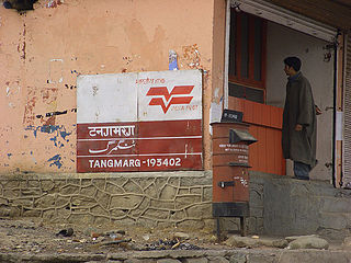
Tangmarg is a town and tehsil in Baramulla district in Indian union territory of Jammu and Kashmir. In 2014, Tangmarg was granted a sub division and trifurcated into three Tehsils, with Sub Divisional Magistrate SDM Office located at Tangmarg. The Tangmarg town is central to more than 100 villages in the vicinity. Tangmarg is gateway of gulmarg which is just 13kms away, also drung waterfall is 3kms away which makes tangmarg most crowded place in the evening due to clean & fresh environment.

Beerwah also pronounced as Beeru is a subdistrict, tourist destination and one of the oldest town of Jammu and Kashmir and a municipal committee in Budgam district in the Indian administered union territory of Jammu and Kashmir. It is also one of the oldest tehsil of Jammu and Kashmir with one of the largest towns in Budgam district. Beerwah is 27 km (17 mi) away from the summer capital Srinagar via Bemina, 31 km (19 mi) via Magam, 33 km (21 mi) via Soibugh and 35 km (22 mi) via Budgam. Beerwah subdistrict has 4 tehsils namely Beerwah, Magam, Narbal and Khag. Beerwah is located along the banks of River Sukhnaag.

Jammu and Kashmir is home to several valleys such as the Kashmir Valley, Chenab Valley, Sindh Valley and Lidder Valley. Some major tourist attractions in Jammu and Kashmir are Srinagar, with its renowned Dal Lake and Mughal Gardens, Gulmarg, Pahalgam, Bhaderwah, Patnitop and Jammu. Every year, thousands of Hindu pilgrims visit holy shrines of Vaishno Devi and Amarnath which has had a significant impact on the state's economy.

The Ganderbal district, or more formally District Ganderdal, is a district in the union territory of Jammu and Kashmir, India. Ganderbal town is administrative headquarters of district. It was formed in 2007 and has 6 subdistricts (tehsils): Kangan, Ganderbal, Tullamulla, Wakura, Lar, and Gund.

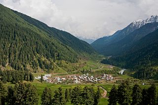
Gurez, or Gurais, is a valley located in the high Himalayas, about 86 kilometres (53 mi) from Bandipore and 123 kilometres (76 mi) from Srinagar, to the north of the Kashmir valley. At about 2,400 metres (8,000 ft) above sea level, the valley is surrounded by snow-capped mountains. It has diverse fauna and wildlife including the Himalayan brown bear and the snow leopard. The Kishanganga River flows through the valley.
Hardu-Aboora is a locality in Karhama tehsil in Baramulla district in the Indian union territory of Jammu and Kashmir. It is situated on the banks of Ferozpora Nallah, at the foothills of the mountain range that runs parallel to the Srinagar-Gulmarg highway on its left side, some 15 km (9.3 mi) from Tangmarg town, Baramulla and 29 km (18 mi) from the state capital, Srinagar, and 10 km (6.2 mi) from railway station Mazhama. Under new Administrative units, Hardu Aboora was granted CD Block status, under the jurisdiction of newly carved tehsil, Karhama.
Ferojpora, also known as Ferojpura or Ferozpora, is a village in the Baramulla district of Jammu and Kashmir, India. It is situated on the bank of Nalla Ferozpora and is 1 kilometre (0.62 mi) from the town of Tangmarg, of which it is a revenue village, and around 39 kilometres (24 mi) from Srinagar. Though Ferozpora Halqa on revenue records have been divided into two subdivisions, Ferozpora (a)(Gamadar) & Ferozpora (b)(Takipora). As a halqa it has few associated villages viz. Mohyen, Check Ferozpora, Drung, Chhanpora and Qazipora, but as a village it is relatively smaller covering about an area of 1 km2.
Ogmuna is a village in the tehsil Tangmarg in the Baramulla district of Indian union territory of Jammu and Kashmir.
Aru is a village, tourist spot in the Anantnag District of Jammu and Kashmir, India. It lies 53km from Anantnag city, the district headquarter. It is located around 12 km from Pahalgam, 11 km upstream from the Lidder River. Noted for its scenic meadows, lakes and mountains, it is a base camp for trekking to the Kolhoi Glacier, Tarsar Lake, Marsar and Herbaghwan Lake. The village lies on the left bank of the Aru river, which is a tributary of the Lidder river. Jammu & Kashmir’s biggest Fodder Seed Product Station is also located in the Aru village.
Hanjiwera is a notified area and village in Singhpora, Pattan, Baramulla district in Indian union territory of Jammu and Kashmir. It is located 31 km (19 mi) to the east from the district headquarters in Baramulla and 23 km (14 mi) from union territory capital, Srinagar.
Pattan is a sub-district, town and a municipal committee in Baramulla district in the Indian union territory of Jammu and Kashmir.
Lethapora, also known as Lethpora and Lalitpur, is a village in the Pulwama district of Jammu and Kashmir, India. It is located in the Pampore tehsil of district Pulwama in Kashmir valley. It has a long history as it was named after a king Lalitaditya Muktapida, who was a powerful ruler of the Karkota dynasty of Kashmir. It was first named as Lalitpur and later changed to Lethapora. It is one of the main market for tourists and locals for Kashmiri dry fruits like walnuts, almonds etc. You can get world's finest saffron from here, which is available easily in the market. It mainly has three main markets that is Upper Market, Main Market and Down Market. Upper market is like the corporate area of the village which mainly has mixture of shops like saffron and other dry fruit shops, restaurants, hotels, tea stalls, banks, school, gym, showrooms etc. In Main Market, you will find basic shops selling fruits, vegetables, kirana and other basics and in the Down Market it mostly has saffron shops along with other shops, and restaurants

Babareshi is the name of a village, forest area, tourist and religious place in Jammu and Kashmir, India. It is named after the Sufi saint Baba Payam uddin Reshi.

Akingam is a village in South Kashmir in the Anantnag district, in the Indian union territory of Jammu and Kashmir. It is at a distance of approximately 14.2 kilometres (8.8 mi) from the Lal Chowk along a route passing through the tourist resorts of Achabal and Kokernag. In revenue records, the village of Akingam is still called Maqan Shiva Bhagwati. The adjacent villages are Mohripura, Hiller, Badasgam, Hardpora and Badoora.
Waripora Bangil is a village located in the town of Kunzer in the Baramulla district of the Indian-administered union territory of Jammu and Kashmir. It is situated 40 kilometres (25 mi) east of the district headquarters of Baramulla and 20 kilometres (12 mi) west of the capital city of Srinagar.
Kulhama is a village situated in Tangmarg tehsil of Baramulla district in the Indian union territory of Jammu and Kashmir. The village is located 42 kilometres from the district headquarters Baramulla and 7 kilometres from the tehsil headquarters Tangmarg.

