Sopore or Sopur, known as Suyyapura in antiquity, is a city in the Baramulla district of Jammu and Kashmir, India. It is 45 km (28 mi) north-west of Srinagar, and 16 km (10 mi) north-east from the city of Baramulla.
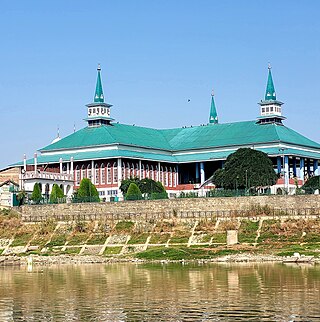
Bandipore or Bandipora is the headquarters of district of Bandipore in the union territory of Jammu and Kashmir, India. It is located on the northern banks of Wullar Lake—the second-largest freshwater lake in Asia. Also highest Mountain peak of Kashmir Valley Mt Harmukh is in Bandipora.Bandipora has a terraced garden similar to that of Nishat Bagh in Srinagar. Bandipora is bound by mountains on three sides and by Wular Lake on the fourth. As per folklore, the name of Bandipora originated either from Bund of Wular as Bund e pur, from the local folk-singing bands (bāṇd) as Baand e pur or from the enclosed (band) geographical location as Bandh e pur.

Bijbehara (Urdu pronunciation:[biːd͡ʒbɪɦɑːɽɑː], known as Vejibror in Kashmiri, is a town and a notified area committee in Anantnag district of the Indian administered union territory of Jammu and Kashmir. It is located on NH 44, and jehlum bank. Bijbehara town is also known as "Town of Chinars" because of a number of Chinars there especially two Chinar gardens. Bijbehara is the home to oldest chinar tree in the region. The town is situated about 45 km from the summer capital of union territory of Jammu and Kashmir, Srinagar.
Botingoo is a village in the Zaingair area of Sopore in Baramulla District in the Indian union territory of Jammu and Kashmir.
Govt. Higher Secondary Institute Botingoo is an educational institution located in Botingoo Sopore in the Baramulla District of Jammu and Kashmir, India and is one of the institutes in Jammu and Kashmir providing secondary education to the students of ambient areas as Watlab, Magraypora, Hathlangoo, Janwara, Mundji, Botingoo, Rampora and Rajpora. The institute is located in the village of Botingoo and has various infrastructural facilities. The institute has well equipped computer lab with Internet facility. The school publishes an annual school magazine Al-Noor in which all the students as well as teachers share their own views. It also provides opportunities to its students to participate in various inter-district and inter-state tournaments. The students of the institute have won trophies and medals in different tournaments.
Zaloora is a village located in the northern Baramulla district of Jammu and Kashmir (J&K), India. It lies approximately 16 km from Sopore, 10 km from Handwara, and 30 km from Kupwara. Zaloora is situated in a valley within a valley, surrounded by mountains on three sides and bordered by the Lal Kul canal on the fourth side. The village is home to over 6,530 chollas (stoves), indicating its size and the number of households. Zaloora is the third largest village in the Zaingair region, following Dangerpora and Shiva. It shares its boundaries with Harwan to the east, Tujjar Sharief to the southeast, and Unisoo to the west and south.
Hadipora is a village in Baramulla district, Jammu and Kashmir. It is 8 km (5.0 mi) away from Sopore town. The village is known as the 'Heart of Rafiabad' as it is surrounded by the main villages of Rafiabad like Achabal, Rebban, Chatloora, Lasser and Chigham. This village is accessible by the National Highway which connects it to Handwara, Kupwara and other northern regions of Kashmir.
Durhama is a small village in Baramulla district in the Indian union territory of Jammu and Kashmir. It is about 20 km from district headquarters Baramulla, 13 km from the apple town Sopore and 50 km from Batmaloo, Srinagar via Putukhah- Wagoora road and 44 km via Tapper-Kreeri road. It is about 100m away from the Tehsil headquarter Wagoora and about 3.5 km from the medical block Kreeri. It is situated on the left side of the link road which connects Baramulla and Babareshi-Gulmarg. The village has three mosques and 95 households. The population of Durhama is about 698. There is a primary and a middle school in the outskirts of the village. The literacy rate of Durhama is about 67.37% as per 2011 census. A building of the block development office Wagoora is located at the entrance of Durhama. A medical sub centre is also located alongside B.D.O. office.
Achabal is the village in Baramulla district, Jammu and Kashmir |Jammu and Kashmir. It is around 5 km (3.1 mi) away from Sopore town. The village is surrounded by the villages of like Lorihama, Alsafa Colony, Ladoora and Ferozpora. This village is accessible by the National Highway from Ferozpora-Achabal link road which connects it to Handwara, Kupwara and other northern regions of Kashmir. It is also accessible by Ladoora-Sopore road. There is a branch of Jammu & Kashmir Bank in the main market.
Hanjiwera is a notified area and village in Singhpora, Pattan, Baramulla district in Indian union territory of Jammu and Kashmir. It is located 31 km (19 mi) to the east from the district headquarters in Baramulla and 23 km (14 mi) from union territory capital, Srinagar.
Nathipora is a village in the Bomai block in Sopore tehsil, within the Baramulla District of Jammu and Kashmir, India.
Chakloo is a village on the bank of the Jhelum River, in the Baramulla District of Jammu and Kashmir, India. It is 7 km from the Baramulla. There are two bridges which connect the village to Kanispora via Ladoora, and Kawaja Bagh via Jambazpora respectively. Its Block is Nadihal, Constituency Rafiabad, Post Office Rohama, Zone/ Police Station/ Tehsil/ District Baramulla, and Jammu and Kashmir. There are Eight Mohalas in the village namely sadeeque colony, Alnoor colony,Usmaan Abaad, Eidgah colony, Gazi Mohalla,sofi mohalla, Dar Mohalla, and Peer Mohalla. Recently the village was given a new administrative unit (Nayabat).
Onagam is a village on the banks of Badshah Canal in Bandipora district, Jammu and Kashmir, India.

Zaingair is a group of villages in the Sopore constituency of Baramulla district, Jammu and Kashmir. It is the largest area in Sopore. It comprises about 38 villages spread over three tehsils of Sopore.
Gadiseer is a village in the Anantnag district in the Indian administered union territory of Jammu and Kashmir. It is located on the bank of Jhelum River. PIN code of Gadiseer is 192124 and its postal head office is Bijbehara. The village falls in the vicinity (jurisdiction) of tehsil Bijbehara in Dachnipora Block.
Langate Assembly constituency is one of the 90 constituencies in the Jammu and Kashmir Legislative Assembly of Jammu and Kashmir a north state of India. Langate is also part of Baramulla Lok Sabha constituency.
Ajas is a village and tehsil located in Bandipora district of the Indian administered union territory of Jammu and Kashmir. The village is located at a distance of 21 kilometres from the district headquarters Bandipore. The village is situated on the banks of the famous and largest freshwater lake of India, the Wular Lake. Its circumference is partly bound by huge mountains and dense green forests. The is one of the wildlife area and only one wildlife range in Bandipora. There are hundreds of Wild Animals like, Leopard, Black Bear, Mask Dear and many other Wild Animals. A large stream flows through the village and is called the "BudKul".
Kigam is a village in Kupwara district of the Indian union territory of Jammu and Kashmir. The village is located at a distance of 9 kilometres (5.6 mi) from district headquarters Kupwara town.
Shallabugh(شالہ بُگ) is a tourist village located in Sherpathri block of Tullamulla tehsil of Central Kashmir's Ganderbal district in the union territory of Jammu and Kashmir, India.
Zurbaf Pora alternatively known as Watapora is a village in Bandipora District of Jammu & Kashmir.


