Mayannur

Last updated

Mayannur
Village
India Kerala location map.svg
Red pog.svg
Mayannur
Mayannur, Thrissur, Kerala, India
Coordinates: 10°45′03″N76°22′52″E / 10.7507°N 76.3811°E / 10.7507; 76.3811
Country Flag of India.svg India
State Kerala
District Thrissur
Elevation
83.13 m (272.7 ft)
Population
 (2011)
  Total
6,660
Languages
  Official Malayalam, English
Time zone UTC+5:30 (IST)
PIN
679105
Bharathapuzha at mayannur Bharathapuzha at mayannur.jpg
Bharathapuzha at mayannur
Mayannur Bridge Mayannur Bridge.jpg
Mayannur Bridge

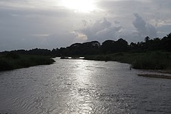
Mayannur is a village in Thrissur District in the state of Kerala, India. [1] [2]

Contents

Demographics

As of 2011 India census, Mayannur had a population of 6,660 with 3,218 males and 3,442 females. [3] [1]

Religion

A Hindu temple viz., Sri Kurumba Bhagavathy Temple is situated in Mayannur neighbourhood. [4]

References

  1. 1 2 "Census of India : Villages with population 5000 & above". Registrar General & Census Commissioner, India. Archived from the original on 8 December 2008. Retrieved 10 December 2008.
  2. "Yahoo maps India :Mayannur, Trissur". Archived from the original on 18 December 2008. Retrieved 12 January 2009.
  3. "Mayannur Village Population - Talappilly - Thrissur, Kerala". www.census2011.co.in. Retrieved 10 January 2026.
  4. "Mayannur Kavu Sri Kurumba Bhagavathy Temple". www.touristlink.com. Retrieved 29 December 2023.