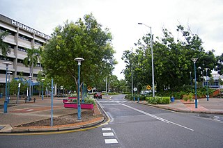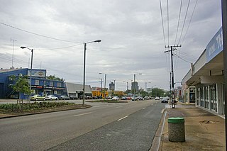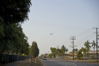
Darwin is the capital city of the Northern Territory, Australia. The city has nearly 53% of the Northern Territory's population, with 139,902 at the 2021 census. It is the smallest, wettest, and most northerly of the Australian capital cities and serves as the Top End's regional centre.

The Northern Territory is an Australian internal territory in the central and central-northern regions of Australia. The Northern Territory shares its borders with Western Australia to the west, South Australia to the south, and Queensland to the east. To the north, the Northern Territory looks out to the Timor Sea, the Arafura Sea and the Gulf of Carpentaria, including Western New Guinea and various other islands of the Indonesian archipelago.

Palmerston is a planned satellite city of Darwin, the capital and largest city of Australia's Northern Territory. The city is situated approximately 20 kilometres from Darwin and 10 kilometres from Howard Springs and the surrounding rural areas. Palmerston had a population of 33,695 at the 2016 census, making it the second largest city in the Northern Territory. According to the 2021 census, the population grew to 37,247 people.

Nightcliff is a northern suburb of the city of Darwin, Northern Territory, Australia. It is the traditional country and waterways of the Larrakia people.

Millner is a northern suburb in the city of Darwin, in the Northern Territory of Australia. It is the traditional country and waterways of the Larrakia people.

Batchelor is a town in the Northern Territory of Australia. The town is the current seat and largest town of the Coomalie Shire local government area. It is located 98 kilometres (61 mi) south of the territory capital, Darwin. A number of residents commute to Darwin and its suburbs for work.

Rapid Creek refers to both a creek in the city of Darwin, Northern Territory, Australia and the name of a suburb north of the city, situated where the creek meets Darwin Harbour. It is the traditional country and waterways of the Larrakia people.

Berrimah is an eastern suburb in the city of Darwin, in the Northern Territory of Australia. It is on the traditional Country and waterways of the Larrakia people.

Coconut Grove is a northern suburb of the city of Darwin, Northern Territory, Australia within the local government area of City of Darwin. It is the traditional country and waterways of the Larrakia people.

Stuart Park is an inner suburb of the city of Darwin, Northern Territory, Australia. It is the traditional country and waterways of the Larrakia people.

Holtze is a locality in Darwin, Northern Territory, Australia. It is 22 km southeast of the Darwin CBD. Its local government area is the Municipality of Litchfield. The locality is mostly a rural area, just north of Palmerston. It was named for Maurice William Holtze (1840–1923), the botanist who established Darwin's Botanical Gardens, and his son Nicholas, who succeeded him as curator.
Bees Creek is an outer rural area of Darwin, Northern Territory, Australia. It is 33 km southeast of the Darwin central business district. It is the council seat of the local government area of the Litchfield Municipality, although most council facilities, public amenities and the actual Municipal offices are in the neighbouring locality of Freds Pass. Bees Creek is mostly rural, with large residential blocks often not served by town sewers or sealed roads. Nevertheless, the area is popular with those wishing to enjoy a rural lifestyle within an easy commuting distance of the city.

Coolalinga is an outer suburban area in Darwin. It is 29 kilometres (18 mi) south east of central Darwin, 10 kilometres (6 mi) south east of Palmerston and 6 kilometres (4 mi) east of the proposed city of Weddell. Its Local Government Area is the Litchfield Municipality. The name was first used by Len Cant for his store and caravan park on the Stuart Highway. Since Coolalinga Store, the area has become an important commercial centre for the Shire.

Tiger Brennan Drive is a major arterial road in the western suburbs of Darwin, Northern Territory, Australia. The road travels southeast–east starting from Darwin CBD toward Darwin's eastern suburb of Berrimah, then continues to a connection with the Stuart Highway at Palmerston. Tiger Brennan Drive runs parallel with the Stuart Highway for most of its length. The road was named after Harold "Tiger" Brennan, a long serving Northern Territory politician and former mayor of Darwin. The road has been assigned the alphanumeric route designation A15 for its entire length.

Darwin City is a suburb in metropolitan Darwin which comprises the original settlement, the central business district, parkland and other built-up areas. It is the traditional country and waterways of the Larrakia people. It is original site of occupation and includes many of the city's important institutions and landmarks, such as Parliament, Government House, the Northern Territory Supreme Court, Bicentennial Park and the George Brown Darwin Botanic Gardens. The city centre is located in the local government areas of the City of Darwin and the Darwin Waterfront Precinct.
The city of Darwin, Northern Territory is served by a wide variety of transport modes. While the city's main form of transport is private transport on the road network, transport is also available by bus, ferry and aircraft. There is no commuter rail network, although The Ghan long-distance train operates out of Darwin.

Berrimah Road is a major arterial road in the outer eastern suburbs of Darwin, Northern Territory Australia. The road provides an important transport corridor to access the port facilities at East Arm as well as the northernmost passenger and freight terminals on the Adelaide-Darwin railway. It has undergone recent upgrades as part of the Tiger Brennan Drive extension works between 2009 and 2012. Berrimah Road is used by approximately 4000 vehicles per day, including a large proportion of heavy trucks and this number is expected to increase significantly with the growth of the port activities There are major junctions controlled by traffic lights at Tiger Brennan Drive and Wishart Road, as well as a public weighbridge used by trucks entering and exiting the industrial precinct at the southern end.

Bagot Road is a major arterial road in Darwin, Northern Territory Australia. The road forms part of the main transport route between the Central Business District, northern suburbs and Darwin International Airport. The origins of the name Bagot Road is believed to be in reference to the Bagot family of South Australia, who had significant land holdings in the early Northern Territory. In 2010, the road was used by an average of 34,487 vehicles per day. Due to the high traffic volumes, a number of major retailers and fast food outlets are situated along Bagot Road. Darwinbus Route 10 and Orbital Link services travel the length of Bagot Road with frequent stops in both directions.
Dorat Road is a designated state route in the Northern Territory of Australia providing an alternative route to the Stuart Highway from Adelaide River and rejoining north of Hayes Creek, a distance of 65 km (40 mi). The road provides access to tourist attractions including Robin Falls and Douglas-Daly Hot Springs, several World War II heritage locations, and forms part of the road access to Daly River and Wadeye via the Daly River Road which branches from Dorat Road approximately 31 km (19 mi) south of Adelaide River.

Trower Road is a major arterial road in the northern suburbs of Darwin, Northern Territory, Australia. The road is a major access route for services and institutions located in the Casuarina area, including Casuarina Square, Royal Darwin Hospital and Charles Darwin University. The road is named for Horace M Trower, Director of Lands from 1917-21. It is one of the busiest roads in Darwin, used by an average of 27,084 vehicles per day in 2010, behind only Bagot Road and the Stuart Highway. Trower Road provides dual carriageways separated by central median for most of its length, however as many suburban collector roads meet along the route, the maximum speed limit is 70 km/h (43 mph). The road was opened in stages between 1963 and 1969 as development in the northern suburbs progressed. A final extension in 1981 providing access to the Casuarina Coastal Reserve left a section of the road in Brinkin isolated from the main route.


