McMullin, Virginia

Last updated
McMullin
CDP
USA Virginia location map.svg
Red pog.svg
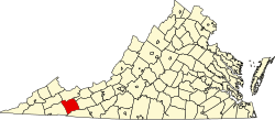
McMullin
Location within the Commonwealth of Virginia
Coordinates: 36°49′3″N81°34′31″W / 36.81750°N 81.57528°W / 36.81750; -81.57528 Coordinates: 36°49′3″N81°34′31″W / 36.81750°N 81.57528°W / 36.81750; -81.57528
CountryUnited States
State Virginia
County Smyth
Population
 (2010)
  Total464
Time zone UTC−5 (Eastern (EST))
  Summer (DST) UTC−4 (EDT)
ZIP codes
24354
FIPS code 51-48445
GNIS feature ID2629841

McMullin is a census-designated place in Smyth County, Virginia. The population as of the 2010 Census was 464. [1]

Fox Farm site was listed on the National Register of Historic Places in 1978. [2]

Related Research Articles

Saluda, Virginia

Saluda is a census-designated place (CDP) in and the county seat of Middlesex County, Virginia, United States. The population as of the 2010 Census was 769.

Hot Springs, Virginia Census-designated place in Virginia, United States

Hot Springs is a census-designated place (CDP) in Bath County, Virginia, United States. The population as of the 2010 Census was 738. It is located about 5 miles southwest of Warm Springs on U.S. Route 220.

Warm Springs is a census-designated place (CDP) in and the county seat of Bath County, Virginia, United States. The population as of the 2010 census was 123. It lies along U.S. Route 220 near the center of the county. Warm Springs includes the historical mill town called Germantown.

Heathsville, Virginia Census-designated place in Virginia, United States

Heathsville is a census-designated place (CDP) in and the county seat of Northumberland County, Virginia, United States. Heathsville is the easternmost county of the Northern Neck of Virginia, which was the birthplace of three of the first five Presidents of the United States - George Washington, James Madison, and James Monroe. It is the county seat of Northumberland County, and has housed four county courthouses since the first was built in 1663.

Flint Hill, Rappahannock County, Virginia Census-designated place in Virginia, United States

Flint Hill is a census-designated place (CDP) in Rappahannock County, Virginia, United States. The population as of the 2010 Census was 209. It is located on Route 522, approximately 2 miles to the east of the border of the Shenandoah National Park.

Sussex is a census-designated place (CDP) in and the county seat of Sussex County, Virginia, United States. The population as of the 2020 Census was 181.

Nottoway, Virginia

Nottoway, or Nottoway Court House, is a census-designated place (CDP) in and the county seat of Nottoway County, Virginia, United States. The population as of the 2010 Census was 84.

Churchville, Virginia Census-designated place in Virginia, United States

Churchville is a census-designated place (CDP) in the western part of Augusta County, Virginia, United States. The population as of the 2010 Census was 194. Churchville is part of the Staunton–Waynesboro Micropolitan Statistical Area.

Nellysford, Virginia

Nellysford is a census-designated place (CDP) in Nelson County, Virginia, United States. The population as of the 2010 Census was 1,076. It is home to the Wintergreen golf course at Stoney Creek. Its zip code is 22958.

Lafayette is a census-designated place (CDP) between the cities of Roanoke and Christiansburg in eastern Montgomery County, southwest Virginia, United States. The population as of the 2010 Census was 449. It is located adjacent to Elliston, at the confluence of the North and South Forks of the Roanoke River.

Greenbush, Virginia

Greenbush is a census-designated place (CDP) in Accomack County, Virginia, United States. The population as of the 2010 Census was 220.

Mappsville, Virginia

Mappsville is a census-designated place (CDP) in Accomack County, Virginia, United States. The population at the 2010 Census was 440.

Sanford, Virginia

Sanford is a census-designated place (CDP) in Accomack County, Virginia, United States. The population as of the 2010 Census was 212.

Shipman is a census-designated place (CDP) in Nelson County, Virginia, United States. The population as of the 2010 Census was 507.

Wintergreen, Virginia

Wintergreen is a census-designated place (CDP) in Augusta and Nelson counties, Virginia, United States, located near Wintergreen Resort. The population as of the 2010 Census was 165.

Ivy, Virginia Census-designated place in Virginia, United States

Ivy is a census-designated place (CDP) in Albemarle County, Virginia, United States. The population as of the 2010 Census was 905. It is a small unincorporated community located on U.S. Route 250, just west of Charlottesville.

Middlebrook, Virginia CDP in Virginia, United States

Middlebrook is a census-designated place in Augusta County, Virginia. The population as of the 2010 Census was 213.

Montvale, Virginia CDP in Virginia, United States

Montvale is a census-designated place in Bedford County, Virginia, United States. The population as of the 2010 census was 698.

Mount Sidney is a census-designated place in Augusta County, Virginia. The population as of the 2010 Census was 663.

Riner is a census-designated place in Montgomery County, Virginia, United States. The population as of the 2010 Census was 859.

References

  1. Virginia Trend Report 2: State and Complete Places (Sub-state 2010 Census Data). Missouri Census Data Center. Accessed 2011-06-08.
  2. "National Register Information System". National Register of Historic Places . National Park Service. July 9, 2010.