References
- ↑ "1950 Census of Population." U.S. Census Bureau. Retrieved on August 18, 2010.
- ↑ "Allison Gap CDP, Virginia". United States Census Bureau . Retrieved April 7, 2022.
- ↑ Climate Summary for Allison Gap, Virginia
- ↑ "2020 Geography Changes". United States Census Bureau.
Municipalities and communities of Smyth County, Virginia, United States | ||
|---|---|---|
| Towns | 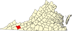 | |
| CDPs | ||
| Other communities | ||
36°53′39″N81°46′36″W / 36.89417°N 81.77667°W
| | This Smyth County, Virginia state location article is a stub. You can help Wikipedia by expanding it. |