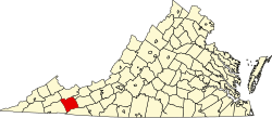
Sugar Grove, Virginia | |
---|---|
Coordinates: 36°46′27″N81°24′35″W / 36.77417°N 81.40972°W | |
Country | United States |
State | Virginia |
County | Smyth |
Area | |
• Total | 2.9 sq mi (7.6 km2) |
• Land | 2.9 sq mi (7.5 km2) |
• Water | 0.0 sq mi (0.0 km2) |
Elevation | 2,585 ft (788 m) |
Population | |
• Total | 610 |
• Density | 210/sq mi (80/km2) |
Time zone | UTC−5 (Eastern (EST)) |
• Summer (DST) | UTC−4 (EDT) |
ZIP code | 24375 |
Area code | 276 |
FIPS code | 51-76448 [2] |
GNIS feature ID | 1487691 [3] |
Sugar Grove is a census-designated place (CDP) in Smyth County, Virginia, United States. The population was 610 at the 2020 census. [1]
Sugar Grove is located at 36°46′27″N81°24′35″W / 36.77417°N 81.40972°W . [4]
According to the United States Census Bureau, the CDP has a total area of 2.9 square miles (7.6 km2), all of it land.
As of the census [2] of 2000, there were 741 people, 320 households, and 213 families residing in the CDP. The population density was 88.6 people per square mile (34.2/km2). There were 365 housing units at an average density of 43.6/sq mi (16.9/km2). The racial makeup of the CDP was 93.52% White, 4.99% African American, 0.13% Native American, 0.13% from other races, and 1.21% from two or more races. Hispanic or Latino of any race were 0.81% of the population.
There were 320 households, out of which 30.9% had children under the age of 18 living with them, 50.9% were married couples living together, 10.0% had a female householder with no husband present, and 33.4% were non-families. 28.4% of all households were made up of individuals, and 13.8% had someone living alone who was 65 years of age or older. The average household size was 2.32 and the average family size was 2.80.
In the CDP, the population was spread out, with 24.0% under the age of 18, 6.7% from 18 to 24, 30.9% from 25 to 44, 22.5% from 45 to 64, and 15.8% who were 65 years of age or older. The median age was 35 years. For every 100 females, there were 95.0 males. For every 100 females age 18 and over, there were 93.5 males.
The median income for a household in the CDP was $27,563, and the median income for a family was $31,065. Males had a median income of $21,607 versus $21,016 for females. The per capita income for the CDP was $14,172. About 7.9% of families and 11.1% of the population were below the poverty line, including 2.3% of those under age 18 and 6.9% of those age 65 or over.
Williamsburg is a census-designated place (CDP) in Orange County, Florida, United States. The population was 7,646 at the 2010 census. It is part of the Orlando–Kissimmee Metropolitan Statistical Area.
Ocean Grove is a census-designated place (CDP) in the town of Swansea in Bristol County, Massachusetts, United States, on the north shore of Mount Hope Bay near the Cole River. The population was 2,811 at the 2010 census, and 2,904 as of the 2020 census.
Cherry Grove is a census-designated place (CDP) in Anderson Township, Hamilton County, Ohio, United States. The population was 4,419 at the 2020 census.
Oak Grove is a census-designated place (CDP) in Lexington County, South Carolina, United States. The population was 10,291 at the 2010 census. It is part of the Columbia Metropolitan Statistical Area.
Seven Oaks is a census-designated place (CDP) in Lexington County, South Carolina, United States, 8 miles (13 km) northwest of downtown Columbia, the state capital. The population of the CDP was 15,144 at the 2010 census. It is part of the Columbia Metropolitan Statistical Area.
Oak Grove is a census-designated place (CDP) in Washington County, Tennessee, United States. The population was 4,425 at the 2010 census. It is part of the Johnson City Metropolitan Statistical Area, which is a component of the Johnson City–Kingsport–Bristol, TN-VA Combined Statistical Area – commonly known as the "Tri-Cities" region.
Powellton is a census-designated place (CDP) in Fayette County, West Virginia, United States. The population was 619 at the 2010 census.
Jefferson is a census-designated place (CDP) in Kanawha County, West Virginia, United States, along the Kanawha River. The population was 676 at the 2010 census. Jefferson was incorporated on March 22, 1997, but was disincorporated less than a decade later on February 21, 2007.
Mallory is a census-designated place (CDP) in Logan County, West Virginia, United States. The population was 1,654 at the 2010 census. The CDP contains the unincorporated communities, from west to east, of Huff Junction, Mallory, Davin, Mineral City, Claypool, Combs Addition, and Gillman Bottom.
Gilbert Creek is a census-designated place (CDP) in Mingo County, West Virginia, United States. The population was 1,090 at the 2010 census. The community takes its name from nearby Gilbert Creek.
Beaver is a census-designated place (C.D.P.) in Raleigh County, West Virginia, United States. The population was 1,308 at the 2010 census.
Bradley is a census-designated place (CDP) in Raleigh County, West Virginia, United States, named in honor of General Omar Bradley, a field commander in North Africa and Europe during World War II and a General of the Army. The population was 1,928 at the 2020 census.
Daniels is a census-designated place (CDP) in Raleigh County, West Virginia, United States. The population was 1,881 at the 2010 census.
MacArthur is a census-designated place (CDP) in Raleigh County, West Virginia, United States. Originally, it was named Hollywood and renamed MacArthur after General of the Army Douglas MacArthur in 1942. The population was 1,500 at the 2010 census.
Piney View is a census-designated place (CDP) in Raleigh County, West Virginia, United States. The population was 989 at the 2010 census.
Prosperity is a census-designated place (CDP) in Raleigh County, West Virginia, United States. The population was 1,498 at the 2010 census.
Stanaford is a census-designated place (CDP) and coal town in Raleigh County, West Virginia, United States. The population was 1,350 at the 2010 census.
Blennerhassett is a census-designated place (CDP) in Wood County, West Virginia, United States. It is part of the Parkersburg-Marietta-Vienna, WV-OH Metropolitan Statistical Area. The population was 3,089 at the 2010 census.
Boaz is a census-designated place (CDP) in Wood County, West Virginia, United States. It is part of the Parkersburg-Marietta-Vienna, WV-OH Metropolitan Statistical Area. As of the 2020 census, the CDP population was 1,321.
Lubeck is a census-designated place (CDP) in Wood County, West Virginia, United States. It is part of the Parkersburg-Marietta-Vienna, WV-OH Metropolitan Statistical Area. The population was 1,311 at the 2010 census. Though first named Watertown, postmaster Theodore Frederick Henry Slevogt in 1856 changed the name to Lubeck after his hometown in Germany.
Sugar Grove, Virginia (Official Community Website) Sugar Grove Community Facebook Page