King's Highway 407, commonly referred to as Highway 407 and colloquially as the "four-oh-seven", is a tolled 400-series highway in the Canadian province of Ontario. Comprising a privately leased segment and a publicly owned segment, the route spans the entire Greater Toronto Area (GTA) around the city of Toronto, travelling through the suburbs of Burlington, Oakville, Mississauga, Brampton, Vaughan, Markham, Pickering, Whitby, and Oshawa before ending in Clarington, north of Orono. At 151.4 km long, it is the fourth-longest expressway in Ontario's 400-series network, after Highways 417, 400, and 401. The segment between Burlington and Brougham in Pickering is leased to and operated by the 407 ETR Concession Company Limited and is officially known as the 407 Express Toll Route (407 ETR). It begins at the junction of the Queen Elizabeth Way (QEW) and Highway 403 in Burlington and travels 108.0 km (67.1 mi) across the GTA to Brock Road in Pickering. East of Brock Road, the tollway continues east as Highway 407, a toll route operated by the provincial government, for 43.4 km (27.0 mi), to Highway 35/115 in Clarington. The route interchanges with nine freeways: the QEW, Highway 403, Highway 401, Highway 410, Highway 427, Highway 400, Highway 404, Highway 412, and Highway 418. Highway 407 is an electronically operated toll highway; there are no toll booths along the route. Distances are calculated automatically using transponders or automatic number-plate recognition, which are scanned at entrance and exit portals.
The Queen Elizabeth Way (QEW) is a 400-series highway in the Canadian province of Ontario linking Toronto with the Niagara Peninsula and Buffalo, New York. The highway begins at the Canada–United States border on the Peace Bridge in Fort Erie and travels 139.1 kilometres (86.4 mi) around the western end of Lake Ontario, ending at Highway 427 as the physical highway continues as the Gardiner Expressway into downtown Toronto. The QEW is one of Ontario's busiest highways, with an average of close to 250,000 vehicles per day on some sections.

The 400-series highways are a network of controlled-access highways in the Canadian province of Ontario, forming a special subset of the provincial highway system. They are analogous to the Interstate Highway System in the United States or the Autoroute system of neighbouring Quebec, and are regulated by the Ministry of Transportation of Ontario (MTO). The 400-series designations were introduced in 1952, although Ontario had been constructing divided highways for two decades prior. Initially, only Highways 400, 401 and 402 were numbered; other designations followed in the subsequent decades. To this day, not all controlled-access highways in Ontario are a part of the 400-series highway network. The network is situated almost entirely in Southern Ontario, although Highway 400 extends into the more remote northern portion of the province.
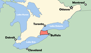
The Niagara Peninsula is an area of land lying between the southwestern shore of Lake Ontario and the northeastern shore of Lake Erie, in Ontario, Canada. Technically an isthmus rather than a peninsula, it stretches from the Niagara River in the east to Hamilton, Ontario, in the west. The peninsula is located in the Golden Horseshoe region of Southern Ontario, and has a population of roughly 1,000,000 residents. The region directly across the Niagara River and Lake Erie in New York State is known as the Niagara Frontier.
The Ontario Provincial Highway Network consists of all the roads in Ontario maintained by the Ministry of Transportation of Ontario (MTO), including those designated as part of the King's Highway, secondary highways, and tertiary roads. Components of the system—comprising 16,900 kilometres (10,500 mi) of roads and 2,880 bridges —range in scale from Highway 401, the busiest highway in North America, to unpaved forestry and mining access roads. The longest highway is nearly 2,000 kilometres (1,200 mi) long, while the shortest is less than a kilometre. Some roads are unsigned highways, lacking signage to indicate their maintenance by the MTO; these may be remnants of highways that are still under provincial control whose designations were decommissioned, roadway segments left over from realignment projects, or proposed highway corridors.
King's Highway 58, commonly referred to as Highway 58, is a provincially maintained highway in the Canadian province of Ontario. The route is divided into two segments with a combined length of 15.5 km (9.6 mi). The southern segment travels from Niagara Regional Road 3, formerly Highway 3, in Port Colborne, to the Highway 58A junction in the southern end of Welland, a distance of 7.2 km (4.5 mi). The northern segment begins at Highway 20 near Allanburg and travels north and west to a large junction with Highway 406 at the St. Catharines – Thorold boundary, a distance of 8.3 km (5.2 mi). An 18.1 km (11.2 mi) gap separates the two segments within Welland and Pelham. The entire route is located within the Regional Municipality of Niagara.
King's Highway 3, commonly referred to as Highway 3, is a provincially maintained highway in the Canadian province of Ontario which travels parallel to the northern shoreline of Lake Erie. It has three segments, the first of which travels from the Ambassador Bridge in Windsor to Highway 77 in Leamington. The second portion begins at Talbotville Royal outside of St. Thomas at Highway 4, and travels to the western city limits of Port Colborne. The road is regionally maintained within Port Colborne as Niagara Regional Road 3, but regains its provincial designation at Highway 140. Its third and final terminus is at Edgewood Park, within the Fort Erie town limits. From there, the road continues as Niagara Regional Road 3 to the Peace Bridge, where drivers can cross to the United States. The total length of Highway 3 is 258.2 km (160.4 mi), consisting of 49.2 km (30.6 mi) from Windsor to Leamington, 187.9 km (116.8 mi) from Talbotville Royal to Port Colborne and 21.1 km (13.1 mi) from Port Colborne to Edgewood Park.
King's Highway 427, also known as Highway 427 and colloquially as the 427, is a 400-series highway in the Canadian province of Ontario that runs from the Queen Elizabeth Way (QEW) and Gardiner Expressway in Toronto to Major Mackenzie Drive in Vaughan. It is Ontario's second busiest freeway by volume and the third busiest in North America, behind Highway 401 and Interstate 405 in California. Like Highway 401, a portion of the route is divided into a collector-express system with twelve to fourteen continuous lanes. Notable about Highway 427 are its several multi-level interchanges; the junctions with the QEW/Gardiner Expressway and Highway 401 are two of the largest interchanges in Ontario and were constructed between 1967 and 1971, while the interchanges with Highway 409 and Highway 407 were completed in 1992 and 1995, respectively.
King's Highway 403, or simply Highway 403, is a 400-series highway in the Canadian province of Ontario that travels between Woodstock and Mississauga, branching off from and reuniting with Highway 401 at both ends and travelling south of it through Hamilton and Mississauga. It is concurrent with the Queen Elizabeth Way (QEW) for 22 km (14 mi) from Burlington to Oakville. The Highway 403 designation was first applied in 1963 to a short stub of freeway branching off the QEW, and the entire route was completed on August 15, 1997, when the section from Brantford to the then-still independent Town of Ancaster was opened to traffic. The section of Highway 403 between Woodstock and Burlington was formally dedicated as the Alexander Graham Bell Parkway on April 27, 2016, in honour of Alexander Graham Bell.
King's Highway 406, commonly referred to as Highway 406, is a 400-series highway in the Canadian province of Ontario. The primary north–south route through the central portion of the Niagara Peninsula, Highway 406 connects Welland, Thorold and downtown St. Catharines to the Queen Elizabeth Way (QEW).
King's Highway 420, commonly referred to as Highway 420, is a 400-series highway in the Canadian province of Ontario that connects the Queen Elizabeth Way (QEW) with downtown Niagara Falls. It continues east as a limited-access expressway named Niagara Regional Road 420 to connect with the Rainbow Bridge international crossing between Canada and the United States over the Niagara River; this was part of Highway 420 until 1998. West of the QEW, the freeway ends at an at-grade intersection with Montrose Road. The highway has a speed limit of 80 kilometres per hour (50 mph), making it the only 400-series highway to have a speed limit less than 100 kilometres per hour (62 mph) for its entirety.
The Lincoln M. Alexander Parkway, nicknamed The Linc, is a municipal expressway in the city of Hamilton, Ontario, Canada, which connects Highway 403 with the Red Hill Valley Parkway, which continues north to the Queen Elizabeth Way (QEW). Collectively, the two expressways form a southern and eastern bypass of Hamilton. Located on the Hamilton mountain, atop the Niagara Escarpment, the freeway was named after the former Progressive Conservative MP and first black Lieutenant Governor of Ontario, Lincoln Alexander in July 1997, despite him never holding a driver's license.
King's Highway 20, commonly referred to as Highway 20, is a provincially maintained highway in the Canadian province of Ontario. Presently, it is a short 1.9 km (1.2 mi) stub between Highway 58 and Niagara Regional Road 70 in the City of Thorold, but until 1997 it connected Hamilton to Niagara Falls, serving several towns atop the Niagara Escarpment en route.

The Red Hill Valley Parkway (RHVP) is a municipal expressway in the Canadian city of Hamilton, Ontario. The route connects the Lincoln M. Alexander Parkway, Hamilton's second municipal expressway, to the Queen Elizabeth Way (QEW) near Hamilton Harbour. It is named after Red Hill Valley, through which it descends the Niagara Escarpment. It is a 7-kilometre (4.3 mi) four-lane freeway with a speed limit of 80 kilometres per hour (50 mph).
King's Highway 8, commonly referred to as Highway 8, is a provincially maintained highway in the Canadian province of Ontario. The 159.7-kilometre (99.2 mi) route travels from Highway 21 in Goderich, on the shores of Lake Huron, to Highway 5 in the outskirts of Hamilton near Lake Ontario. Before the 1970s, it continued east through Hamilton and along the edge of the Niagara Escarpment to the American border at the Whirlpool Bridge in Niagara Falls. However, the Queen Elizabeth Way (QEW) replaced the role of Highway 8 between those two cities, and the highway was subsequently transferred from the province to the newly formed Regional Municipality of Niagara in 1970. In 1998, the remaining portion east of Peters Corners was transferred to the city of Hamilton.
The Bradford Bypass, also known as the Highway 400–404 Link is a proposed east–west 400-series highway in the northern Greater Toronto Area of the Canadian province of Ontario. The approximately 16.2-kilometre (10.1 mi) route is currently undergoing planning and analysis under an environmental impact assessment (EA) by the Ministry of Transportation of Ontario (MTO) and the Government of Ontario. If approved, a new four-lane controlled-access highway would be built between Highway 400 near Bradford in Simcoe County, and Highway 404 near Queensville in York Region. It would serve as a bypass to the north side of Bradford.
The Niagara Parkway, formerly known as Niagara Boulevard and historically as the Niagara Road, is a scenic road in the province of Ontario that travels on the Canadian side of the Niagara River from the town of Fort Erie to Niagara-on-the-Lake. The portion north of Table Rock in the city of Niagara Falls is designated as an Ontario Scenic Highway. Niagara Boulevard originally referred only to the section from Fort Erie to Chippawa.
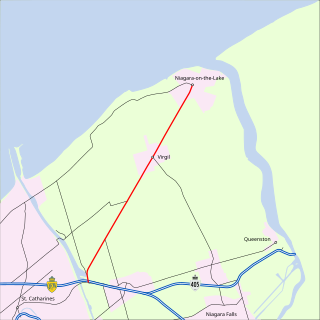
King's Highway 55, commonly referred to as Highway 55 and historically as the Niagara Stone Road and Black Swamp Road, was a provincially maintained highway in the Canadian province of Ontario, which connected the Queen Elizabeth Way (QEW) with Niagara-on-the-Lake, following Niagara Stone Road. The route divided a swath of wineries at the foot of the Niagara Escarpment, passing at an oblique angle to the concession road grid.
King's Highway 58A, commonly referred to as Highway 58A, is a provincially maintained highway in the Canadian province of Ontario. The short route serves to connect Highway 58 with Highway 140 and passes beneath the Welland Canal through the Townline Tunnel. The entire route is located within the city of Welland in the Regional Municipality of Niagara.
King's Highway 413, known as the GTA West Corridor or GTA West until 2021, is an 400-series highway and bus transitway that will be under construction in the western Greater Toronto Area of the Canadian province of Ontario. The approximately 52-kilometre (32 mi) route is currently undergoing planning and analysis under an environmental impact assessment (EA) by the Ministry of Transportation of Ontario (MTO) and the Government of Ontario. If approved, a new four-to-six lane controlled-access highway would be built between the existing interchange of Highway 401 and the 407 ETR at the Halton–Peel boundary, and Highway 400 north of Vaughan. In addition, two new extensions would be built to connect Highway 410 and Highway 427 with Highway 413.
